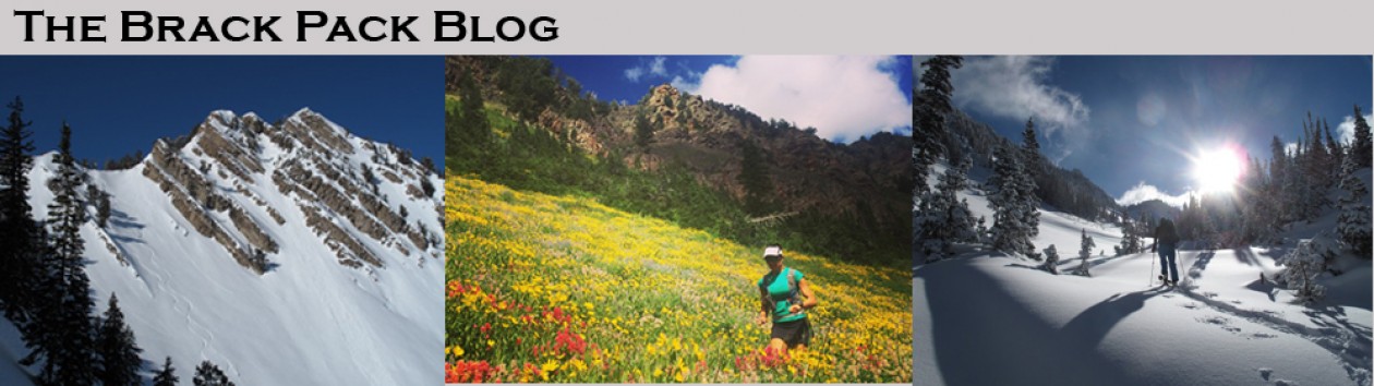
While the hills were hot, it was far cooler than the beach and it was tough to be back in the heat. When we got to Mararikulam we checked into the homestay, had lunch, and then went to the beach. With no intention of going for a swim, we were too hot not to. Still in the clothes we had worn for now 6 days, we used the ocean as our “Prewash” of our clothes. The Arabian Sea was amazing. The water was close to 90F and it was luxurious.
The Arabian Sea
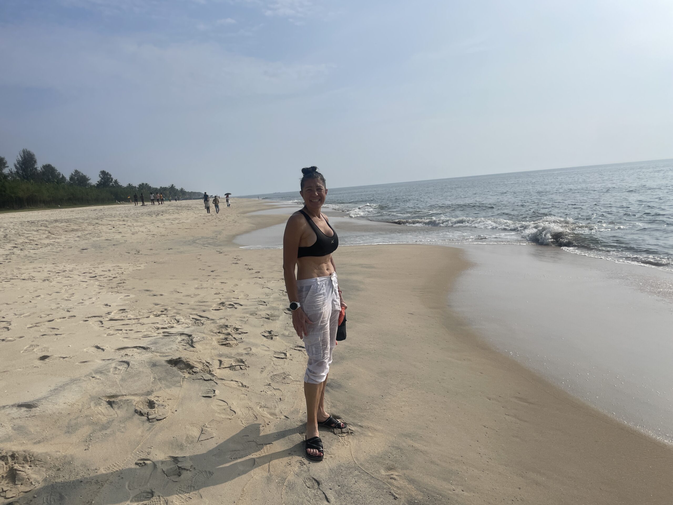
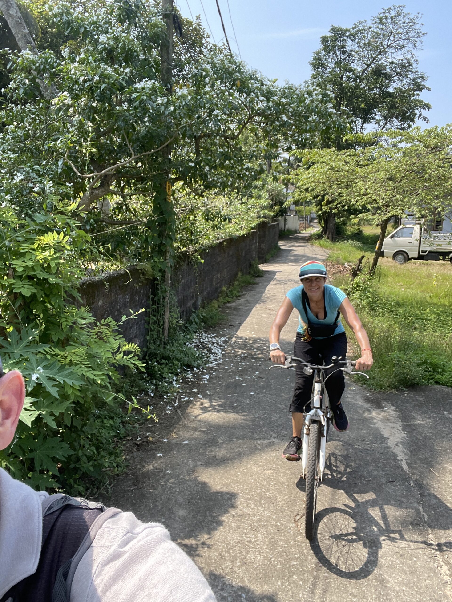
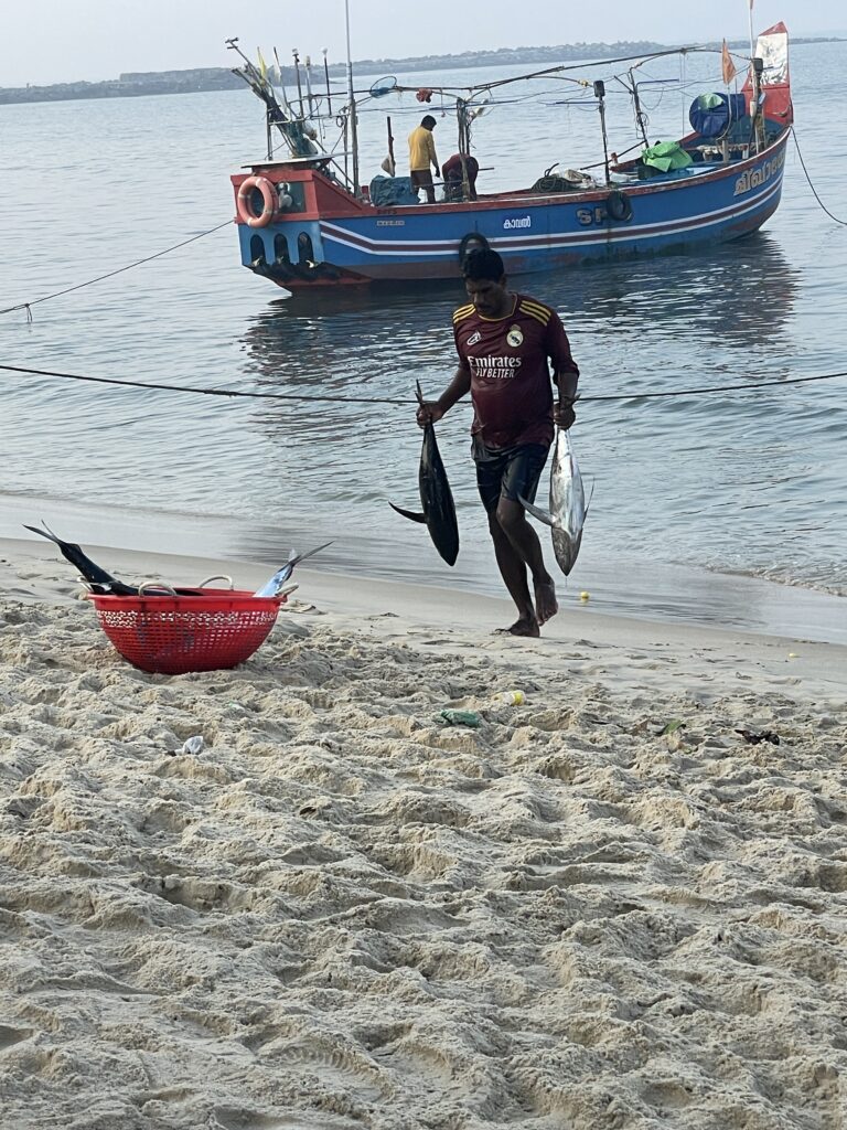
The hotel had some old junker bikes. We put 60 KM on the bikes seeing the wholesale fish market, Allepey, and Mararikulam areas. It was great to see a ton of the surrounding area that we were visiting.
Our mighty steads
2-lane roads
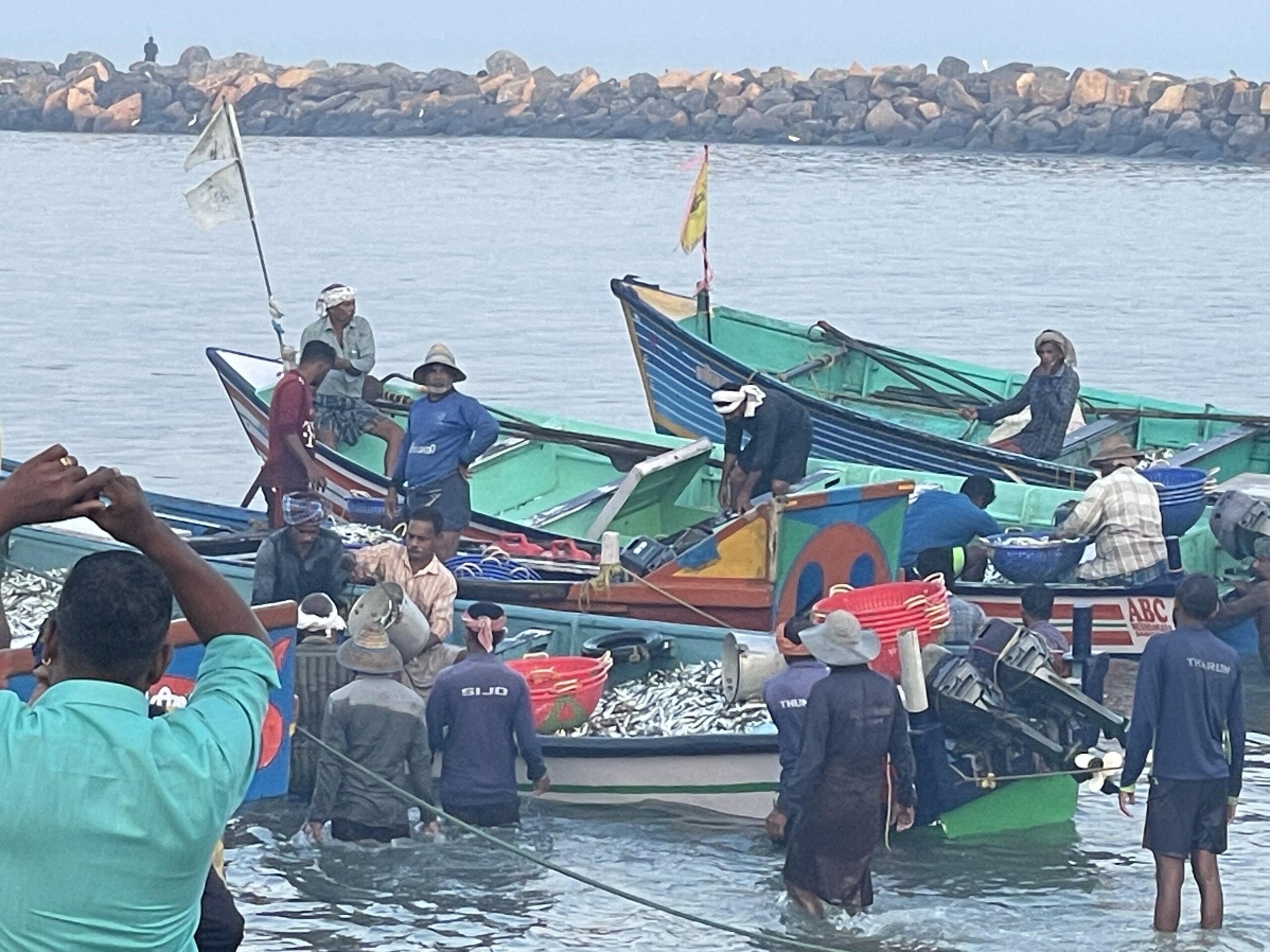
The sunrise fish market was super cool. The smaller fish were sold by the kilo and the larger fish were sold by a verbal auction.
Fish Market
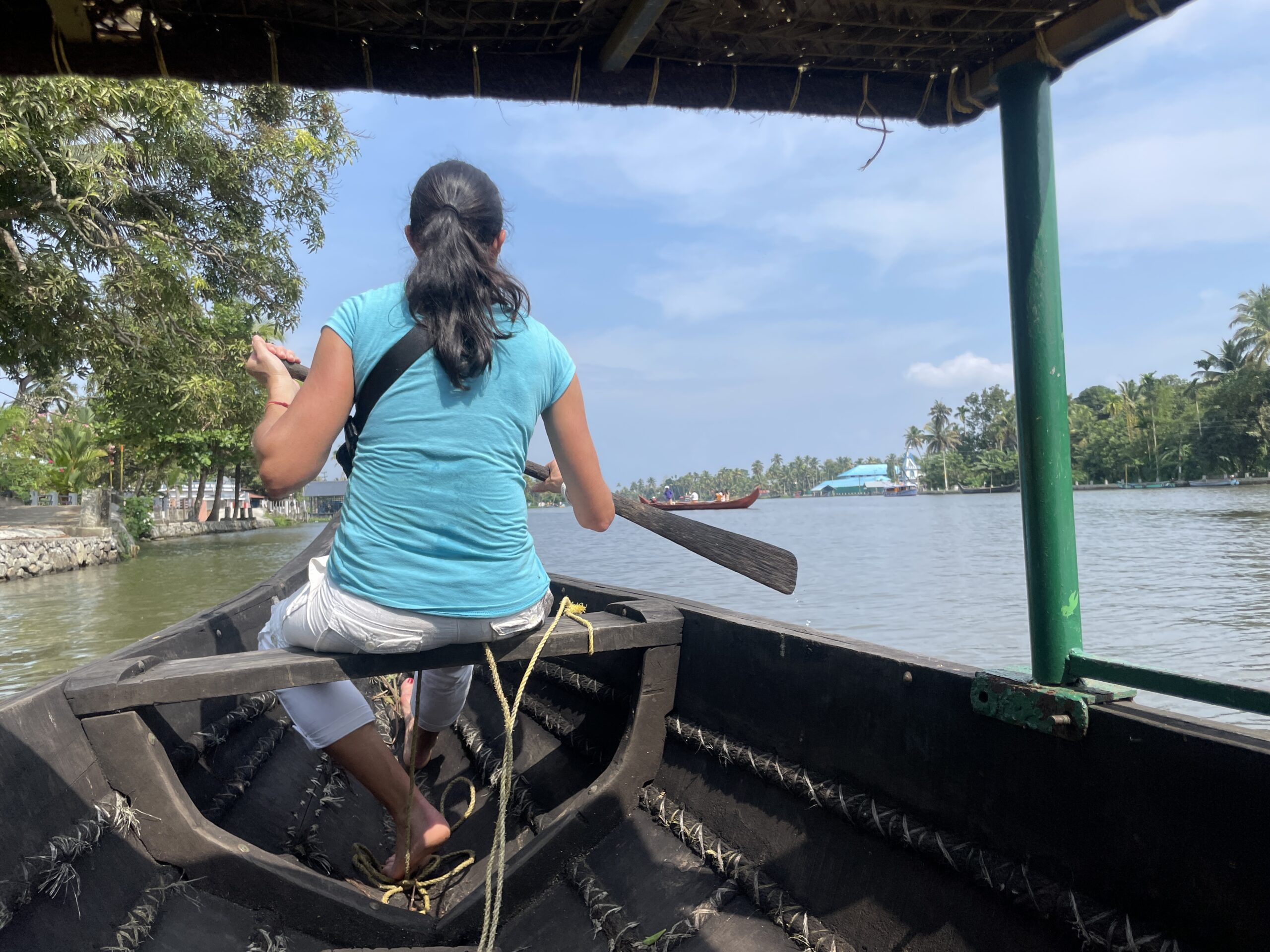
One of the things listed as not to miss in the Allepey area is a backwaters boat cruise. You can do large houseboats, small boats, canoes, or kayaks. We chose the canoe trip. If this was your first chance to see local communities it would be an amazing experience, but having spent 5 days walking through the communities, it was a disappointment and was not worth investing 6 hours of a day. We got bored so we helped paddle for about half of the trip. We were still glad to have done it, but would have seen more walking another day in Idukki.
Canoeing the Backwaters
Another very interesting thing that we wanted to do and ended up doing twice was an Ayurveda massage. It was a very interesting process with oils, chanting, and massaging from the top of your head to your toes in one motion.
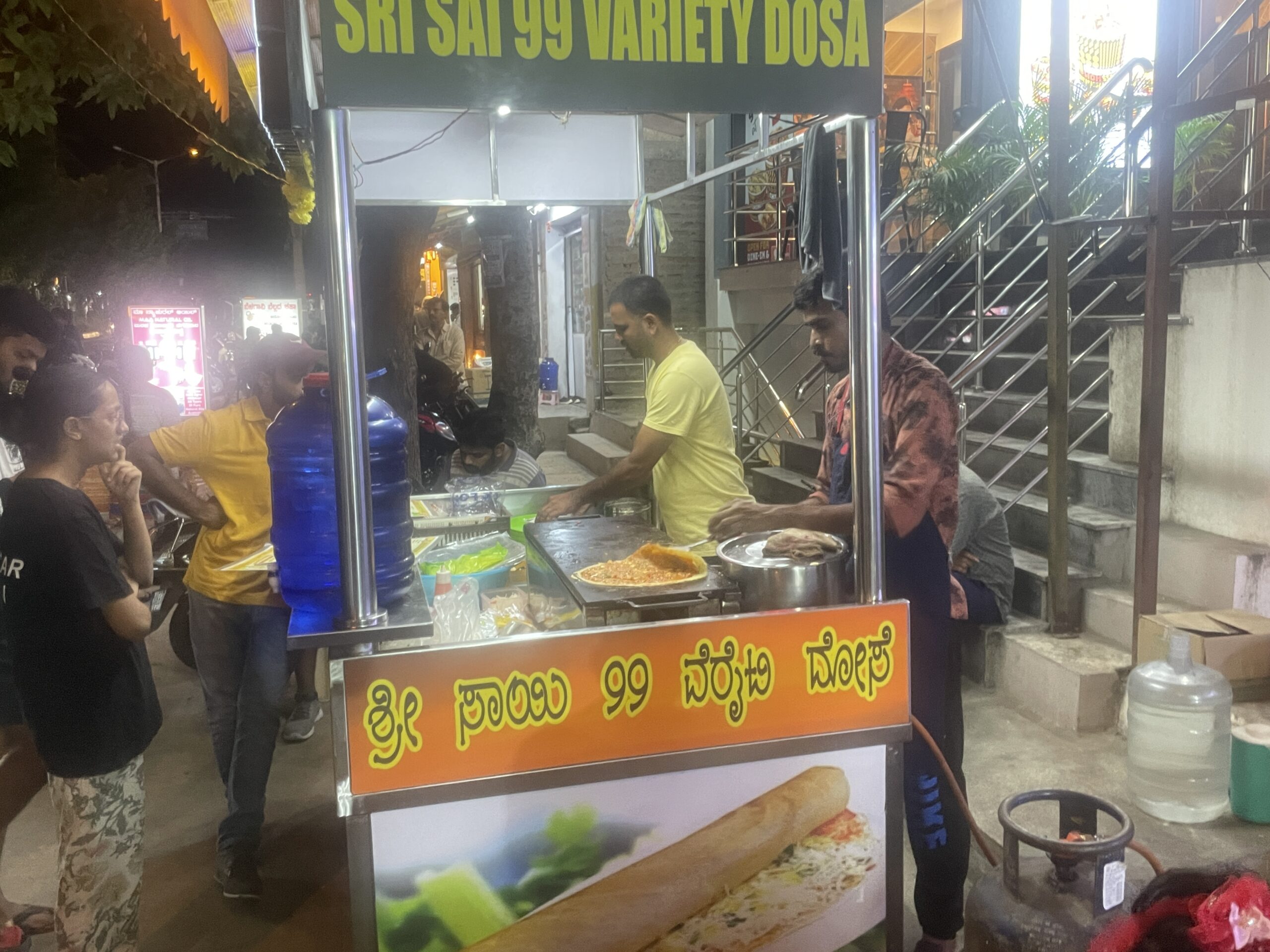
We enjoyed a little beach time before spending Thanksgiving as a travel day. It was a two-hour drive to Kochi, a 70-minute flight to Bangalore, then a four-hour drive from Bangalore to Mysore which included a stop for a roadside dosa which may have been the best dosa of the trip.
Thanksgiving dinner
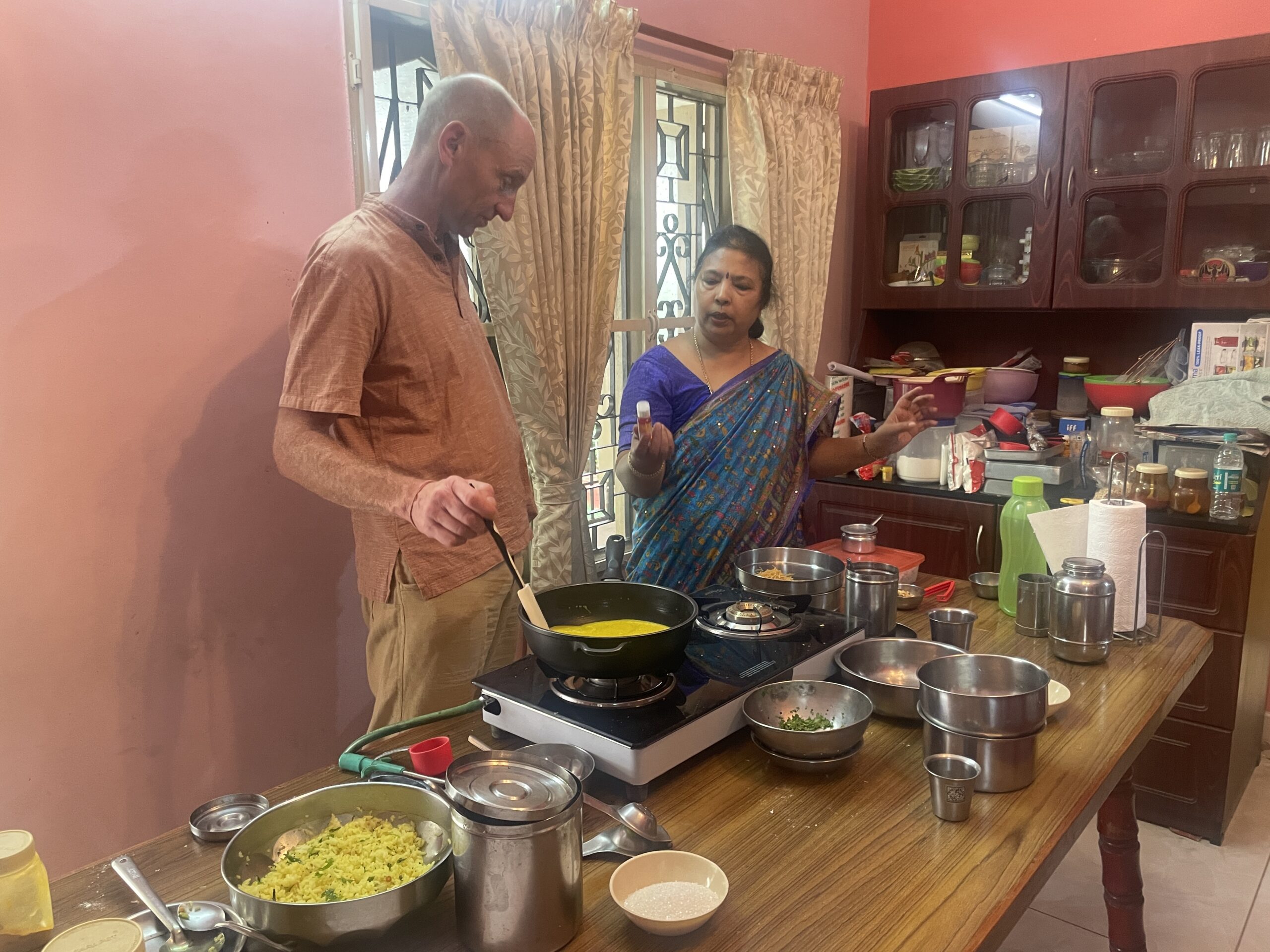
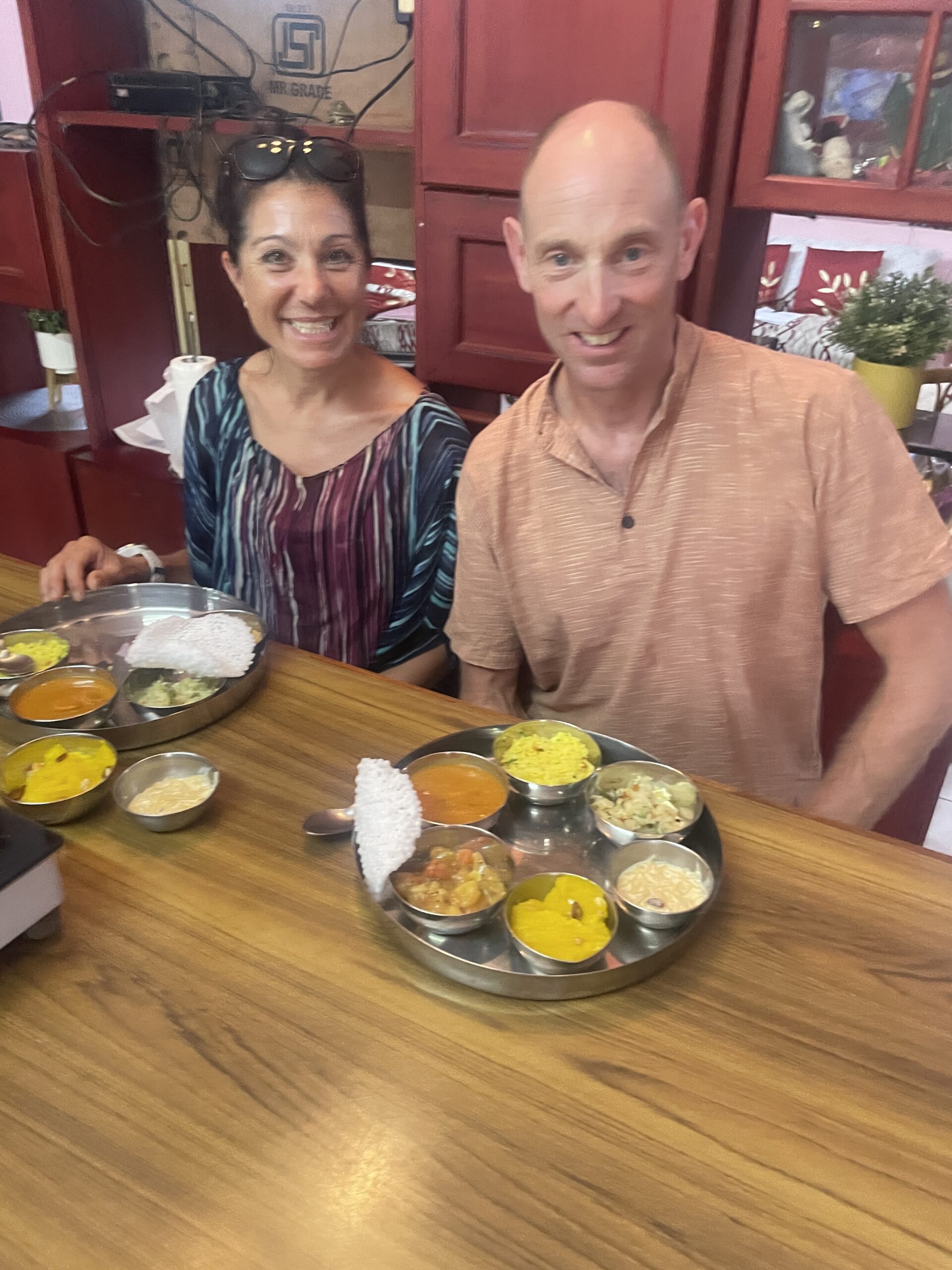
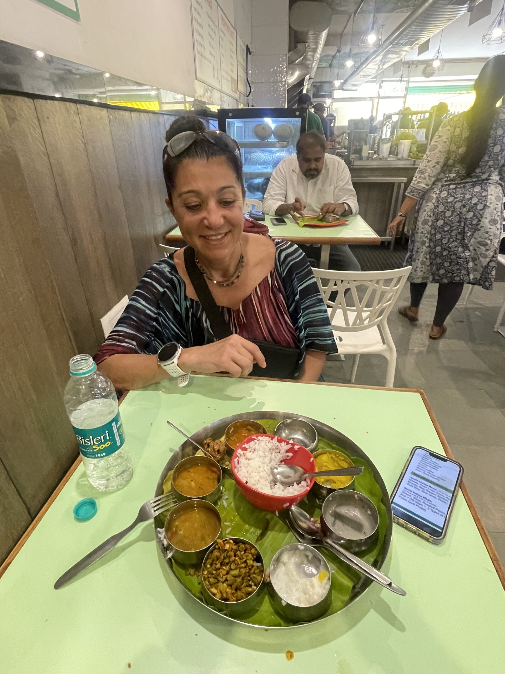
Mysore is known as the cleanest city in India and it showed. It was so different than any other Indian city. It truly was clean. Only in a few back dirt roads did we find the normal road trash of India. For our first full day, we had arranged a cooking class. It was 3.5 hours in a husband and wife’s home where we made 9 dishes and then got to indulge ourselves in eating them. It was a great meal and greatly built on the other 2 classes we had taken. The rest of the day was spent walking around and seeing some of the many temples and palaces of Mysore.
Shree Chamundeshwari Temple sits at the top of Chamunde Hill with 1,025 steps leading up to it. It was great to get some climbing in after a few days. The temple was huge and there were tons of people making the pilgrimage to the top. We chose not to deal with the long wait to enter and instead took in the surroundings. This also made a great workout on Sunday morning doing 2 laps of stairs before taking the train back to Bangalore marking the end of an amazing Southern India trip.
Cooking Class
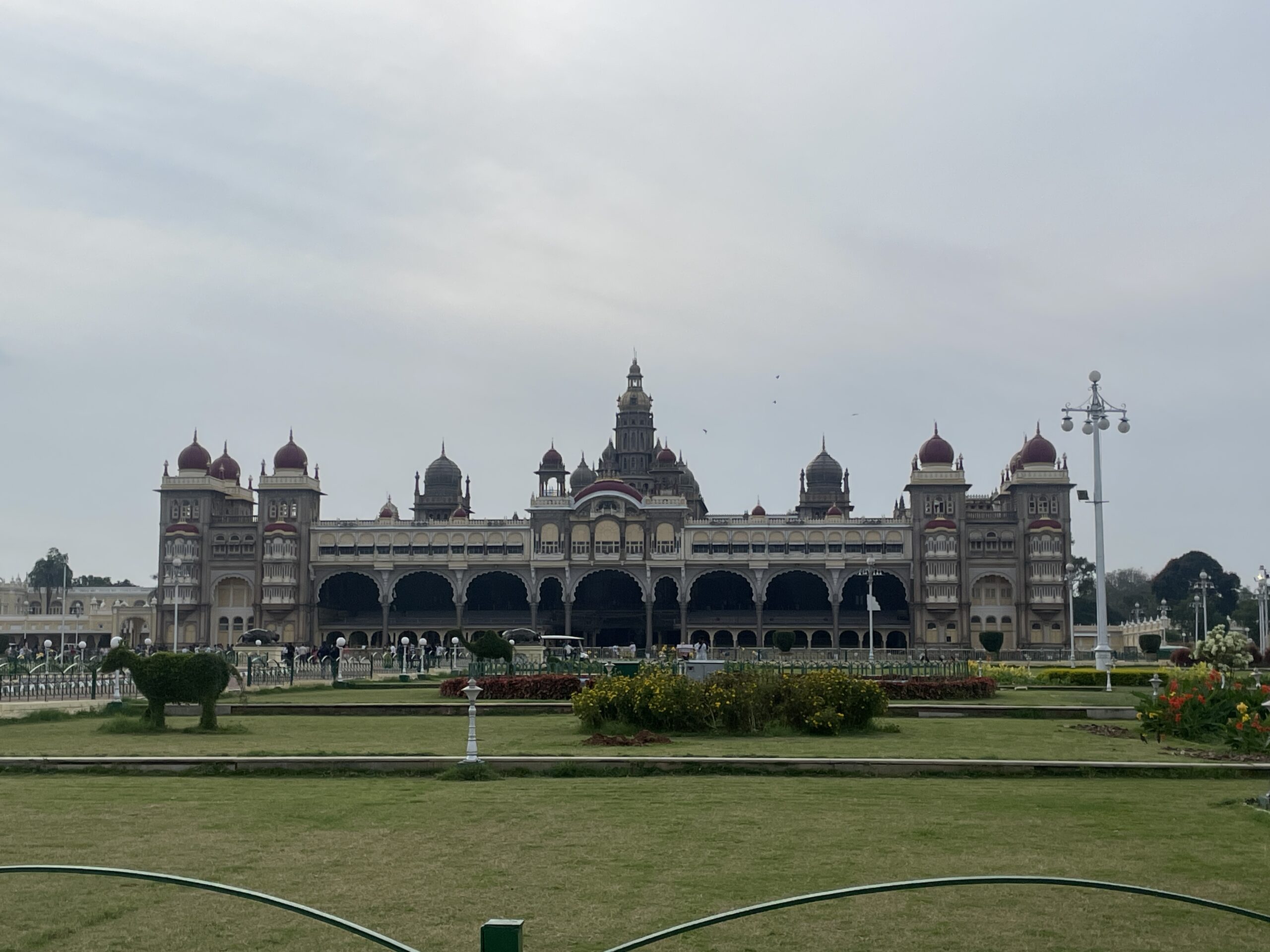
Mysore Palace
Since our first trip in 2002, India has been near and dear to our hearts. It had been a long time since we had been there and it has us eager to plan another trip. Maybe a bike tour in Uttar Pradesh or Uttarakhand?
We had a lot of highlights. We each took a turn writing down our highlights and then when we compared we both wanted to add each other’s to our list. I guess that is the sign of an amazing trip.
Chad’s Highlights
Overall walking from village to village of Idukki and just seeing local life.
Picnic with locals on the walk from Kurisumala Hill Church to Thangalpara
Cooking class in Mysore
Diwali with Mamatha and her family
Having cheap, but really good food and doing some dirt bagging
Flower market in Bangalore
Emily’s Highlights
Diwali with Mamatha and family
Flower market at Diwali
Walking around the streets in neighborhoods seeing people celebrate Diwali
The two breakfasts of eating parotta with the locals
All the friendly people when we were walking through the villages
Walking through the villages seeing how people live
Ayurvedic massages
All the colors, smells, food!
Overall, every trip to India is a rewarding experience. It is not a restful vacation, but we have always come back with a deep and long-lasting appreciation for everything it has to offer.
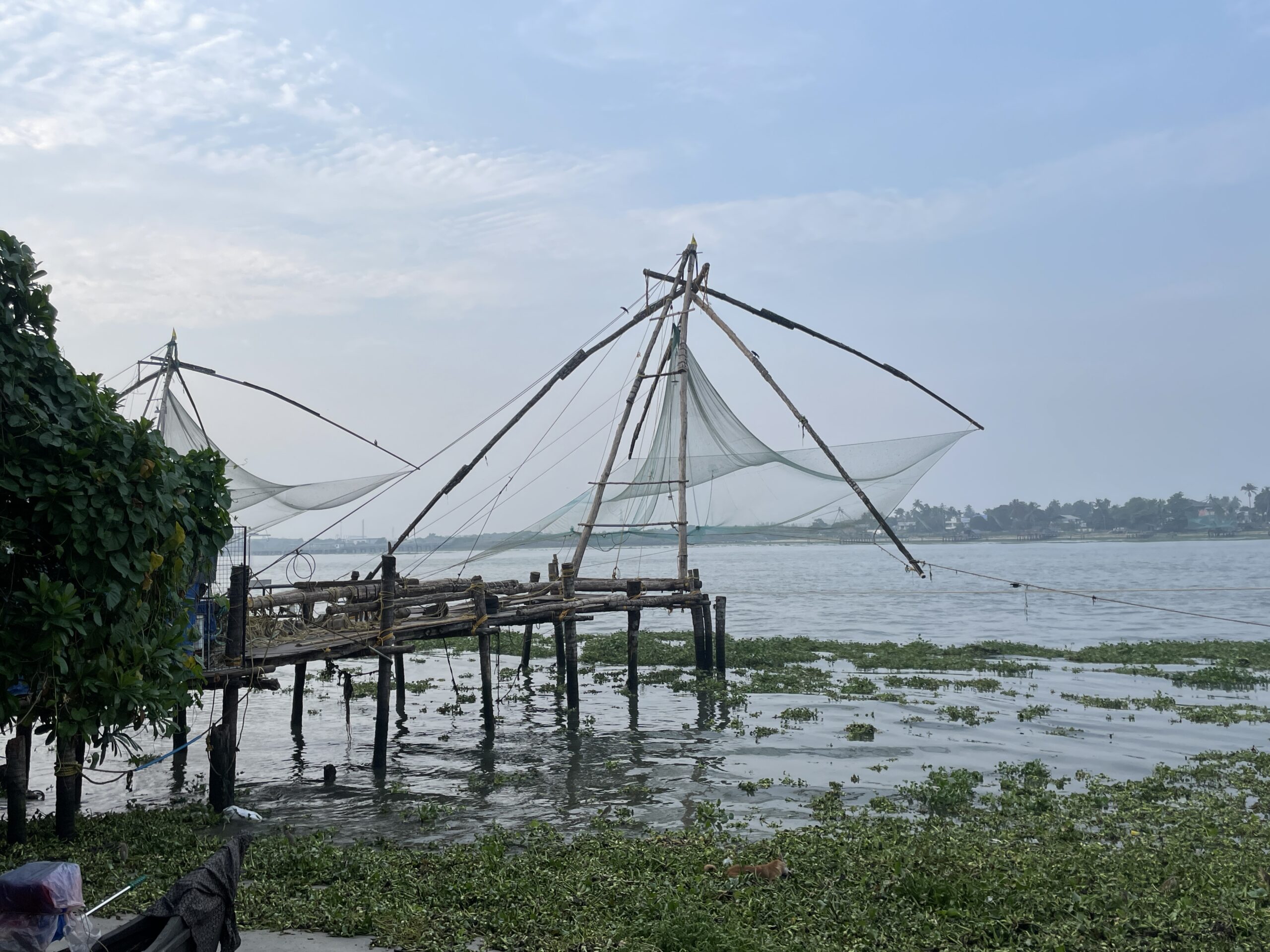
Kochi – The Queen of the Arabian City. We arrived in Kochi and immediately felt the intense heat and humidity. It was overwhelming from the first step out of the airport. We had 2 days to explore Kochi before heading into the hill regions. With the heat that was going to be plenty. Kochi and much of Kerala state is much different than anywhere else in India in that it has a large Christian presence. There are numerous churches dating back as old as 800 AD. Vasco de Gama was in Kochi in the 1400s and died there. There is a mix of Dutch, Portuguese, and British influence. There was also a Chinese influence as well.
Chinese Fishing Nets
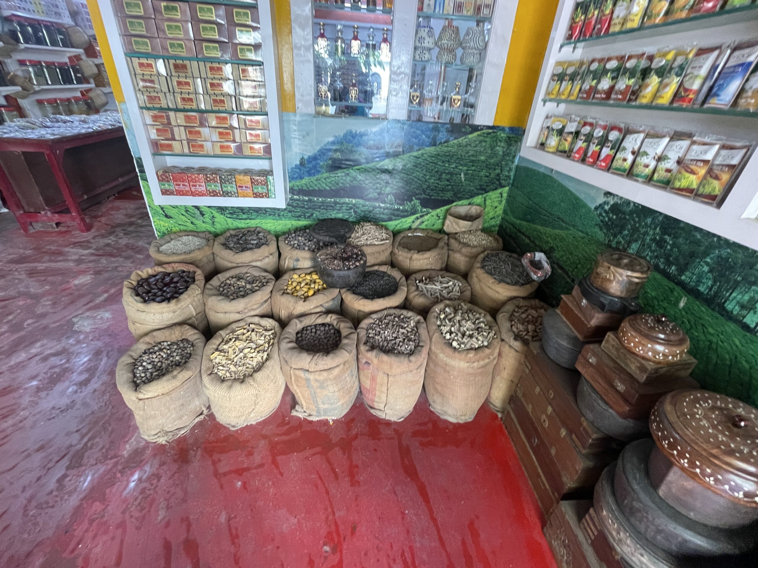
Kerala is known for Fish, Tea, and Spices, especially Caradmmon and Pepper
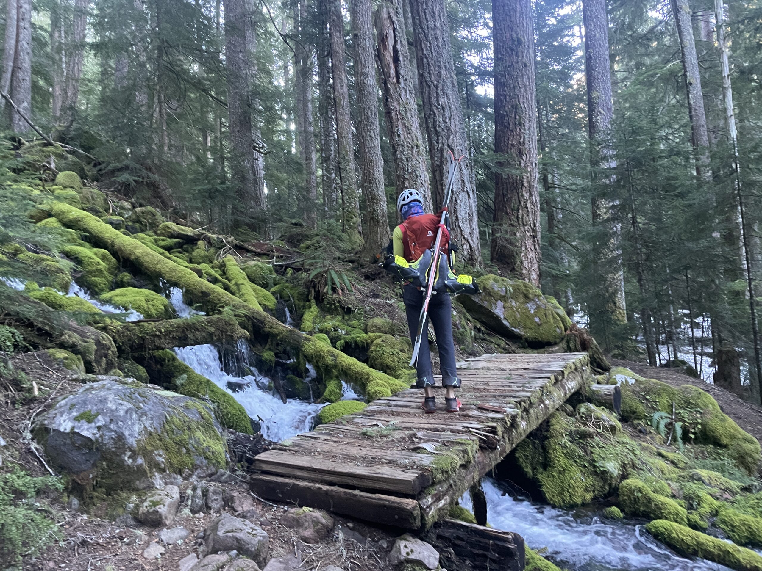
We had over a week in Kerala and a big goal was to take some cooking classes. Our first class was in Kochi where we made Dry Vegetable Curry (Thoran), Daal, Coconut Rice, Chicken Masala, and Roti. The cooking class took place in Meera’s home and it was a great experience, the dishes were delicious, and we can’t wait to make them at home. A village-to-village trek through the Idukki region was definitely a highlight of the trip. It was very hard to plan a trek with limited topo maps so it was sort of a big guess of back roads tied together in a route from Google Maps, GAIA, and CalTopo. The route ended up great and in the end, we wished we had spent at least 2 more days walking. Day 1 was pretty much a bust. We got to Idukki Dam and it was closed so we couldn’t see the dam and walked to our hotel at 10o North. We got dropped off up the road a little way and had an amazing 7.5-mile walk with over 2,000′ of climbing. About 1.5 miles from the hotel it started raining – HARD. We had a great time sitting at a very small store along the road for about a half hour drinking tea and waiting for the rain to die down (a little). Our hotel was set on a beautiful plantation hillside. Unfortunately, it was socked in fog with zero visibility the entire time we were there.
Waiting out the rain with tea and snacks
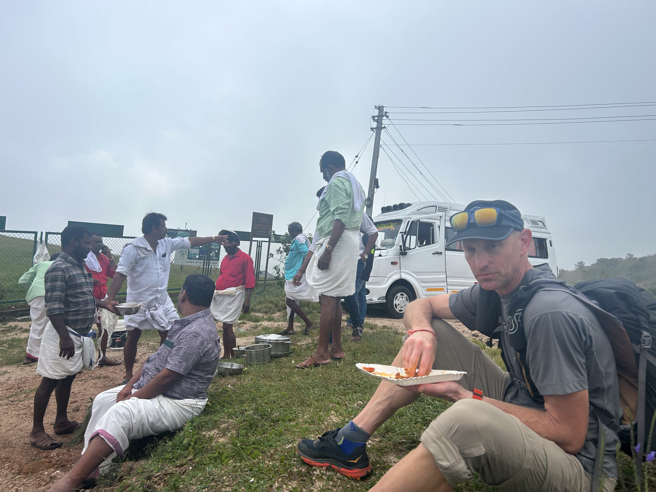
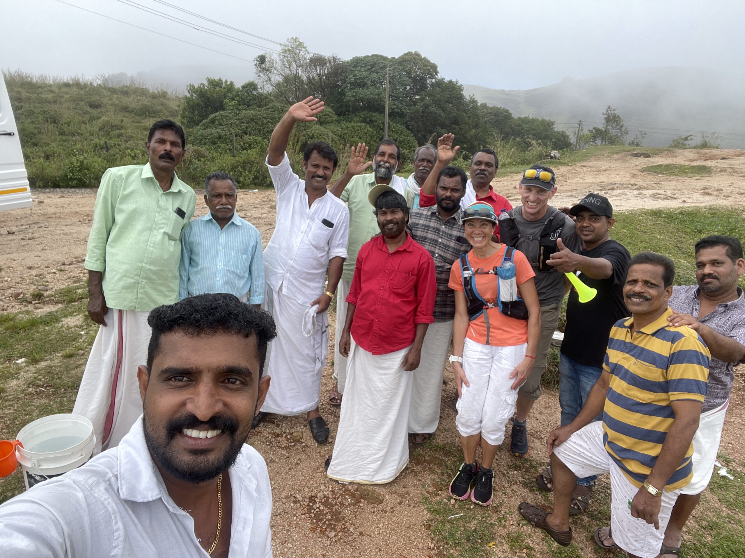
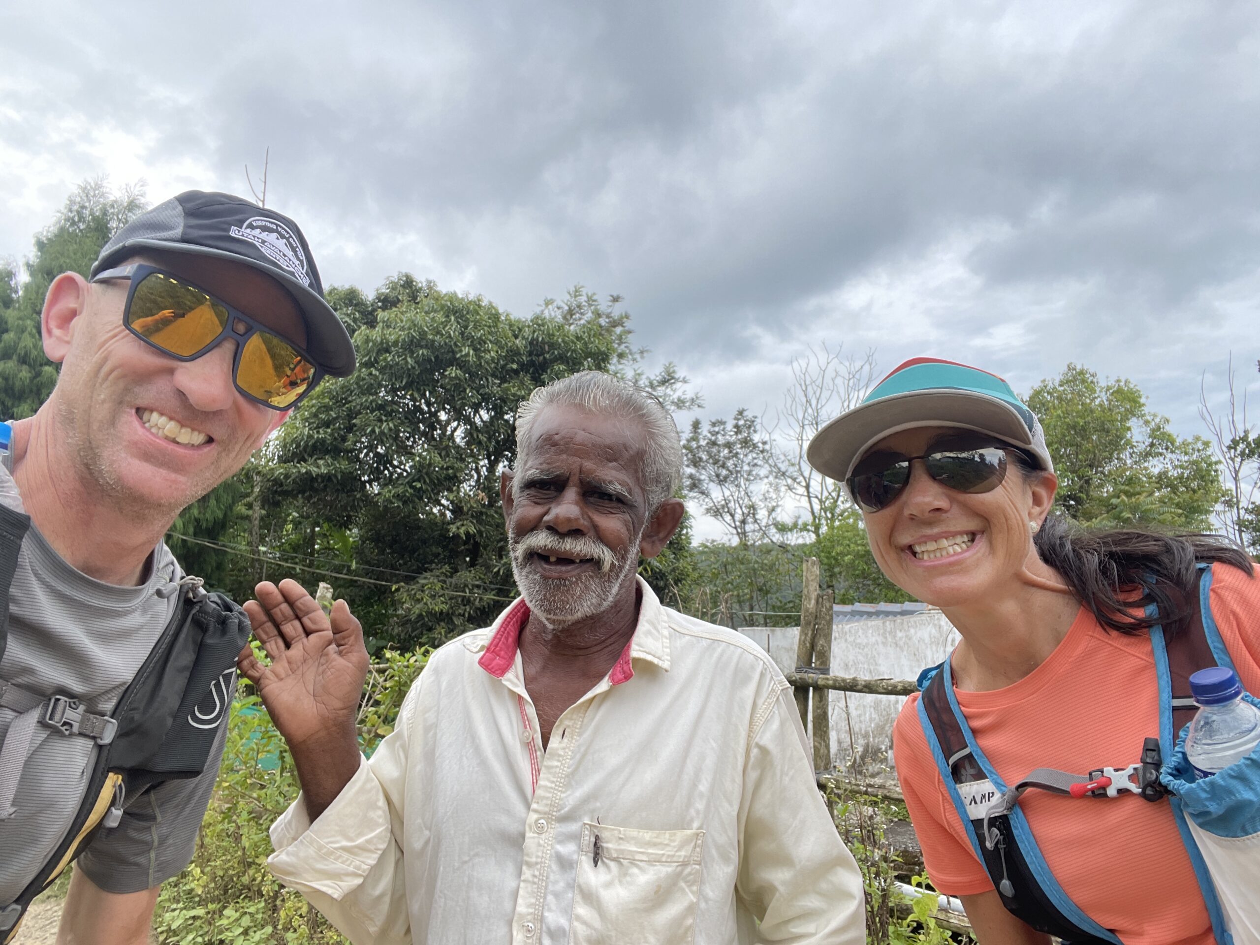
Day 2 was a taxi ride to Vagamon for the rest of our hiking. This by far started the best part of our trip. We walked around Vagamon, then to the Kurisumala Hill Church which was a long climb up to a Catholic church overlooking the valley. We had not packed food assuming there would be stalls along the road like we had seen during our trip. A few hours went by and there were no food stalls. As we topped a hill there was a small tour bus with a big group of men having a picnic. As we walked by, they motioned us to join them. We declined twice, but on the third request, we accepted. What came out was a highlight of our trip and this great rice and chicken meal. The men loved that we ate with them and asked to take pictures of us. They took tons of photos and videos of us as we ate and we had a fun group photo at the end. Even though they spoke no English and us no Malayalam, we could tell it was a highlight of all of our days and a lifelong memory for us.
Hilltop picnic – this was a highlight of the trip
Post picnic group photo
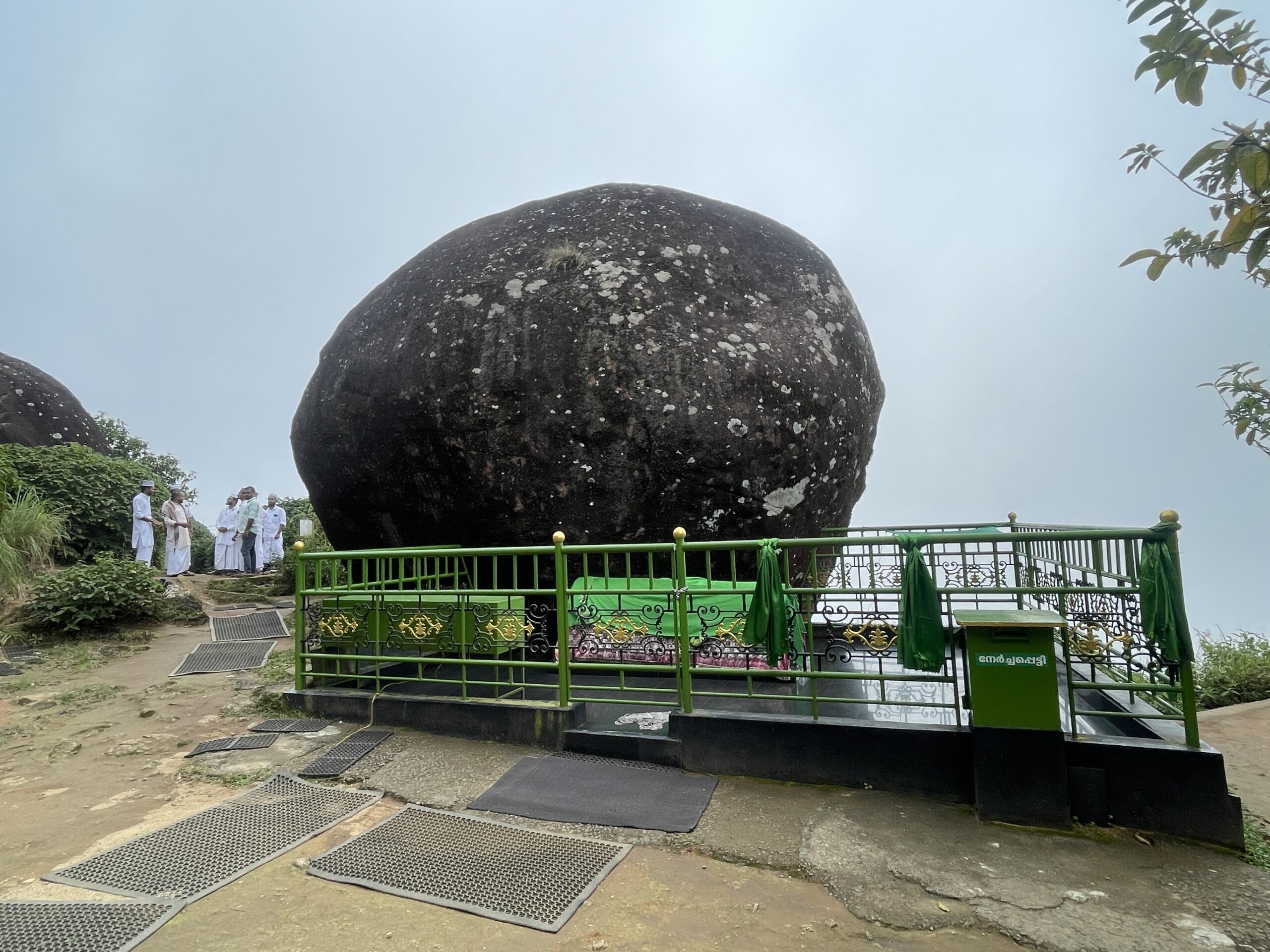
From there we continued to Thangalpara which was another climb, but this time to the tomb of Sheikh Fariuddin from the year 1200 AD. Many schoolchildren and locals were making the pilgrimage. From there, to the Pine Forest which was a beautiful forest that was frequented by many locals and Indian tourists.
Thangalpara – Thomb of Sheikh Fariuddin
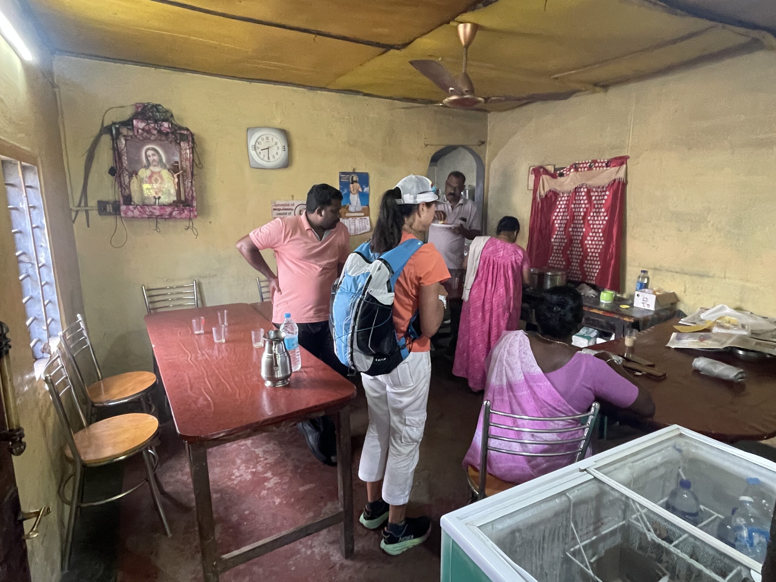
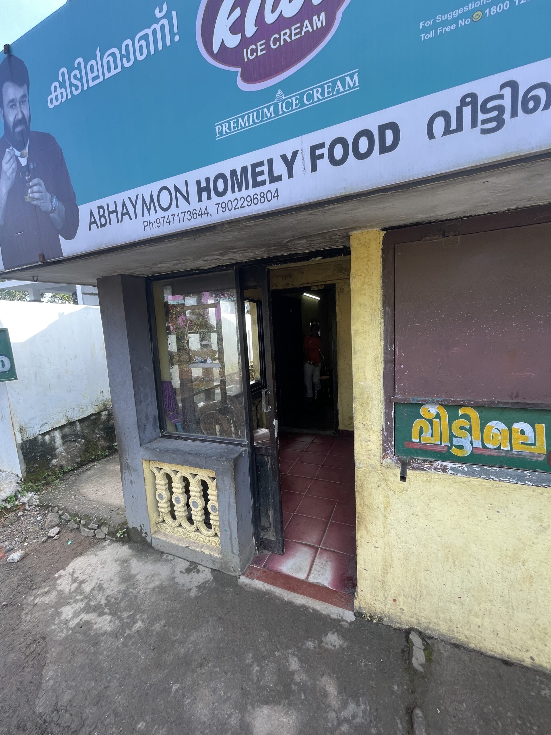
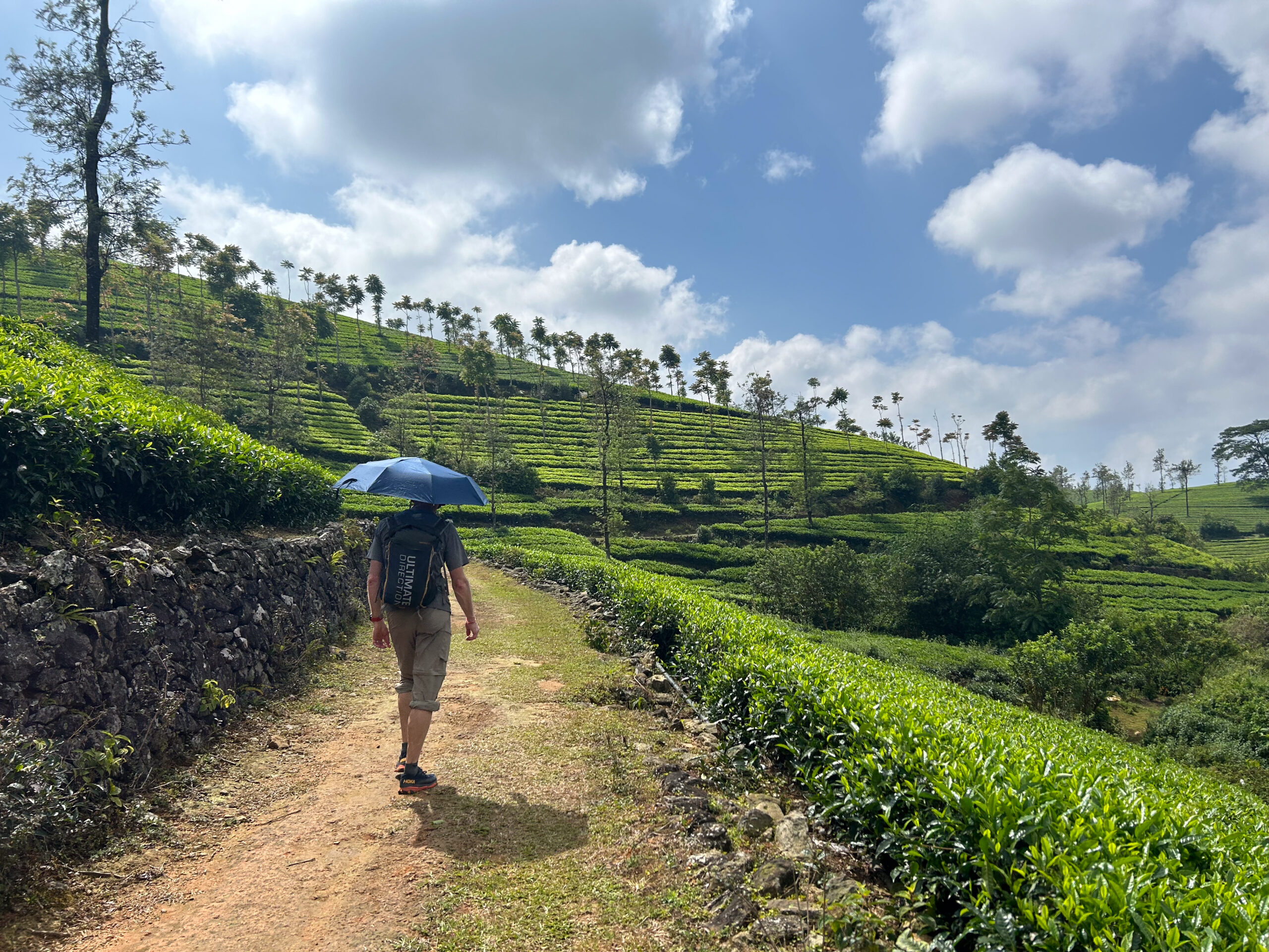
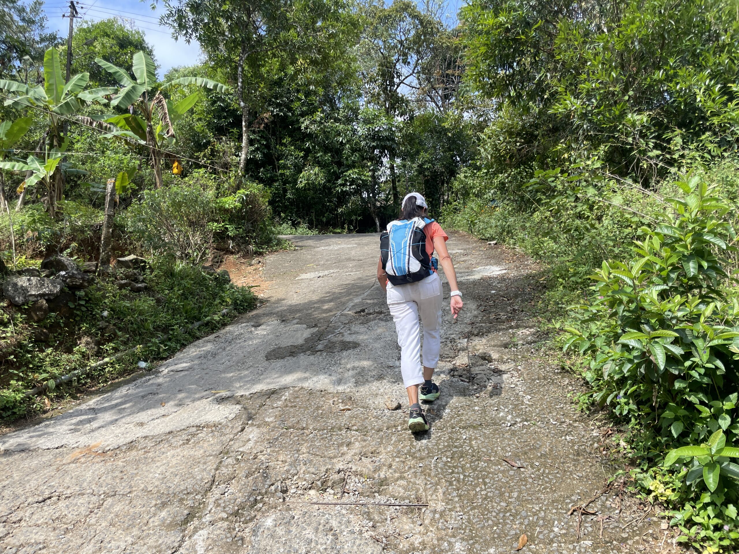
Day 3 was not about sites, but rather about walking back roads and plantation trails. We were completely “off the beaten path”. People looked at us like we were crazy and I am sure they were wondering what the hell we were doing. Breakfast was also a fun experience for us as we found a “homely” restaurant (that is literally what the sign outside stated) which we called the local bread shop as not only were there lots of locals coming in for breakfast but many coming in for takeout of the parotta bread wrapped in newspaper and a plastic bag of the local curry to accompany the parotta. All along, people were so friendly, they would wave, greet us, or stop their car or moto to talk. The friendliness was just amazing and made us feel great. We felt like we were integrating into the local culture. It was hot and shade was minimal. An umbrella was fantastic for shade as we walked.
It may say homely food, but it was excellent.
An umbrella was welcome shade in the stifling heat
This was a fairly typical 2-lane road. I measured the slope angle at 20o
Day 4: We regret not having more time to spend in villages. Our final day was great walking through plantations and going out of our way to see the Pattumala Church. We had several people asking to take photographs with us which is always a comical, but fun experience.
One of the many locals excited to see white people and ask us to have their picture take with them
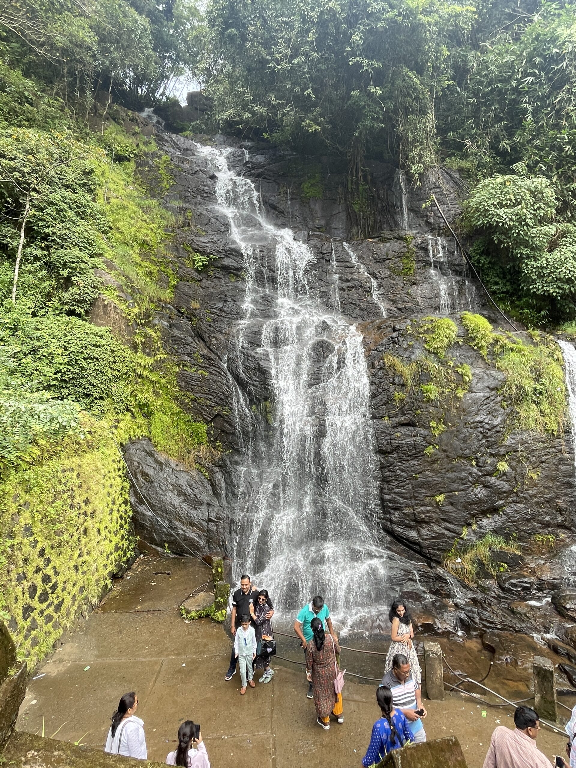
Day 5: A short walk past Valanjanganam Water Fall and then a bit further to our pickup spot for our ride to Mararikulam.
Valanjanganam Water Fall
Part 3 coming up – Allepey, Mararikulam, and Mysore
Ahhh – India. Our first visit in 2002 was our first big travel experience spending 7 months in Southeast Asia with most of that in Nepal. At that time, we walked across the border from Nepal to India and then took trains across the country through Varanasi, Delhi, and Rajasthan. That alone was an experience.
Our next trip to India was in 2007 to Ladakh and Sikkim. We spent 6 weeks in Ladakh with most of that doing dental clinics for kids with Tom Grahams and then trekking through rural villages teaching handwashing and tooth brushing and giving out toothbrushes. We had an amazing experience learning and teaching. Tom was later executed by the Taliban while doing dental work in Afghanistan with a British humanitarian group. It is impossible to be back in India without him in our minds.
We have never traveled through South India. We were excited for this trip and a big part of that excitement was for the food. It is hard to get South Indian food in the US, but that is the food we prefer.
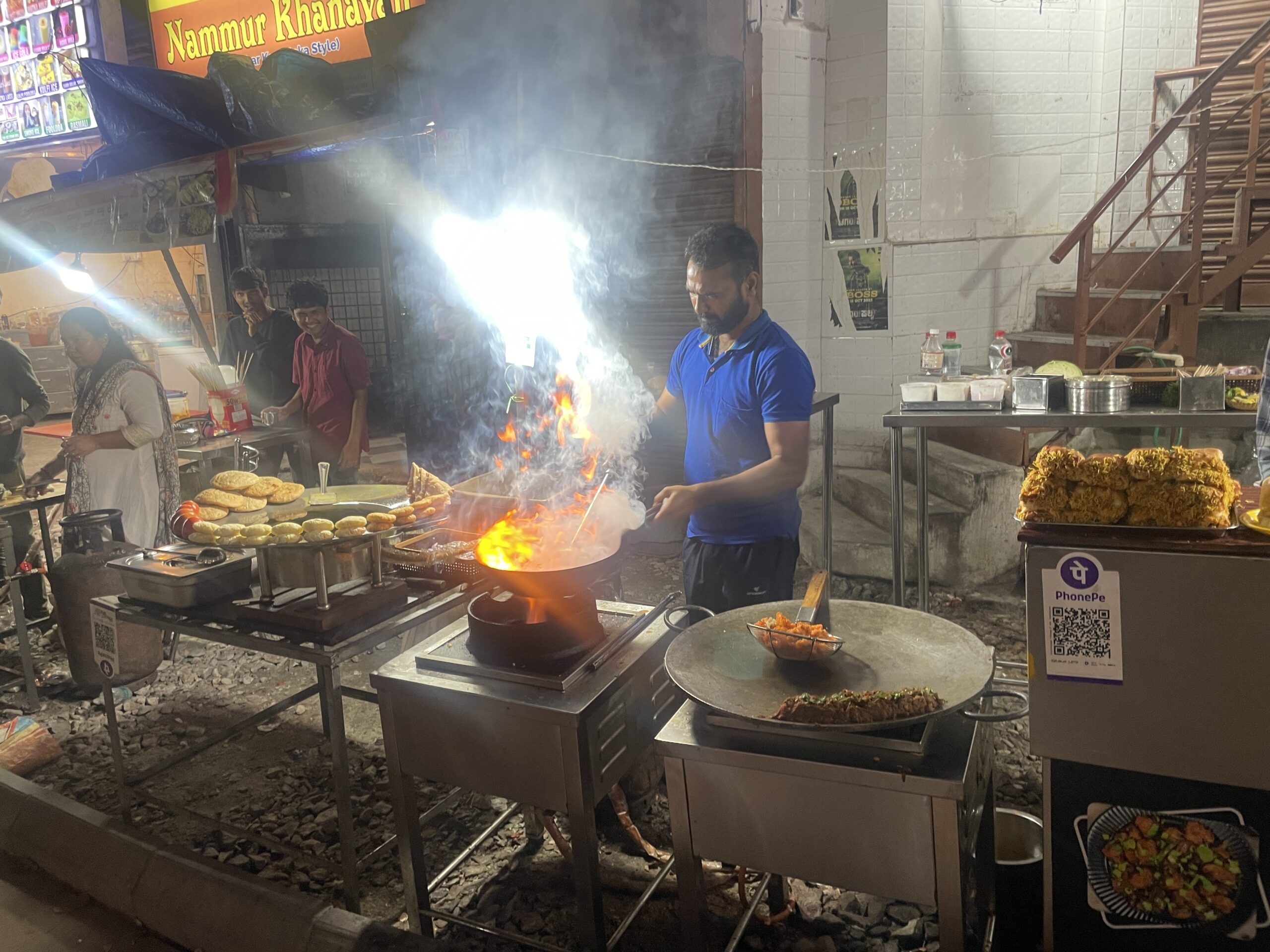
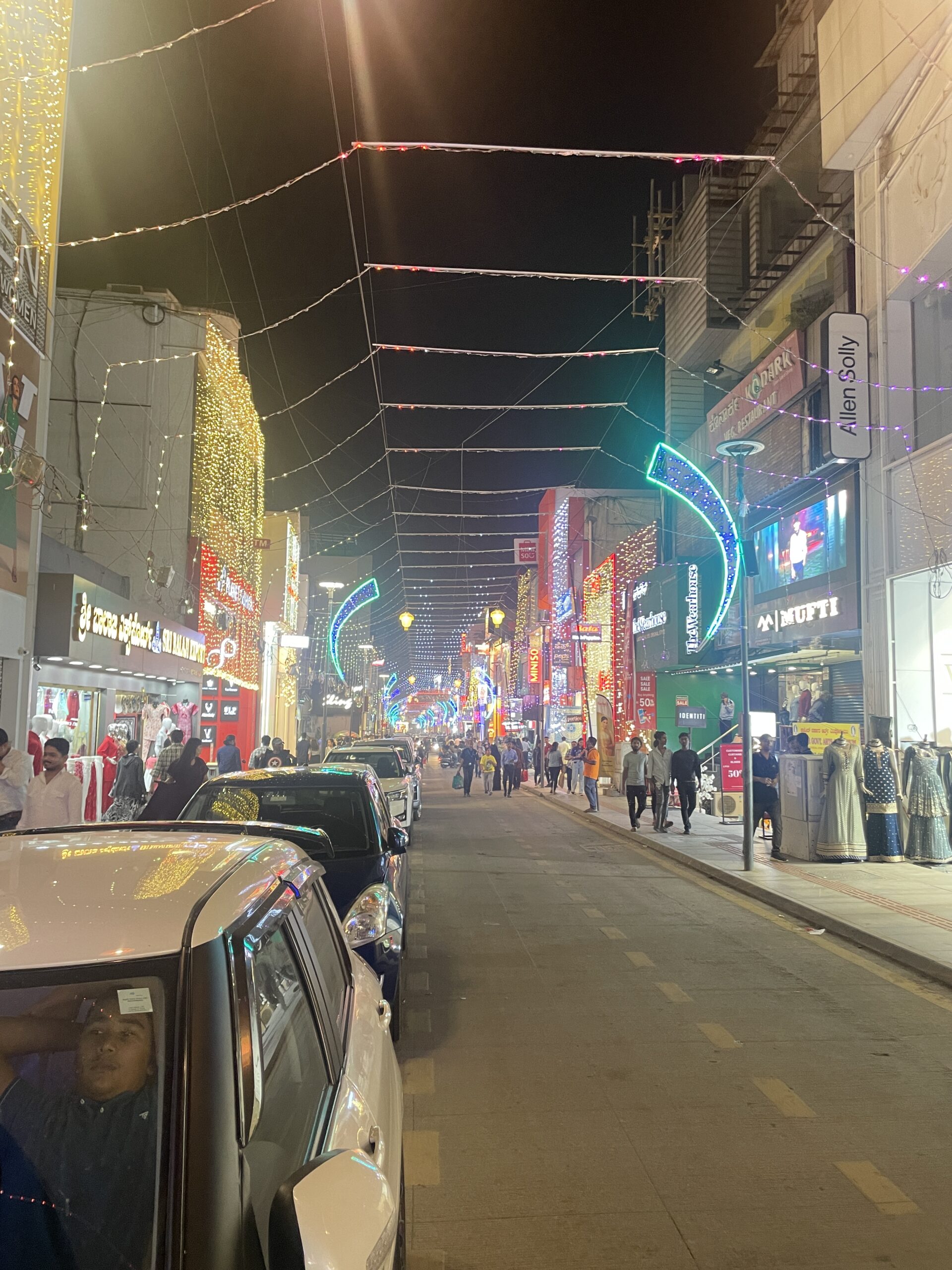
It doesn’t seem like much has changed in India since our last trip. The traffic is still crazy and the roads are a mix of asphalt, rock, and dirt and are shared by cars, buses, motorcycles, cows, and donkey-drawn carts. Street food is everywhere. It ranges from something we should probably not try (or risk getting sick) to street stalls that are mostly clean, and busy, and the food is all freshly cooked. We ate most meals at these stalls where the 2 of us could eat a meal for ~125RS per person ($1.50) and it is better Indian food that we can get in Utah.
Thindi Beedi Street Food Stalls – Dinner on Night 1
Thali Meal for just over $1.
Bangalore is a green city. There are lots of parks and huge trees. It is so different than a city like Delhi where I don’t remember parks and much greenery.
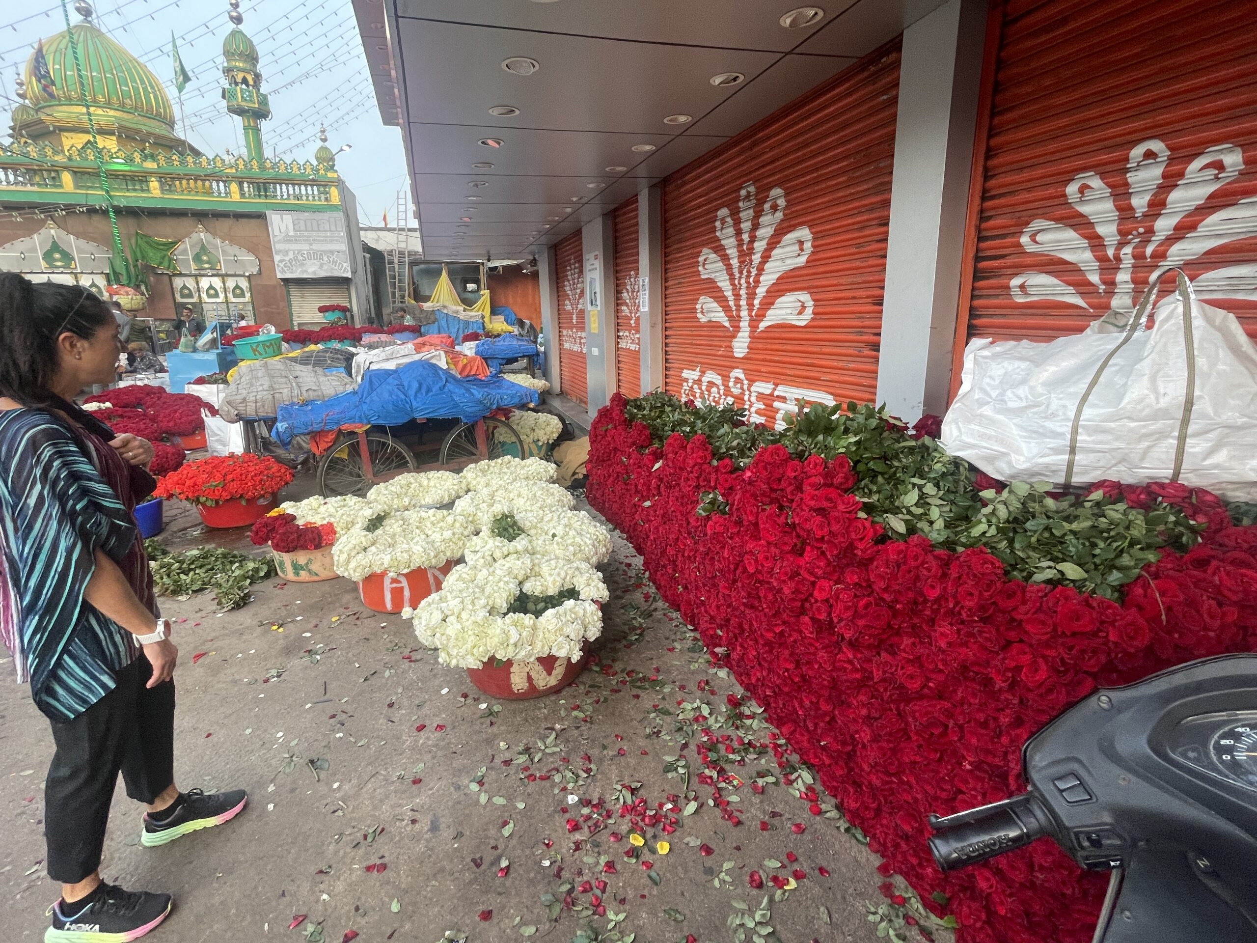
Diwali – the Festival of Lights – “victory of light over darkness, good over evil, and knowledge over ignorance”. It is like Christmas meets the 4th of July. We were excited to spend Diwali in Bangalore. To see one of their biggest holidays in a city of over 11M people was surely going to be an experience. We were also invited to celebrate the holiday with Emily’s past boss and her family. We were excited to see how the locals celebrated. We started our Diwali early walking to the KM Market (Krishnarajendra Market) which is the flower, vegetable, and fruit wholesale market. The market was crazy and overwhelming. It was at least 6 blocks in both directions and probably 500,000 people. Amazing flowers everywhere and people buying huge bags of them for their celebrations as well as for reselling.
KM Market with people stocking up for Diwali celebrations
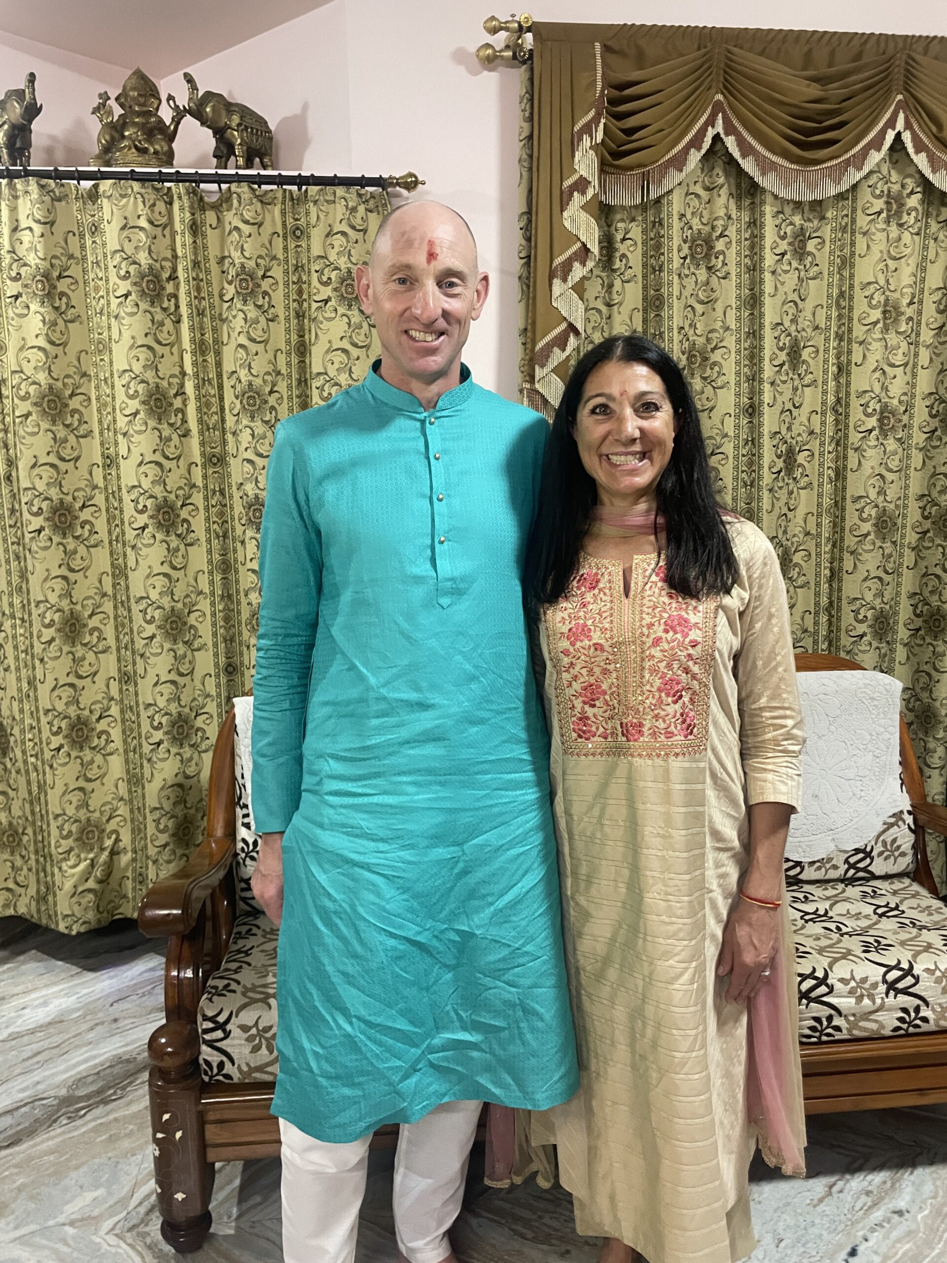
As we walked around the street on Diwali, we walked into a Hindu temple where we received our first-ever Hindu blessing. It was an amazing process of the Hindu Pandit (priest) reciting something as he moved a tray with a burning flame around a shrine 5 times. We then had to put our hands in the flame smoke and touch our foreheads 3 times. This was followed by him putting the red powder on our forehead then a tablespoon of sweet milk being placed in our hand to drink and then a tablespoon of coconut water in our hand to drink. It was a great experience.
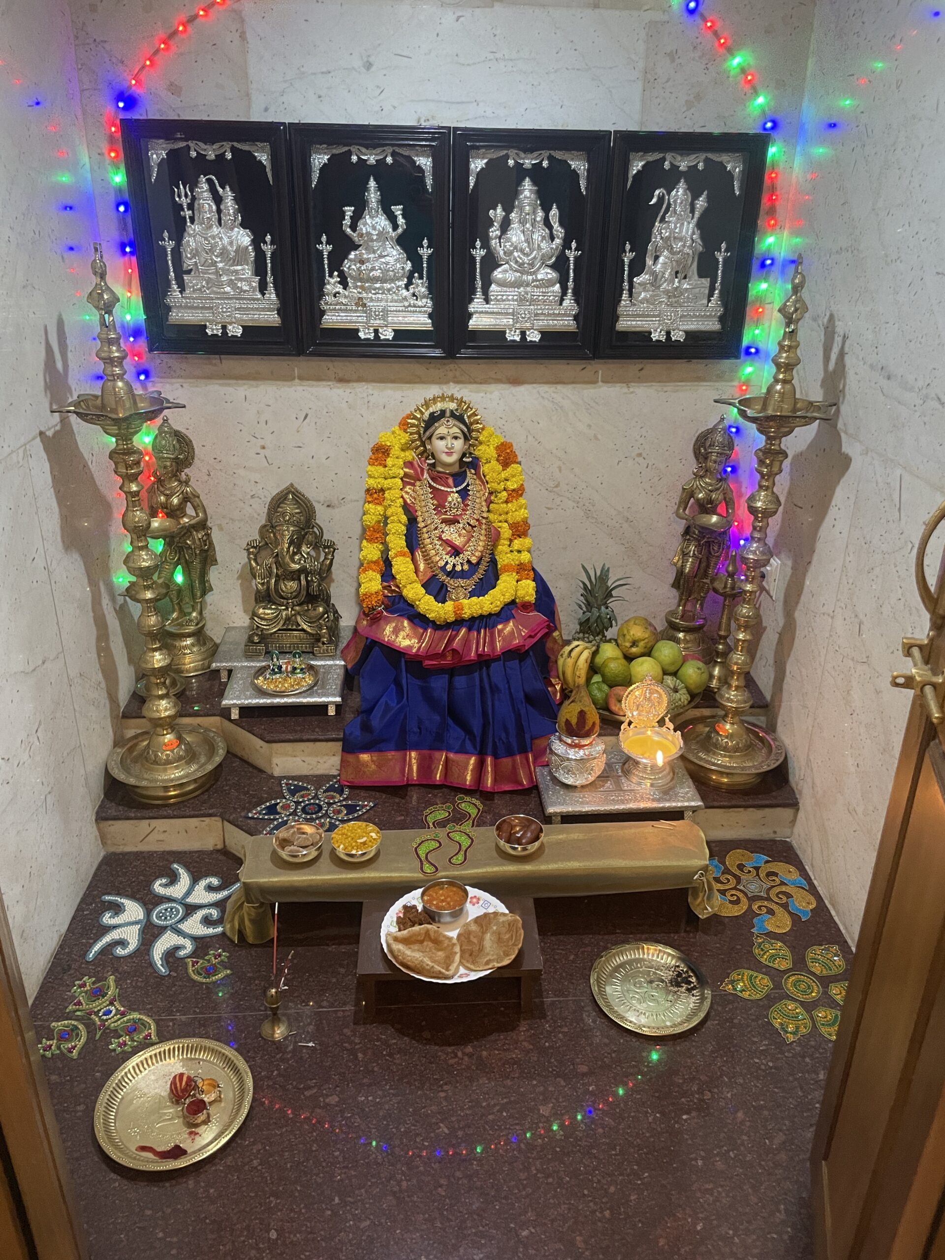
We donned our Indian attire for an evening Puja and celebration with Mamatha and her family. It was amazing to see. They had a puja to worship Lakshmi and bring good fortune. The shrine at the house was amazing. A ghee lamp needs to burn for 24 hours. At the shrine, they give 5 fruits and 5 desserts. There is a burning of some type of material that you bring the smoke to your face and then carry through the house. After the puja, 51 oil lamps are lit and placed at every door and window to honor Lakshmi. We ended the evening walking around Commerce Street which was all lit up for the holiday and packed with people.
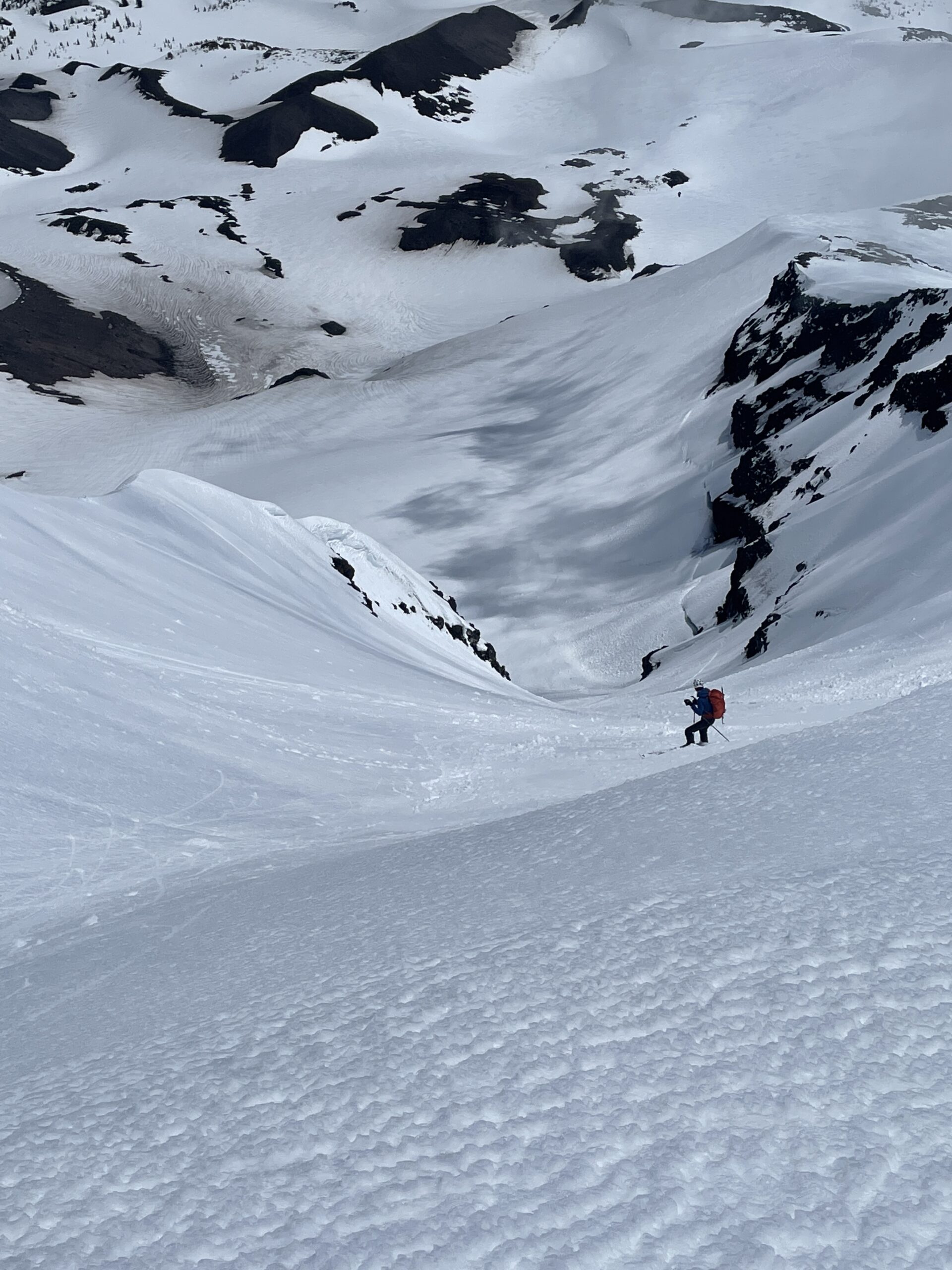
Seven volcanos in seven days. It is something I have wanted to do for over a decade. Timing, snow, partners, a weather window – there was always something preventing the trip – until this year.
With only a loose plan of getting to Bend, Oregon, and figuring it out, Marc Calaf and I were road-bound. We had an 11-hour drive to figure out a rough plan for the first 3 days. After that, we were going to watch the weather. The Pacific Northwest weather can be very unpredictable. The day we left, Rainier had sustained 60+mph winds. We had options where we could ski Bend and South or if the weather improved head north to the bigger peaks of Adams, Hood, and Rainier.
We decided to start the trip on Cascade Lakes Highway with a warm-up on Broken Top and then ski South Sister. We lucked out that the Cascade Lakes Highway opened on May 16 and we would be arriving on May 20. This would save us many miles of skinning to ski both peaks.
Broken Top is a rugged mountain whose magma core collapsed leaving a huge crater. We chose to ski The Sheild on the SW Ridge so we actually only summited South Broken Top. We were treated to solitude with no other skiers and amazing views of numerous prize ski lines. We were also treated to great weather with a small storm hitting just after we returned to the trailhead.
Day 1
Ascent
5,000′
Descent
13.0 miles
Broken TopSummit of Broken Top from the summit of South Broken Top
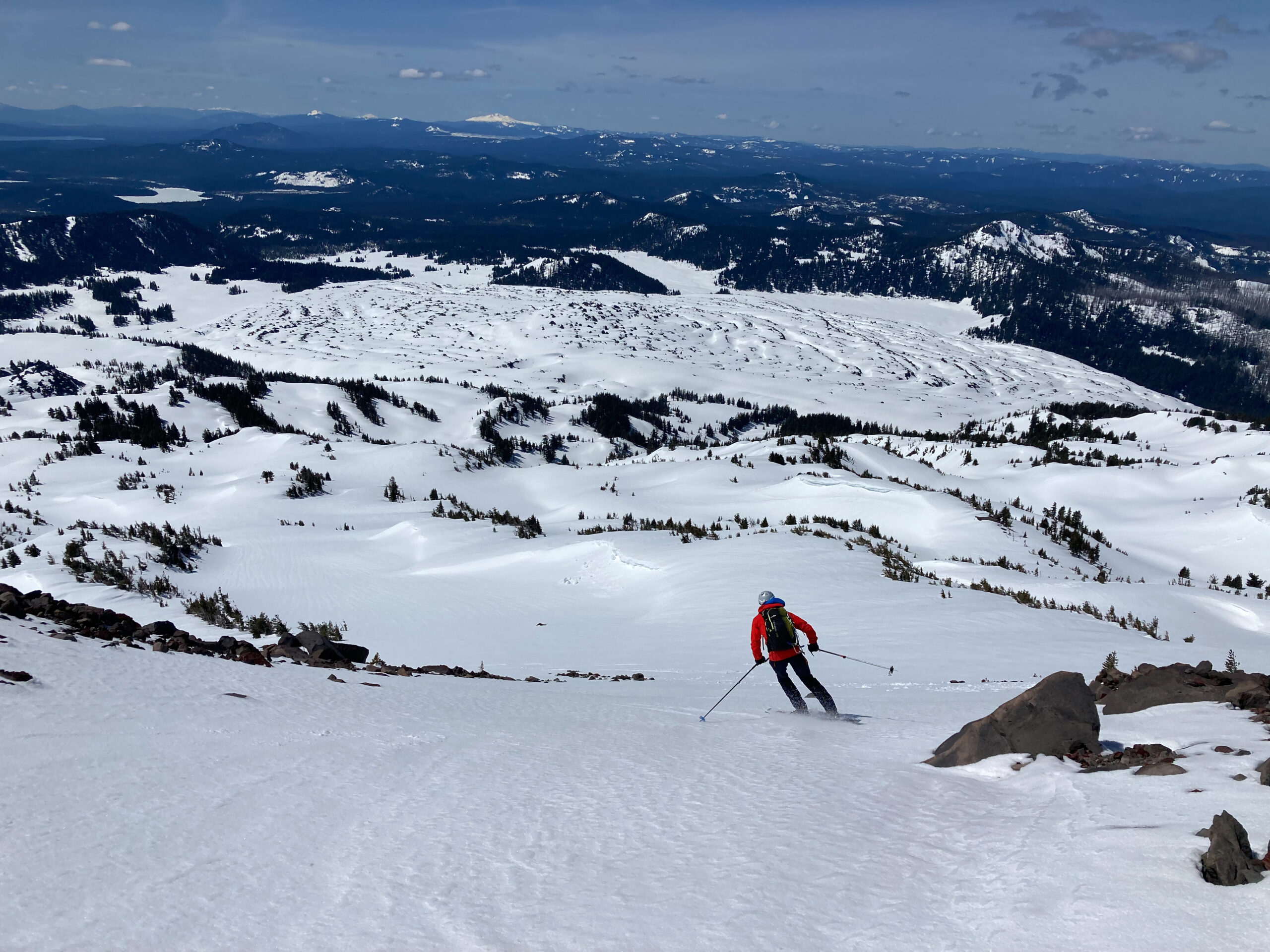
South Sister is the tallest and youngest of the 3 sisters. It also has the highest lake in Oregon (Teardrop Pool on the summit crater at 10,358’). South Sister’s SE Ridge is a very straightforward climb that was very busy with climbers and skiers. The highlight was definitely the summit crater. We were able to skin and ski right to and from the summit. We were treated with a 5,150’ descent with the top 3500’ being a continuous fall line
Day 2
Daily
Total
Ascent
5,150′
10,150′
Descent
12.5 miles
25.5 miles
The less sketchy of our 2 stream crossings5,150′ of bliss
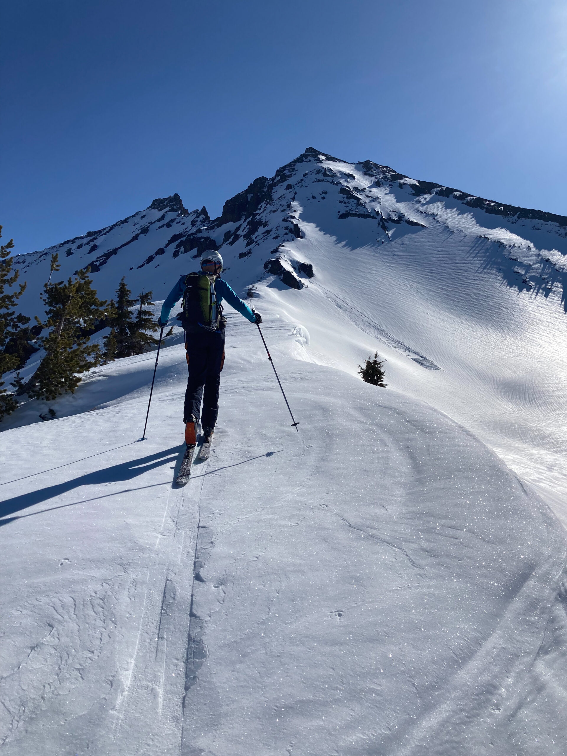
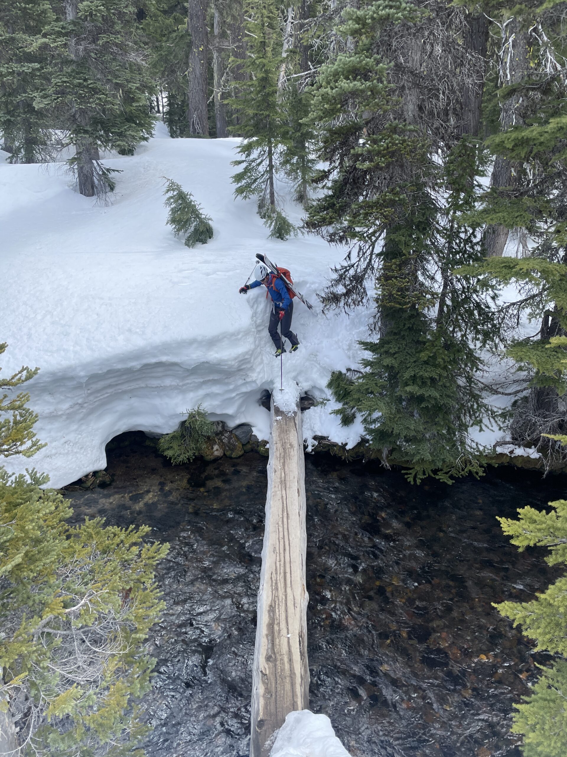
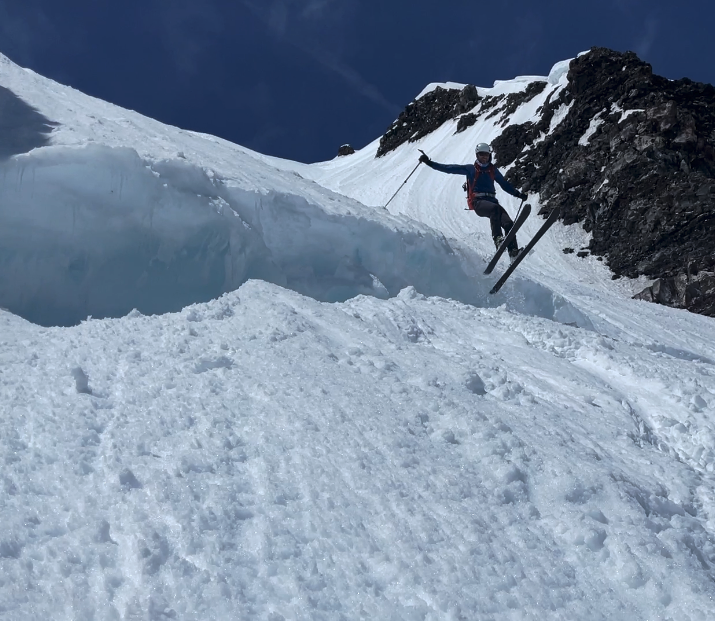
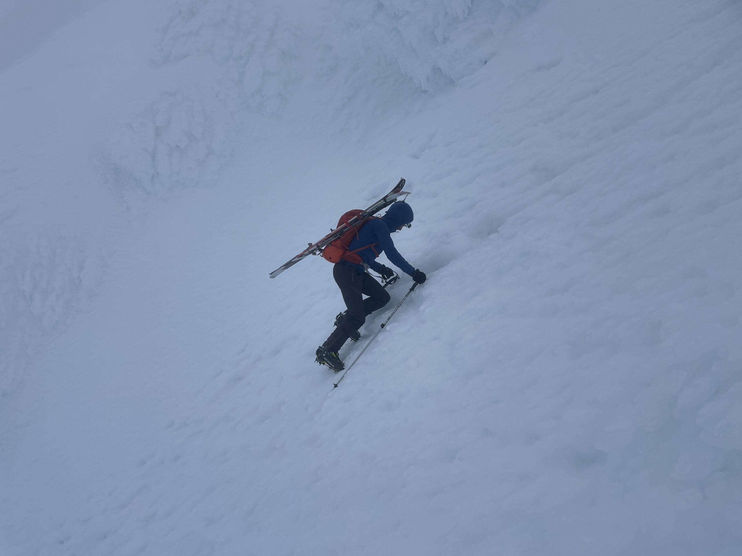
Back into Bend for some work and supplies and we were off to Pole Creek Trailhead for a doubleheader of the SE ridge of North Sister, up Hayden Glacier to the Summit of Middle Sister, and then ski the Diller Headwall. North Sister is a craggy and jagged peak and one of the hardest climbs in the Cascade volcanoes. We wouldn’t be summiting North Sister, but we would be able to get a few hundred feet below the summit to ski and avoid the 5.8 climbing of the top 400’. Middle Sister on the other hand would get us onto glaciers and steep ice. We climbed the Hayden Glacier and then had 55-degree snow ice to the summit. My flimsy aluminum crampons were not sufficient. We were treated to being able to ski the Diller Headwall which we learned from some locals is not always skiable. An amazing 42-degree descent, jumping the bergshrund, and then a few thousand feet of corn on the apron put us back to our shoes and a long 3.1 mile walk out over lots of deadfall.
Day 3
Daily
Total
Ascent
6,460′
16,610′
Descent
16.6 miles
42.1 miles
3.1 miles of burn to the snowApproach to North SisterDiller Headwall off Middle Sister – it was as steep as it looked Mark jumping the bergshrund at the bottom of the headwall
We had a 1.5 hr drive to Mt Jefferson – or so we thought. We arrived at the junction to our trailhead to a closed road and no cell service. From Jim, who we met at Pole Creek, we knew there was good skiing up from Pamelia Lake so we rerouted to that trailhead and the task of planning a new route.
Mt Jefferson is an extinct volcano that last erupted 40,000-50,000 years ago. It is the only volcano in the Cascade range that hasn’t erupted in the last 10,000 years. The peak was named by Lewis and Clark in honor of President Jefferson. The peak is the 2nd highest in Oregon and has 5,777’ feet of prominence!
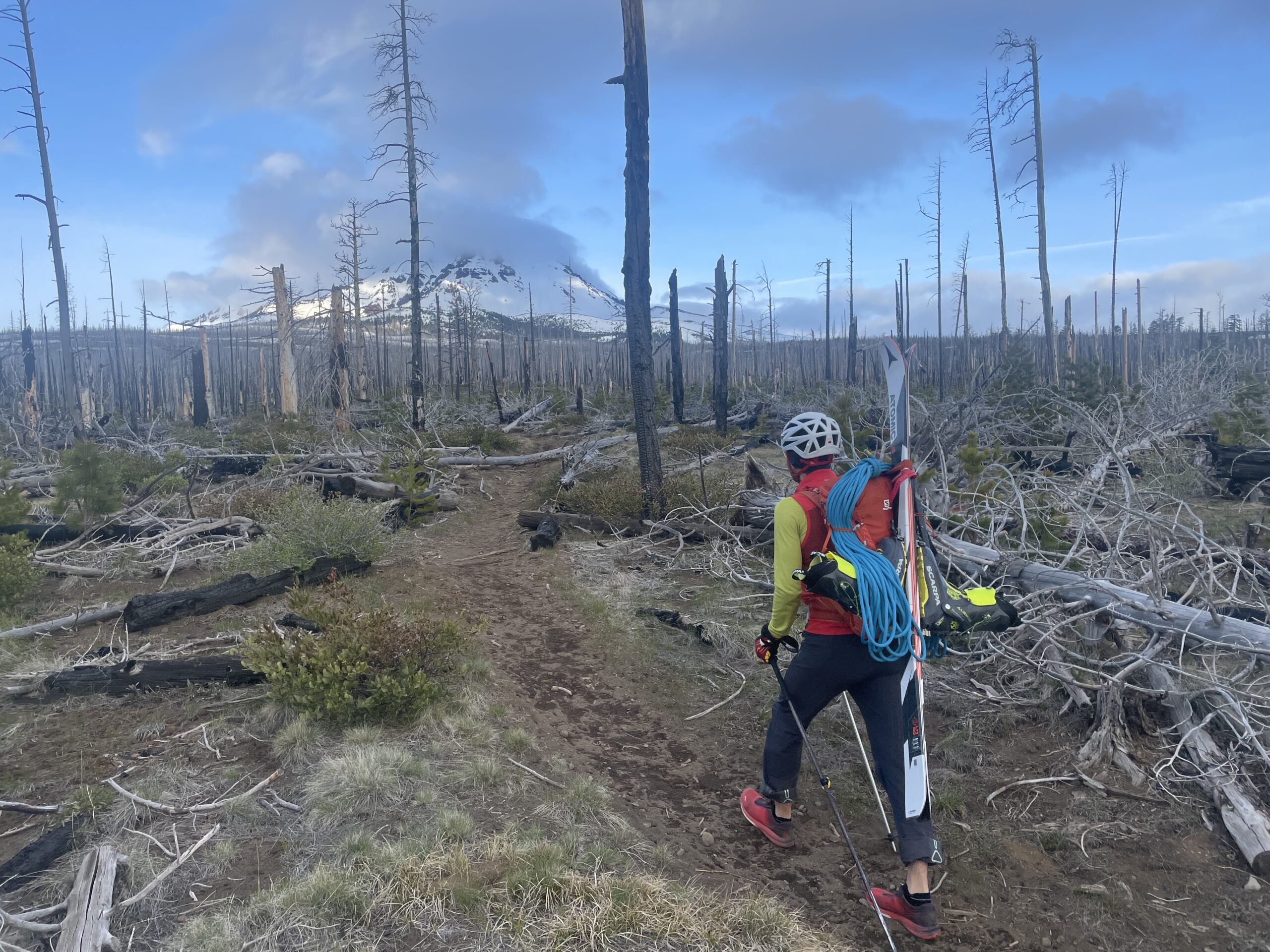
The skiing options from Pamelia Lake looked great, but the approach, not so much. The trailhead was only 3,100’ which was 1,000’ lower than we planned. We decided for a 6 AM start. 8 miles later we finally left dirt for snow and started the 5,200’ climb to just below the vertical wall of the Mt Jefferson Summit. The climb was long into the beating sun and we cooked as we climbed. We ran into a couple more locals that Jim had told us would be there and climbed for a few hundred feet with them getting more beta. After the long climb, we were treated to the 5,200’ descent on amazing corn. The LONG hike out seemed to last forever but was only around 2.5 hours. Back at the van, we ate, packed, and got ready for the 3.5-hour drive to Mt Hood.
Day 4
Daily
Total
Ascent
7,480′
24,090′
Descent
20.2 miles
62.3 miles
The approach that never endedThe final pushWe stopped short of the summitMother Nature’s Wrath
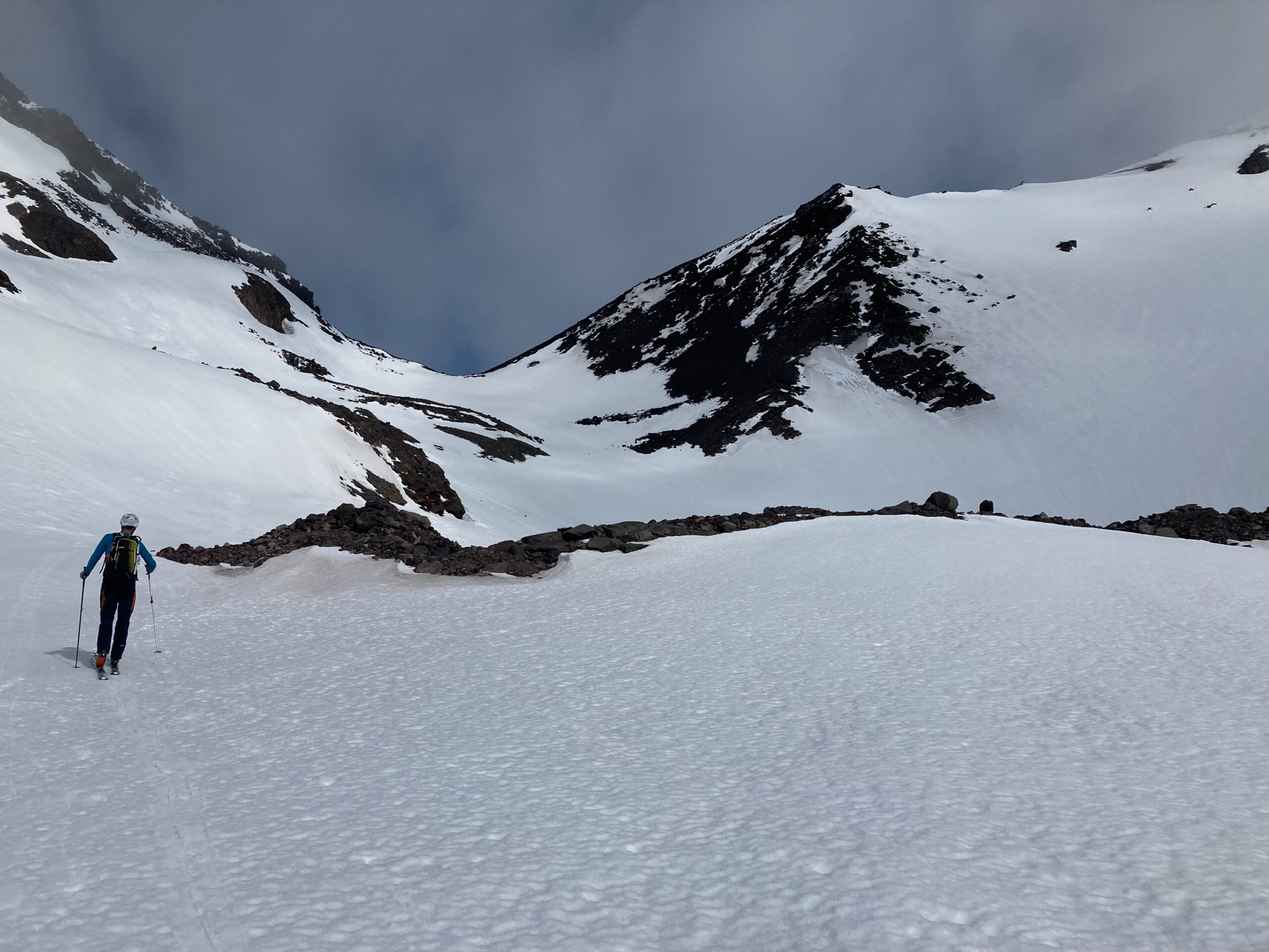
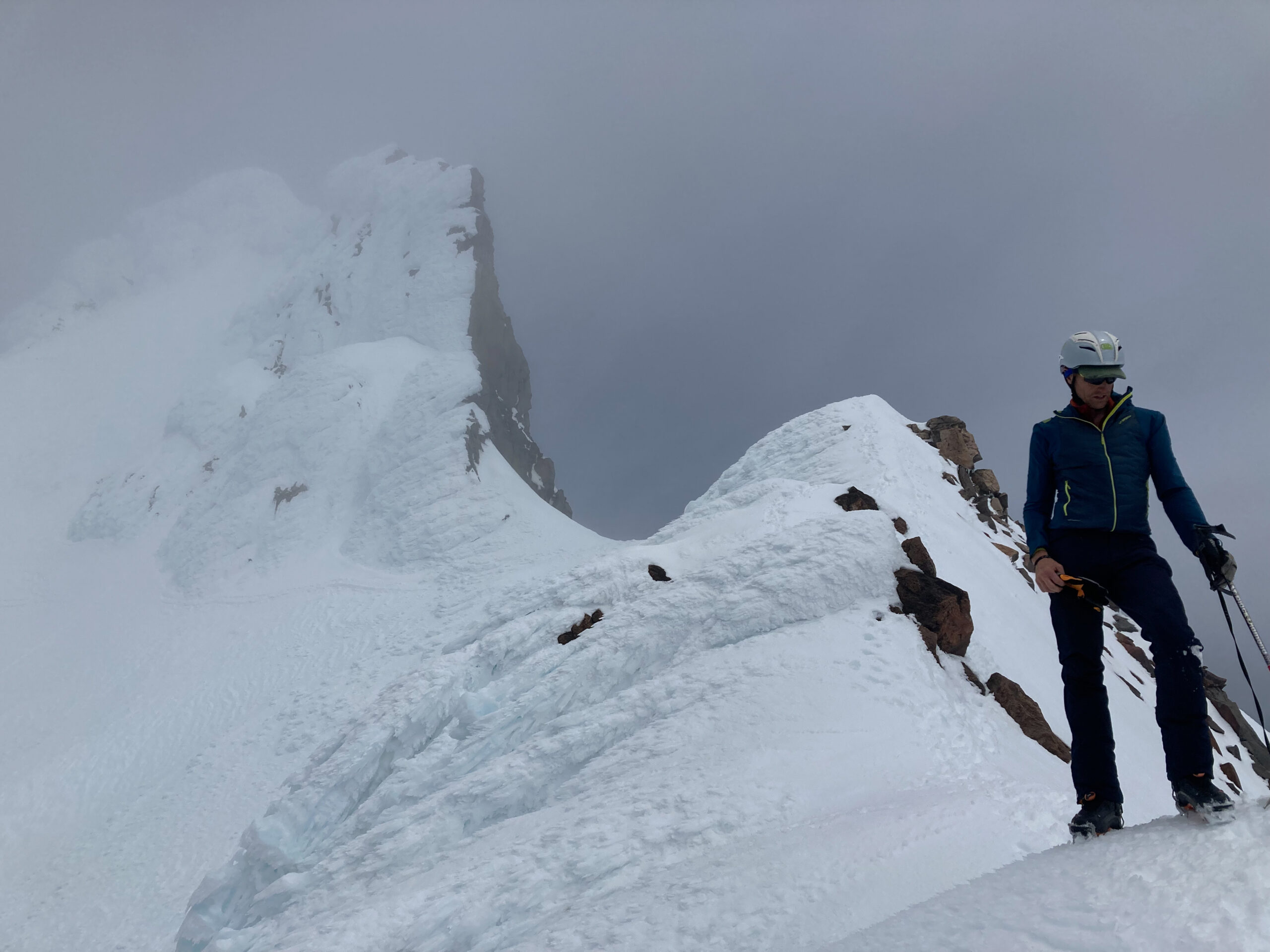
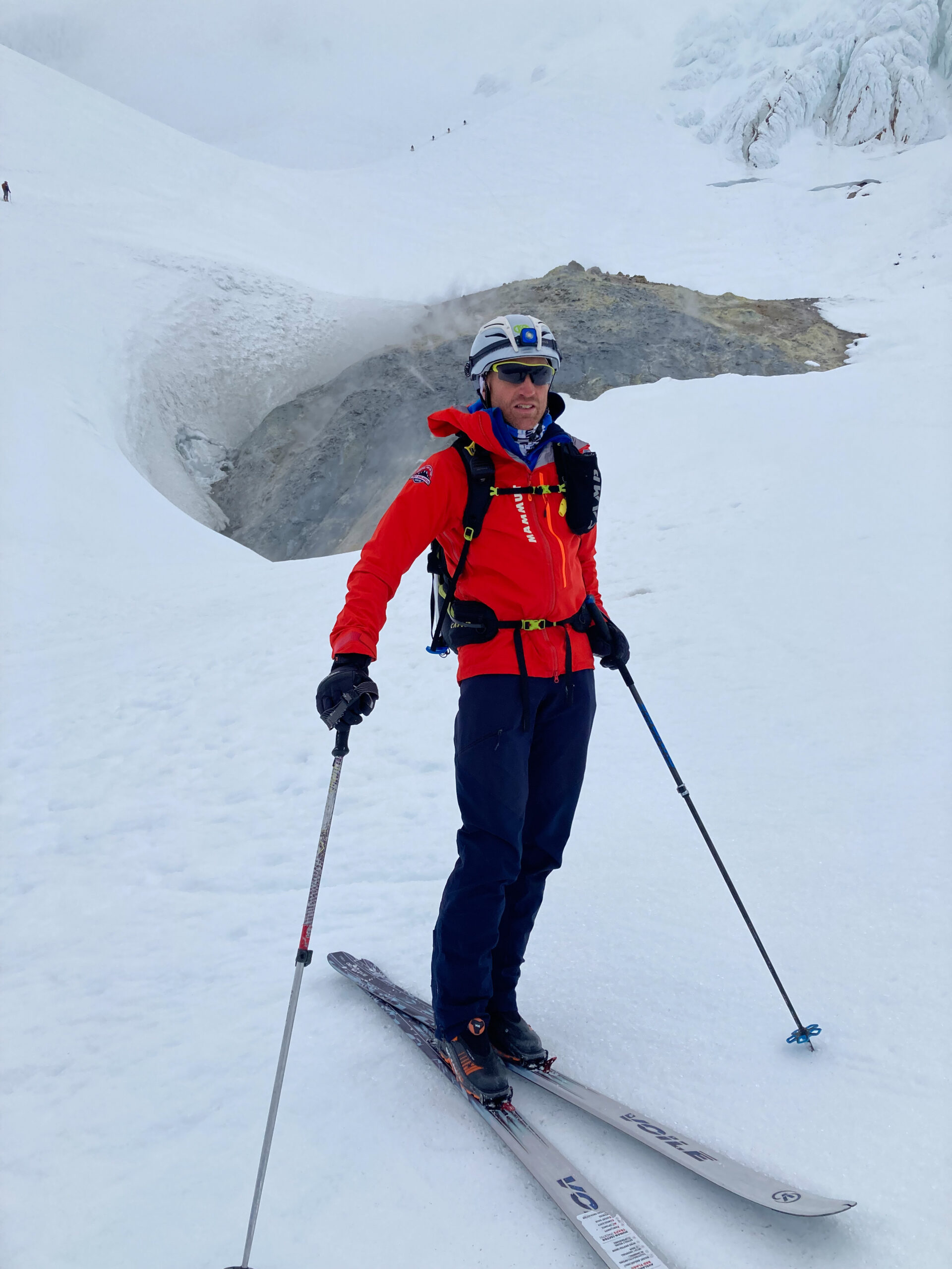
Mt Hood is a volcano with active fumaroles that last erupted in 1865 and is said to have a Very High potential to erupt again. While one of the best ski lines is the Wy’East, we wanted a summit so we were going to climb the South Side and either Old Chute or Pearly Gates. Mt Hood is the 2nd most climbed glaciated peak in the world (Mt Fuji being the most climbed).
We woke to horrible weather with 100-meter visibility and light rain. We hung out drinking coffee, working, and analyzing weather model after weather model. There appeared there might be a break in the afternoon so we decided to ascend to 8,400’ and wait for a couple of hours for a potential weather break. The weather didn’t break. We descended back to Timberline, enjoyed the comedy show of the parking lot people, analyzed weather models once again, and decided there most likely would not be a window.
Day 5
Daily
Total
Ascent
2,650′
26,740′
Descent
4.7 miles
67.0 miles
Waiting for the weather window the didn’t come
We finally decided to pull the plug and drove 10 miles down when the storm broke. Back to the drawing board – meaning looking at the weather models. The models still did not favor a summit, but they were consistent for the next 14 hours. We turned around and headed back to the parking lot with plans for a 3:30 AM departure which would get us to the summit and back down before the weather front moved in.
The 3 AM alarm was early. We dressed and ate quickly and were on skis by 3:30. We made good time climbing at a strong, but comfortable pace and ticking off the first 4,000’ in 2 hours. The clouds moved in around sunrise and the wind picked up strongly. We were hopeful the weather would hold, both concerned about winds on the summit. We locked in compass bearings for our descent assuming we would have limited visibility.
Beautiful morning as the clouds rolled inFumaroles
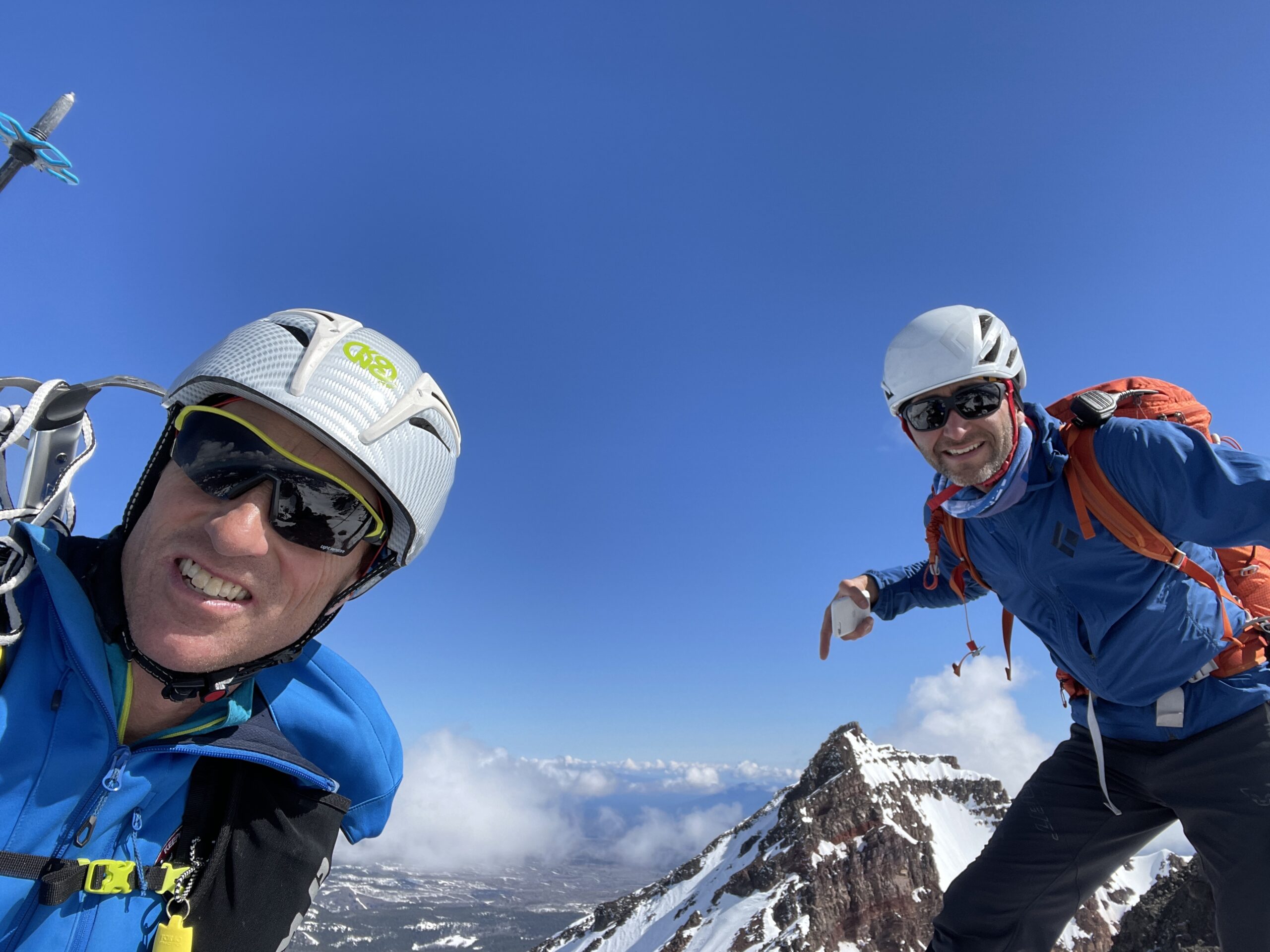
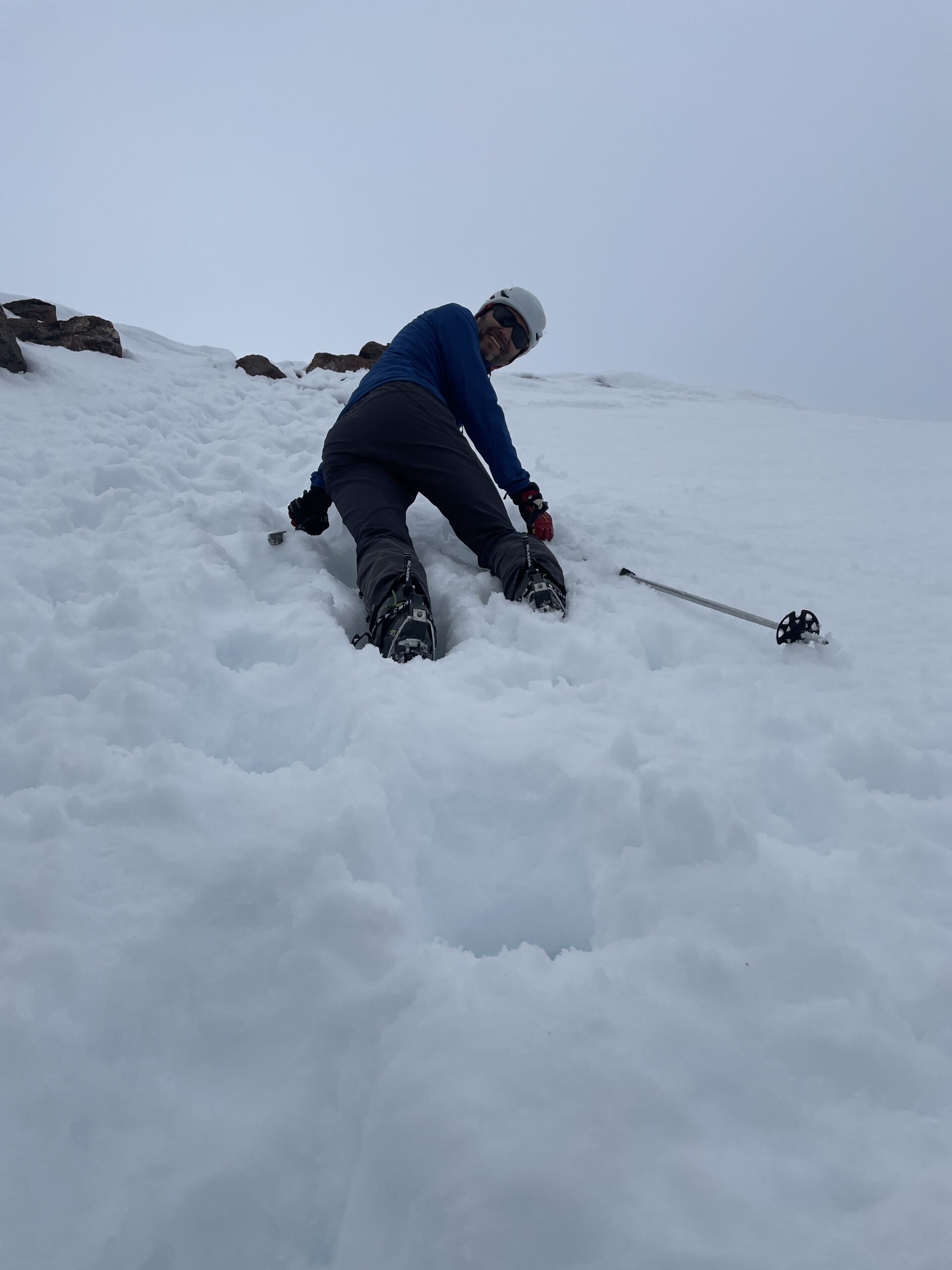
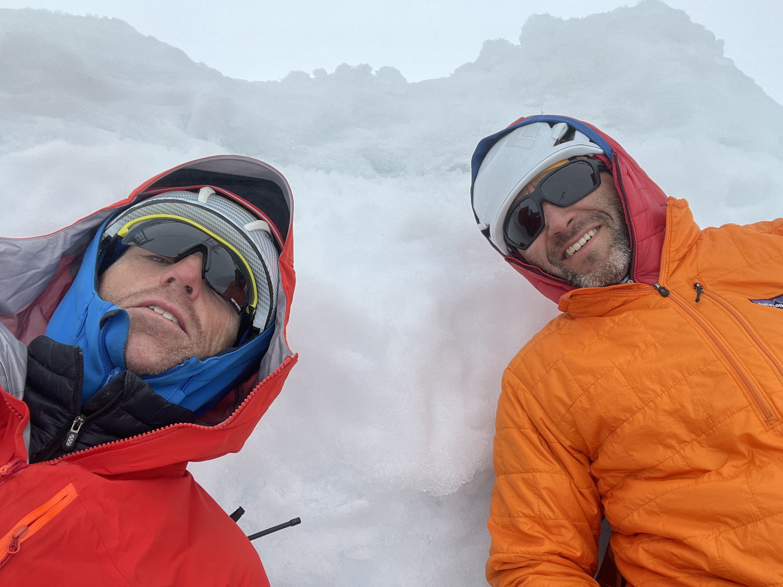
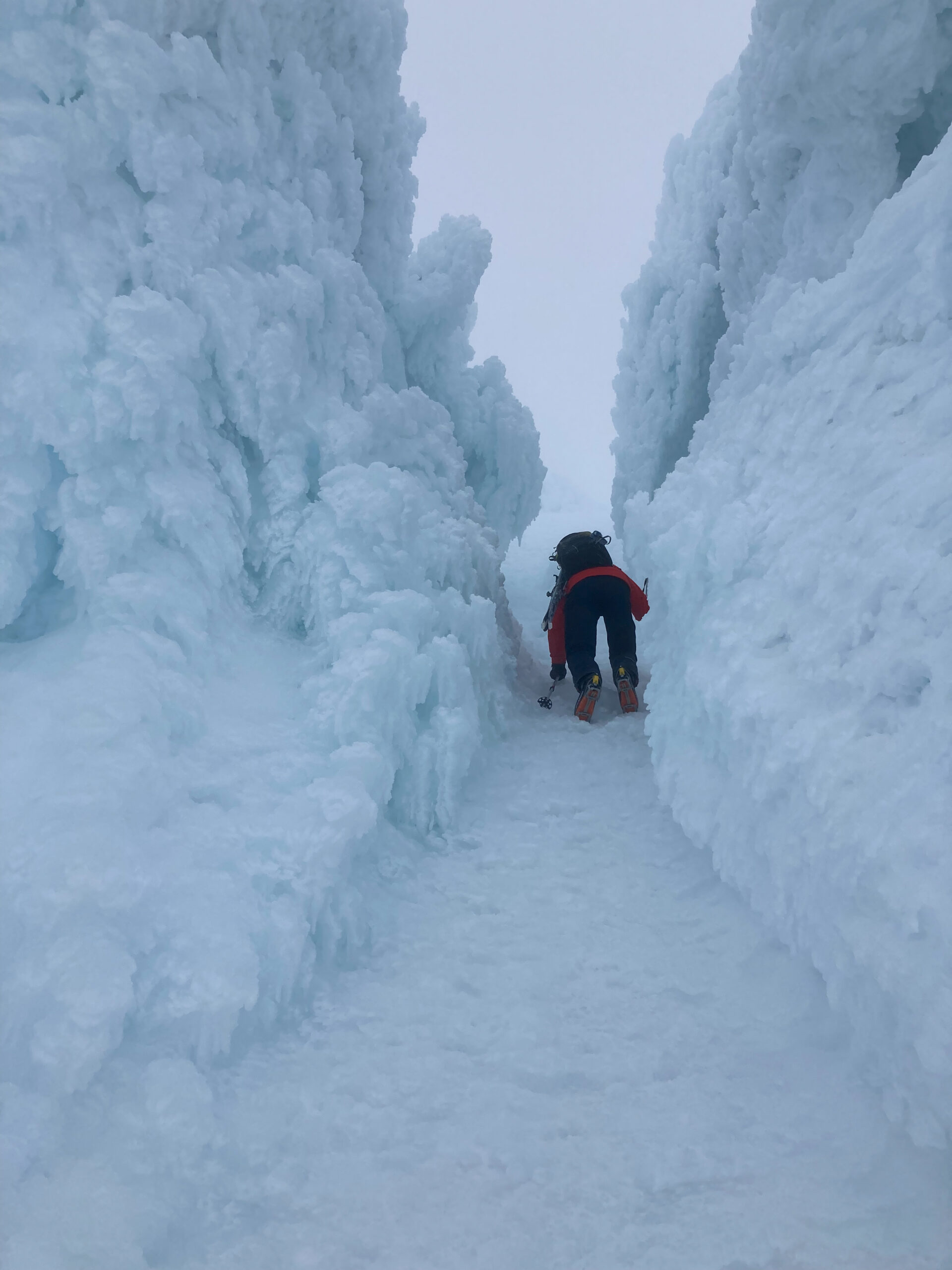
We switched to crampons at the fumaroles and continued up through the Pearly Gates which were an amazing tunnel of ice taking us to the crater rim and then the summit.
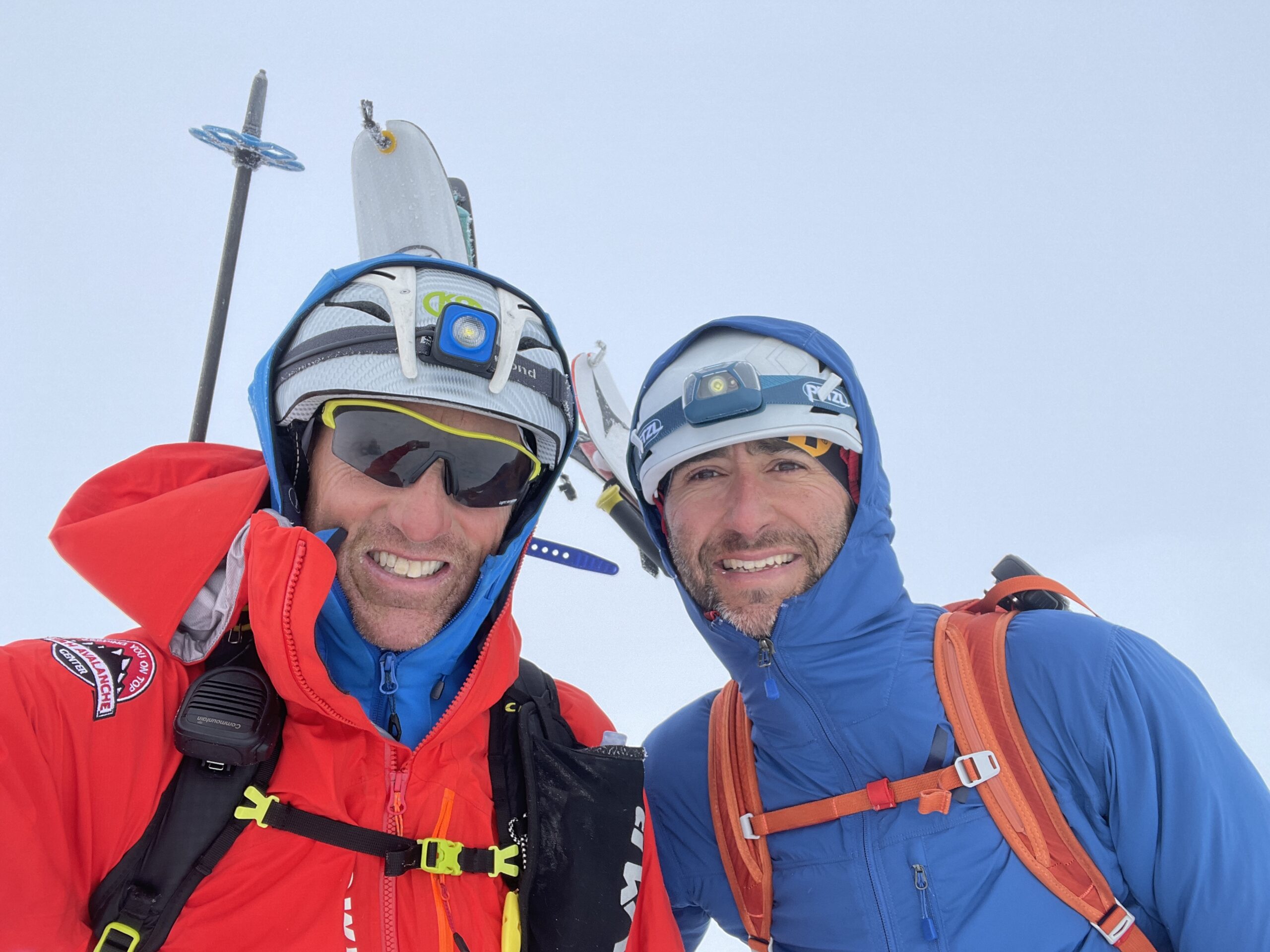
Climbing up the Pearly GatesThe final steep sectionThe top. We were treated to amazing views of the inside of a pingpong ball
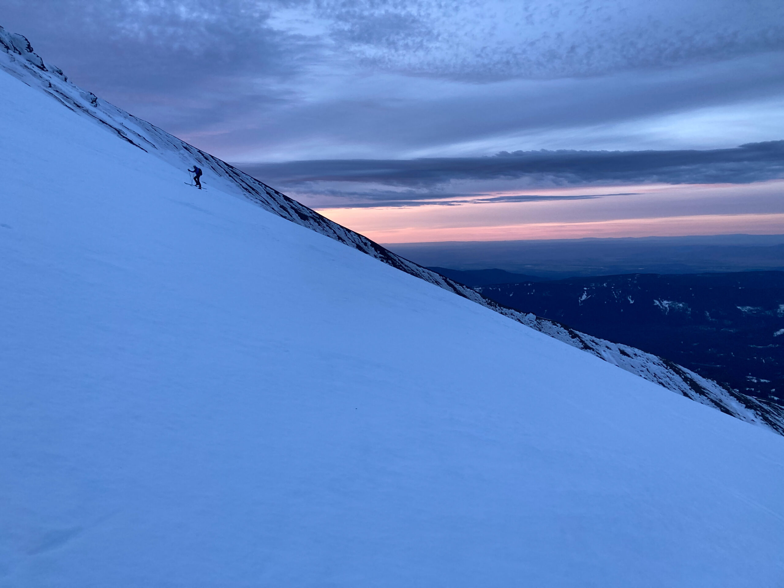
We had to downclimb to the bottom of Pearly Gates and then I switch to skis for a rowdy 50+ degree descent on solid ice. To say I skied it would be an exaggeration. With poles on my pack, I used my ice tool to lower myself down the pitch until it dropped to around 45 degrees. The ice didn’t subside for another 1,000’ after which we were treated to around 4,000’ of great corn all the way to the parking lot.
Day 6
Daily
Total
Ascent
5,460′
32,200′
Descent
8.2 miles
75.2 miles
Our weather window was officially shut and our skiing would be over for the trip. While we didn’t get 7 volcanoes, 6 volcanoes in 5 days of skiing was a success.
One year ago, I made the bold leap from the comfort, stability (and stress) of the technology consulting world for a new challenge. I began my role as Executive Director (ED) of the Utah Avalanche Center (UAC) nonprofit. I now have my first year under my belt and it has been such an amazing experience. I took on this challenge for not only a life change but also for the chance to make a difference in a sport that I love. I started backcountry skiing when we moved to Utah in 2002 and quickly developed a passion for avalanche knowledge and education. Upon becoming friends with Paul Diegel (the departing ED), I developed a huge respect for what the UAC does and I hoped to be a part of the organization at some point in my life. I think that deep down, I have always wanted a career that would help people and be something that I was passionate about at the same time.
One of the too many to count events we provide awareness and education materials at.
What has it been like to be the ED? For starters, I have never worked with such a passionate group of people. The entire staff is whole-heartedly dedicated to the mission of the UAC and is committed to our success. This is such a change from the corporate world where so many people are just ‘filling a seat’.
Dedication is dressing up for a throw-back ski movie (Aspen Extreme) fundraiser.
I have learned so much over the past year. One of the great things about a small nonprofit is that every day is different. You can be writing a grant, talking with a donor, fixing a trailer, and giving an avalanche awareness presentation all in the same day. Payroll, insurance, employment law, hiring, teaching, grant writing, project management and the list goes on. These are just a few things that fill my days.
Bourbon tasting and avalanche education – the perfect combination.
On-snow avalanche classes.
I have also had the privilege to meet many, many amazing people that share our passion and support our cause. These people range from donors, to educators, to the staff of other avy centers.
I have also learned new skills, like riding a snowmobile in the mountains. Turns out this is MUCH harder than I had imagined.
Patient instructors
One of the big questions I get is, what are you going to do in the summer. It is often hard for people to believe, but the ski season is actually not our busiest time of year. Summer consists of special projects (this year we are rebuilding our website and building 5 online learning modules) as well as planning our fundraising events, the Utah Snow and Avalanche Workshop, and getting all of our winter classes scheduled. Fall is event season. We have several fundraisers ranging from as small as 50 people to as large as 1,000 people, we have educational tables are numerous events (ski sales, outdoor events, etc), and we have our large 900+ person Utah Snow and Avalanche educational workshop, The list goes on.
What a year it has been! As we ramp up for the upcoming season, I am excited to be able to take what I learned in my first year, help keep people safe in the backcountry, and continue to grow our fantastic organization.
Alaska is on the bucket list of almost every skier I know. Eric and I are no different and have been talking about a ski trip to Alaska for many years. This was our year! With busy work schedules, we deccided on the last part of April and early May. It was easy to convince Tom Diegel to join us and the 3 of us were excited for another adventure after last year’s attempted Highline Trail Ski.
As Tom said, “3 dorks ready for an adventure”
Plans were discussed, modified, updated, changed again, and we finally had a loose plan to get dropped off on the Pika Glacier in Little Switzerland of the Alaska Range for 12 days of base camp/expedition style skiing.
None of us ever having done an expedition style trip, we built out our menu and just didn’t think it could be correct to need quantities like 20lbs meat, 14 lbs cheese, 48 bagels, 60 tortillas, and the list went on until we were at $600 and around 160lbs of food. It didn’t seem possible to need that much, but that came out to 3.8lbs/person/day for 14 days of food (2 extra days)
499 lbs of gear and no beer!
Our first indication that this may not be the ski trip we had planned should have been the delay in getting in due to a several day storm and a questionable 5-day forecast. Undeterred (or maybe not smart enough to know what was to come), we were excited to get onto the glacier and start skiing. We flew in on Sunday with plans to get picked up 13 days later.
Luxury Limo Service by Talkeetna Air Taxi
Amazing views of the Alaska Range
The glacier landing in fresh powder snow was amazing, you just floated down not really even knowing you were on the ground.
Landing in 2 feet of fresh
With our gear unloaded, we started slogging loads and getting camp set up. We had a short window to ski after setting up camp and little did we know, it would basically be the end of our ski trip and the start of ourshoveling trip.
Slogging loads to camp
The only day camp was underground
The Black Diamond Megamid makes an amazing cook tent
On day 2, we were able to sneak in a partial day of skiing before “The Storm” moved in. We ended up with a storm that lasted 9 days with only a short clearing on the 9th day giving us long enough to get picked up by TAT before the next storm moved in. We spent 8 full days at camp only leaving twice (once to check out another camp and another time during a 2-hour clearing to ‘try’ to ski). Like any good ski trip where you plan to ski for 7-8 hours per day, on our now shoveling trip, we were shoveling 7-8 hours per day with rarely being able to go more than 4 hours at a time without digging out camp. We passed our time pretending to be funny, reading, playing scrabble, eating, and sleeping. Luckily the 3 of us travel very well together and were able to keep each other’s spirits high in light of the grim situation.
No beer, but we have bourbon!
The Mad Hatters demonstrating our dual purpose pot parkas
Storm day 2 of 9
Storm day 3 of 9
Storm day 4: Sleeping tent, we had to dig our way out every 3-4 hours
Cook tent on storm day 4 just 3 hours after digging it out
Looking up out of the cook tent on one of the few storm breaks
By the 5th day of the storm, with the limited forecast we could get, and what we had not looking good, we made the call to TAT that we were pulling the plug for the next available transport back. They had no clue when the storm would clear as all long-term models showed snow with a couple breaks in 4 or 5 days. So – we continued to shovel. We attempted to leave camp, it didn’t work, it took us 20 minutes to go 300 meters.
We tried leaving camp on storm day 5, it didn’t work
So we shoveled some more.
Continued digging and terracing of our now buried camp
And occasionally were treated to some views of the surrounding peaks
Another rare storm break on storm day 6
By the 7th day of being tent bound, our creativeness was really starting to develop and we invented the great new sport of competitive shoveling. We really hope this sport takes off next season as after 70+ hours of training, we felt we were in a good position to do well at competitions. Here is a tutorial on the new sport.
As the days passed and the storm didn’t, we were starting the discussions of food rationing. On day 8, we knew we had 8 more days of food but were unsure if that would be enough as there were other groups on the glacier already 5-7 days overdue. Finally, on day 10 we woke up to clear skies. Unfortunately, Talkeetna was stormed in. By mid-morning, the fog had rolled in and visibility dropped to zero. It cleared and fogged in a couple times. It would be clear on the glacier and foggy in Talkeetna. This continued until late afternoon when things cleared up and we received the pickup message.
Storm day 9, day 10 at camp. A partial day of clearing, just enough to break camp and get out before the next wave
This was camp – our tents are buried in those 3 holes
On our final day, everyone pitched in to pack in the runways
A quick ski run before getting picked up
A quick ski run before getting picked up
After 15 feet of snow, everything had avalanched. These slide paths were absolutely amazing.
TAT Pilot Paul – this was the largest storm he had seen
Glad to be out of shoveling mode and hoping to sacrifice the ski trip, we made our way to Hatcher Pass for a few days of skiing in the ping-pong ball (low visibility and flat light). We had 3 days of poor weather. We skied the Bomber Traverse in a day in character building conditions (5 miles of downhill skinning in low light and isothermic snow).
Bomber Traverse in flat light. You never knew if you were going up or down until you were down
Our final day was the best weather of the trip with partially cloudy skies and bright sun.
Final day and best weather we had the entire trip
We savored 3 runs above Independence Mine and then had to head back to Anchorage to pack and get ready for early flights out. A great completion to a failed ski trip and a successful shoveling trip.
For some reason, I am obsessed with the Highline Trail across the Uinta mountains of Utah. I first backpacked across the trail around 2005, did a solo run across it in 2010 to set an FKT, then ran across it again in 2013 to set another FKT. I have wanted to attempt a ski traverse of the Highline Trail and started to plan it in 2014. Snow, weather, ski partners, car shuttle drivers, etc just never seemed to work out to be able complete the traverse. Eric Bunce and I committed last spring to get it done when we could get the logistics to all line up. We wanted a third person to join us and we reached out to Tom Diegel knowing that he is always up for an adventure. The text string below for inviting Tom would probably sum up our adventure.
Text Message Invite to Tom
I was excited to have a strong set of partners for what I knew would be a very challenging few days (I also now have a feeling these partners may second guess any future adventures I invite them on). We were planning for a traverse Thursday to Sunday, then due to deteriorating weekend weather, bumped up the start to Wednesday. We knew this risked not having consolidated snow from the last storm, but hoped for the best.
We had everything lined up with a very simple plan
Tuesday I would borrow the neighbors truck and loaded my sled.
Tuesday night we would get together to finalize gear and logistics. We reviewed with Emily and Jackie our options for bailing out and the trailheads we could end up at. None were good options and all involved well over 15 miles of skiing to get to a road plus at least 3 hours of someone driving to get us
Jackie would drive us to the trailhead on Wednesday morning and then mt bike in Vernal on her way home.
We would ski for 3-4 days using a Delorme InReach to mark our progress and to call out for a ride if we had to bail out.
Thursday Evan and Paul would take 2 snowmobiles up Mirror Lake Highway and ski for the day leaving 1 sled and a pack of gear for us at the west Highline Trail Trailhead. They would stash the sled, key and bag and hope it was all there when we reached the trailhead. They would leave the neighbors truck and my trailer at the trailhead for us to get back home with if/when we finished.
We would eventually reach Mirror Lake Highway and drive the sled towing 2 skiers back to the trailhead where our (hopefully) waiting vehicle and trailer would be there for us to drive back home.
As Paul clearly pointed out, what could possibly go wrong with this ‘simple’ plan.
On Tuesday we decided that a later morning start with more sleep would allow us to go longer into the night as our goal was short naps and move as much as possible. We left Summit Park shortly after 6AM on Wednesday and we were walking up the access road by 9:30 for what we thought would be a 4 hour approach to the Leidy Peak Trailhead that ended up taking us 7 hours with 14 miles and 3700′ climbing as well as some good bushwhacking and lots of trail breaking. By the time we reached the actual start of the Highline Trail, our feet were already in bad shape from being wet for so long from trail breaking through ankle+ deep wet snow. We continued on with hopes of making it to Chipeta Lake shortly after dark. By the time we reached Whiterocks Lake (5 miles from Chipeta), we had to stop for the night due to foot issues. Trenchfoot was now turning into frost nip. We had travelled about 23 miles and climbed 4800′ in 11.5 hours. In the entire time, we took our skins off once and made 8 kick turns through stiff breakable crust.
We lit a fire and setup our bivies and attempted to dry out some socks and boot liners. This would prove to be impossible and we spent 3 days in wet boots. I had a restless night for my first winter open bivy, but woke up Thursday morning feeling restless and excited to get moving.
We had a slow start Thursday getting gear situated and feet fixed. We enjoyed some long gradual climbs and even had a few turns on Thursday. We were able to take advantage of the descent off North Pole Pass to make good mileage traversing into the massive Fox Lake and Kidney Lakes basin. We were not making great time. We were breaking trail through breakable crust in the mornings; through soft, unsupportable snow in the afternoon; and then back to breakable crust in the evenings. We were expecting to be able to use gravity and cost across some areas, and this just was not happening. We were hoping for ~3mph as an average pace and were making barely over 2mph. We talked about options, do we bail out at Painter Basin for the 18 mile skin to Henry Fork road, do we push on and hop to beat the storm, do we push on and hope the storm is delayed, etc. We sent out a request for a weather forecast via our InReach and the storm was still scheduled to hit us on Friday night. The winds would pick up and by Saturday night it would be -8F wind chills. We knew we would need to be done by 2 or 3 on Saturday to get out of Mirror Lake Highway before the storm really hit. Day 2 had us covering about 25 miles with 4300′ ascent and 3600′ descent in 13 hours.
We had our decision to push on, we would hope to camp in Yellowstone Basin Thursday night. After the skin from Kidney Lakes to Painter Basin took far, far longer than expected, we were not willing to ski down the thin snow and exposed rocks of Anderson Pass in the dark so we camped at the last stand of trees in Anderson Basin. We had made it around 26 miles in 13 hours. We made a fire to attempt to try boot liners and went to bed with the alarms set for 4:30 to get an early start in order to make it to Rock Creek on Friday. Around midnight, the winds started to pick up in earnest. I had a completely sleepless night as I listed to the wind howl, the trees shake, and tried to keep my already failing bivy system from being blown to shreds. When we woke in the early morning, I knew we could not safely continue on. The winds was gusting 40mph and was expected to pick up to 60 mph gusts by end of the day. We would be climbing from 11,500′ where we were camped to over 12,000′ and we had 4 large passes to climb all into the wind. Eric thought we could make it; Tom wasn’t sure, but didn’t want to take risks; After being the person who pushed the others to commit to the finish on Thursday, on Friday morning, I knew we had to pull the plug as we had 40 miles to the snowmobile and we were at our only bail out option. We made the hard decision to bail and sent the ‘come get us’ message to Emily, Jackie, and Ashley at 6AM as we were on our way from Painter Basin 18 miles to the road where we could get picked up. The wind was fierce on Friday. I have skied up to King’s Peak 5 times and have always dreaded the long skate across Henry’s Fork Basin by Dollar Lake. With the massive tailwind, all we did was hold our arms out and get pushed across the flat basin. Eric clocked us at 20 mph across the flat basin (which was a lot of fun when we hit the breakable crust sections). Once we got to Henry’s Fork Creek the next set of fun began. The snow was supportable for a while as we crisscrossed the creek on questionable snow bridges and eventually was unsupported and we were forced to skin the final ~5 miles to the road. We reached the road and couldn’t get our boots off fast enough as we ate through the remains of our food and waited for Jackie and Paul to come and rescue us. Our bail out was 18 miles with 1600′ ascent and 3700′ descent and took us 7 hours.
Unfortunately, the adventure wasn’t over as on Saturday we had a borrow a snowmobile and go 20 miles back up Mirror Lake Highway to retrieve our exit sled.
I think the trip can be summed up with blisters, sore shoulders, sunburnt lips, long hours on skins, and an even larger desire to go back and ‘get it done’.
Things I learned
Really great partners are a necessity for crazy long adventures like this
You can actually get frostnip toes and trenchfoot in the same day
Before your first bivy, test out your bivy gear – my bivy sack wripped open night 1.
The odor that develops when you don’t take off wet boot liners (or skimo race suits) for 3 days is worse than I ever could have imagined
Click on the gallery below to browse the photo gallery and click on each photo to see full size with captions.
The second part of our trip was planned around relaxing. After another late night, we caught an early morning bus to Girona, rented a car and headed to the beach. The coast was HOT and it didn’t take us long to remember how much we hate heat and humidity. We relaxed on the beach Tuesday afternoon, then got to our hotel in Tossa de Mar to learned it had no AC or wifi. We were planning to use some of this time to catch up on work and emails and now this would not be possible. Our hotel room was over 32C, so sleep didn’t look like it would happen. .
Cala del Sr. Ramón
Ruins in the fortified city of Tossa de Mar
We had booked 2 scuba dives on Wednesday with a friend of Gerard and Marta’s then had an amazing sea side dinner on a private terrace (thanks to Gemma’s roommate’s parents who are friends with the owner and made reservations for us) followed by a very warm night. It was so hot, I soaked a pillow case on water and laid it over my body to attempt to cool myself.
Dinner on a private terrace at Bahia in Tossa de Mar
We were excited to dive on Wednesday as we don’t get an opportunity to do it very often and always nice to see under water in different areas.
Scuba Diving with L’amfora in Tossa de Mar
Scuba Diving with L’amfora in Tossa de Mar
Afer diving, we drove to Villafranca in the Penedes area to tour and taste cava. We had planned to spend 1 night in this area and we were very happy we extended this to 2 nights. Cava is the traditional sparkling wine from the Penedes area. Any Spanish sparkling wine can be called cava, but the only certified cava (each bottle has a certification sticker) comes from Penedes. We were staying right on a vineyard in a 12-room boutique hotel shaped like stacked wine bottles. The base of the bottle was the windows and our windows overlooked the vineyard.
Our fantastic boutique hotel at Mas Tinell in Villafranca, Penedes
Our fantastic boutique hotel at Mas Tinell in Villafranca, Penedes
On Thursday morning, after a run through the vineyards and hillside, we had a cava breakfast and hit the road for some tours and tastings. We had an amazing time learning about cava and tasting the differences. I think we both may have become cava converts.
Cava tours in tastings in the Penedes region – bottles ranging from 350ml to over 26L
Cava Tasting
Freixenet winery
The traditional method for getting cava settlement into the bottle neck
Mastinell tasting
After several hours of tastings (probably a few too many), we needed a walk and some groceries. In town, we found a nice meat and cheese shop. Everything in the shop was Euro/Kg (so we thought). We found the Iberico Jamon we wanted, ordered 300g and when the bill came to $43 Euro’s, we realized that the 4 Jamon’s on 1 of the tables were Euro/100g. We quickly changed plans from meat and cheese as a snack and quick lunch to focusing a good meal on this amazing meat. The quality was not wasted and we thoroughly enjoyed every bit of this delicacy. We had a truly amazing meal accompanied by cava and wine tasting at our hotel that night and had a plan to get on the road to Calafell on Friday morning with a stop for a trail run along the way.
Run in El Montmell-Marmellar on the way from Villafranca to Calafell
Calafell was a little too touristy for us, but there was a Starwood hotel there so we could stay for free on points (one of the few perks of business travel is that we used frequent flyer miles for our airfare and could stay on this beach on hotel points). We checked into a beautiful Le Meridian hotel and quickly went down to the beach. I was once again reminded of my distaste for heat and humidity and didn’t last long on the beach. We decided we needed a relaxing night so we planned our dinner to be tapas in our room. We already had top shelf meat, we just needed a few other items and we were quickly able to put together an amazing meal of Iberico Jamon, tapenade, salmon pate, white anchovies, gazpacho, bread, and wine. It was nice to sit on our patio and have a long, relaxing dinner.
Tapa dinner on our patio
Calafell beach time
Roman ruins in Tarragona dating back to 200 BC
Our last day would be spent driving back to Barcelona. We had spent time in Barcelona a few years ago so we didn’t want to spend much time there. What we hadn’t planned for is that most everything would be closed on Sunday. We were disappointed to miss out on a few shops we wanted to check out (mostly the huge Mercado). We were able to take in a Jamon tour and tasting which while a little touristy, was very informative.
Jamon tasting in Barcelona
Jamon tasting in Barcelona
We capped the night off with dinner at 7 Portes which is known for their paella (although Gemma’s mom’s was much, much better) and an early night back at the hotel as we had to leave for the airport at 4AM.
Since spending a week training for Hardrock 100 in the Pyrenees 2013 during a break between work trips to London I have wanted to get back to the Pyrenees to run the GR11 trail (this is part of the Grande Randonnee long distance trail system in Europe). Emily and I started to plan a run across the GR11 over 10 months ago. Or original plan was to run the entire trail (when we thought it was ~500km during initial research). After more detailed research, and learning that it was an 800km trail, we planned to run the best 500km from Candanchu in the west to the Mediterranean Sea. With help of local Catalan friends Gemma and Jordi, we put together a great route utilizing a combination of huts and villages for an 11-day running adventure. As winter and plans progressed, Emily was sidetracked from training with a pulled hamstring from skiing. Plans were once again modified and reduced to a 300 km and 8 day run that would start further west, but be equally beautiful. Since we were no longer covering as much of the GR11, we also modified plans to visit some key locations off of the GR11 (like visiting friends Marta and Gerard who run the Refugio de Colomina a 1-day run south of the GR11). Spring work schedules were busy, Chad’s work travel schedule was unrelenting, training was not what it should have been, Emily’s hamstring was not healing, and the day before leaving my back went out once again leaving our trip and all of our running plans in question. Some good drugs for Chad, a change of plans for Emily to do fewer running days and do some biking with Gemma and we decided that we would see what happened on the GR11 and best case I would do 250-300km and worst case we would have to bag those plans and just have a good Spanish holiday.
I had visited Gemma’s home village of Guils de Cerdanya in 2013 and could not wait to return to the village. It is a small place of ~100 homes on a hillside overlooking the town or Puigcerda and the beautiful mountain valley.
View from Gemma’s house
Shake out hike with Gemma and her nieces
Hiking the lakes above Guils de Cerdanya
A couple days were planned in Guils to recover from travel. Gemma treated us to amazing hospitality, a rapid adjustment to Spanish time (dinner at 10PM), and a reminder that we are not as young as we used to be and just can’t party till 5AM any longer.
Partying all night at the Puigcerda festival
After a short night sleep after the Puigcerda festival, we were on our way to Gavernie, France where we would spend the first day running to the GR11, but also get to take in some great Tour de France history as Gavernie is at the base on Col du Tourmelade one of the famous TdF climbs.
We started out climbing past the highest waterfall in Europe (Le Grande Cascade) to Refugio des Seraradets, Passamos de la Brecha, Collado del Descargador and finally to our resting spot of Refugio de Goriz.
Day 1: Gavernie to Goriz; Les Grande Cascade – highest waterfall in Europe
Day 1: Gavernie to Goriz; Les Grande Cascade – highest waterfall in Europe
Day 1: Gavernie to Goriz; climbing to Refugio des Seraradets
Day 1: Gavernie to Goriz; Passamos de la Brecha
I continued from Goriz to the summit of Mt Perdido while Emily and Gemma went on a shorter run.
Day 1: Goriz to Mt Perdido back to Goriz – Summit of Mt Perdido (3365M)
We were all tired after a lot of climbing on day 1
Day 1: Gavernie to Goriz; Emily tired out and cathing a quick nap on a comfortable rock at the refugio
Day 1 Recap:
Route: Gavernie – Refugio des Seraradets – Passamos de la Brecha – Collado del Descargador – Refugio de Goriz – Mt Perdido – Goriz
24km,2720M ascent,1790M descent,2 passes,1 summit
Gemma returned to Gavernie and Emily and I continued to Parzan. Gemma was going to pick up Emily in Parzan for a couple days of road biking in the Pyrenees with her friend Enrique. It was day 2 where I realized how slow going the ‘running’ was going to be. The ascents and descents were all very steep and there would not be much running on these. I also quickly realized that I did not want to move fast as I wanted to stop and enjoy the amazing mountain scenery and take photos.
Day 2: Goriz to Parzan – Route from Collado de Goriz o de Arrablo to Collado de las Olsd o de los Maquis
Day 2: Goriz to Parzan – Route from Collado de Goriz o de Arrablo to Collado de las Olsd o de los Maquis
Day 2: Goriz to Parzan – Collada de Anisclo
Day 2: Goriz to Parzan – descending to Refugio de Pineta
Day 2 Recap:
Route: Goriz – Collado de Goriz o de Arrablo – Collado de las Olsd o de los Maquis – Collada de Anisclo – Refugio de Pineta – Collodeta Plana Fonda – Collata las Coronetas – Parzan
33km,1560m ascent,2600m descent,5 Passes
I would spend the next 2 days covering long distances alone. I was looking forward to some mountain solitude. My back was doing ok. I was able to go a little further each day before the pain and sciatica started. By day 3, I was up to 4 hours pain free (which meant 5-6 hours in pain). My legs were tired and I didn’t have the ‘pep’ in my step that I had hoped for. It was also very hot and the heat was taking a toll on me and preventing me from sleep. I was going into day 3 with about 10 hours of sleep in 3 nights.
Day 3: Parzan to Puen de San Chaime – Collado de Urdiceto
Day 3 Recap:
Route: Parzan – Collado de Urdiceto – Refugio de Biados – Puerto de Chistau o de Estos- Puen de San Chaime
42.5km,2460m ascent,2140m descent,2 Passes
Emily spent the day biking and had an amazing time riding TdF cols.
Emily’s day 3 bike ride with Gemma and Enrique
Emily’s day 3 bike ride with Gemma and Enrique
Emily’s day 3 bike ride with Gemma and Enrique
Emily’s day 3 bike ride with Gemma and Enrique
Day 4 would be my hardest day. I caught a 5AM bus to get 4km of road out of the way. I was exhausted with another night of 4 hours of sleep and since it was still dark when I got off the bus, I curled up on the side of the road and slept for another hour. Waking up at sunrise freezing cold, I started the ~1800M and 10km climb. I just could not get moving and for the first couple hours had a hard time staying awake on the trail. I continued to slog upwards trying to gain motivation from the mountain beauty. I never really got moving this day and what I thought would be an 8 hour day took over 10 hours to get to Refugio dera Restanca where Emily was meeting me. I slogged in and started the normal ritual of stretching, eating, drinking, and attempting to recover. I realized that this time that I had 2 huge days of over 50km and 3300M ascent planned and that there was no way I would be able to complete these days. We did some re-routing and I decided that after day 7 I needed a rest day and since Gemma had left her car for us by Espot, Emily would drive me to Andorra and I would cut out about 75km of difficult terrain.
Day 4: Puen de San Chaime to Refugio dera Restanca – Ibon Alto de Ballibierna
Day 4: Puen de San Chaime to Refugio dera Restanca – Collada de Vallibierna
Day 4: Puen de San Chaime to Refugio dera Restanca – struggling on the final climb up to Refugio dera Restanca
Day 4 Recap:
Route: Puen San Chame – Collado de Vallibierna – Refugio de Cap de Llauset – Collado de lid Ibones – Refugio de Conangles – Port de Rius – Refugio dera Restanca
40km,2702 m ascent,2053 m descent,3 Passes
I awoke on day 5 feeling good and felt like I had probably gotten over the ‘hump’ of big days and I was starting to get into the rhythm of my days. We left Restanca for an amazing day to Colomina. The terrain was challenging with lots of scrambling, and steep descents, but I was happy to have company again and we would spend the night in the presence of friends. It was great to see Gerard (Marta was doing an adventure race and was not there) and spend some time catching up with him.
Day 5: Refugio dera Restanca to Refugi de Colomina – Leaving Restanca
Day 5: Refugio dera Restanca to Refugi de Colomina – Coret d’Oelhacrestada
Day 5: Refugio dera Restanca to Refugi de Colomina – Hiking up to Coll de Contraix
Day 5: Refugio dera Restanca to Refugi de Colomina – Coll de Contraix
Day 5: Refugio dera Restanca to Refugi de Colomina – Coll de Contraix
Day 5: Refugio dera Restanca to Refugi de Colomina – Collada de Delluir
Day 5 Recap:
Route: Restanca – Coret d’Oelhacrestada – Refugi Ventosa i Calvall – Coll de Contraix – Refugi d’ Estany Llong – Collada de Delluir – Refugi de Colomina
27.5 km,2150 M ascent, 1750M descent,3 passes
With the re-route, day 6 would be my shortest day and Emily and I would drive to Andorra to enjoy a relaxing afternoon and a much needed good night sleep in a hotel. The weather forecast was for afternoon storms so we got an early start and decided to summit Pic de Peguera on our run to Espot. This turned out to be a pretty bad decision as the storm moved in 3 hours early and we hit the summit as the clouds blanketed us. We had a difficult time down climbing off the summit in minimal visibility and hit Collado de Monestero just as the lightening and hail started. We started down the steep col as quickly as possible and finally found a large rock to escape the now marble sized hail and put on rain pants. We spend the next 10km running through a torrential downpour. We were able to easily hitch a ride with a couple other runners from Espot to la Guingueta d’Aneu where Gemma had left the car and after a short lunch stop we were on our way to Andorra.
Day 6: Refugi de Refugi to Espot – Coll de Peguera
Day 6: Refugi de Refugi to Espot – scramble to Pic de Peguera (2982M)
Day 6: Refugi de Refugi to Espot – Pic de Peguera (2982M)
Day 6: Refugi de Refugi to Espot – Collado de Monestero
Day 6: Refugi de Refugi to Espot – Descending from Collado de Monestero in the storm
Day 6: Refugi de Refugi to Espot – Lunch in Llavorsi after a wet run
Day 6 Recap:
Route: Refugi de Colomina – Coll de Peguera – Pic de Peguera (2982M) – Collado de Monestero – Estany de Saint Maurici – Espot
18.6 km,670 M ascent,1750M descent,2 pass
We had an early start in Andorra La Vella where Emily planned to run the first 2 hours (all uphill) with me, then return to the car and drive to Guils. The climb out of the town was over 20% and was slow going. I would spend this day running almost the entire way across Andorra and ending at Gemma’s house. It was amazing terrain and scenery, but on and off rain, strong wind, and cold temperatures until the afternoon. I enjoyed the run through the cattle pastures and was excited to see Emily and Gemma as I approached Guils.
Day 7: Andorra La Vella to Guils de Cerdanya – Coll de I’llla
Day 7: Andorra La Vella to Guils de Cerdanya – Emily and Gemma meeting me for the final descent to Guils
Day 7 Recap:
Route: Andorra La Vella – Refugi de Fontverd – Refugi de Riu dels Orris- Refugi de I’llla – Coll de I’llla – Cabana dels Esparvers – Portella d’Engorgs – Refugi de Malniu – Guils de Cerdanya
38.5 km,2450M ascent,2075M descent.2 Passes
Gemma had invited us to her friend Chavi’s birthday party on Saturday night and while being tired, we couldn’t pass up the invitation and this turned out to be one of the highlights of our trip. We arrived at normal Spanish dinner party time (show up at 9PM for 10PM dinner) to a long table set for 28 people. There was traditional Catalan foods (salad, meets, bread, olives, chips, wine, beer) and a group of amazing people that treated us like old friends and loved the chance to practice some English. The night was capped off with Zac playing accordion for the entire group. This was like something out of Bon Appetite for both of us. We capped this night off with another festival in a small village of just a couple dozen houses that had drawn about 400 people. Another 4:30 AM night and we had mixed emotions of if we could really make good Catalans or if we were too old for this.
Chavi’s birthday party
another late night festival in Travessares
Sunday was a rest day with a long hike through the hills around Guils followed by late Catalan lunch with Gemma’s parents and grandma (none of whom speak English). Gemma’s mom taught us how to make Paella (which was amazing) and we had a traditional salted code salad (also amazing). It is too bad the Norwegians cured their cod in lye and not salt as if lutefisk tasted like this salted and reconstituted cod, I would be much more eager to eat it at Christmas.
The last day of running became a short day on the GR11 with a focus of running 4 of the peaks and ridge line visible from Gemma’s house. This also took us into the ski town of Nuria named after the virgin Nuria that so many Catalan’s are named after.
Day 8: Peaks and Ridge visible from Guils – Puigmal de Llo
Day 8: Peaks and Ridge visible from Guils – Pic de Segre (2843M)
Day 8: Peaks and Ridge visible from Guils – Pic de Segre to Coma de Finestrelles
Day 8: Peaks and Ridge visible from Guils – Puig de Coll de Finestrelles (2827M)
Day 8: Peaks and Ridge visible from Guils – Puigmal d’Err (2909M)
Day 8 Recap:
Route: Puigmal de Llo (2801M) – Pic de Segre (2843M) – Coma de Finestrelles – Puig de Coll de Finestrelles (2827M) – Nuria – Puigmal d’Err (2909M) – Tossa del Pas dels Lladres
21 KM,2050 Ascent,3 passes,4 summits
We did our last laundry, packed up, had an amazing last meal with Gemma and on Tuesday morning we were on our way to Tossa de Mar for the next stage of our trip. Looking back, we had such a wonderful experience being taken in by friends and friends of friends. We met so many people and truly go the experience we strive for when traveling (to be able to live like a local). This is something that will always be a highlight of this trip for us.
Final dinner with Gemma
I have done a few 2-3 day fast pack trips, but never a long trip with refugios and villages so it took some planning to figure out what to take. We wanted to pack as light as possible while still being able to be semi-self-sufficient if things went bad. In the end, we decided that we would pack a space set of running cloths and a mylar bivy so that if the shit really hit the fan, we could survive a night out although it would most likely be type 3 fun. My total pack weight was around 6Kg.
CAMP Raid Vest (20L): A 15-17L pack would have been ideal, but I didn’t want to purchase something new