Running the GR11

Since spending a week training for Hardrock 100 in the Pyrenees 2013 during a break between work trips to London I have wanted to get back to the Pyrenees to run the GR11 trail (this is part of the Grande Randonnee long distance trail system in Europe). Emily and I started to plan a run across the GR11 over 10 months ago. Or original plan was to run the entire trail (when we thought it was ~500km during initial research). After more detailed research, and learning that it was an 800km trail, we planned to run the best 500km from Candanchu in the west to the Mediterranean Sea. With help of local Catalan friends Gemma and Jordi, we put together a great route utilizing a combination of huts and villages for an 11-day running adventure. As winter and plans progressed, Emily was sidetracked from training with a pulled hamstring from skiing. Plans were once again modified and reduced to a 300 km and 8 day run that would start further west, but be equally beautiful. Since we were no longer covering as much of the GR11, we also modified plans to visit some key locations off of the GR11 (like visiting friends Marta and Gerard who run the Refugio de Colomina a 1-day run south of the GR11). Spring work schedules were busy, Chad’s work travel schedule was unrelenting, training was not what it should have been, Emily’s hamstring was not healing, and the day before leaving my back went out once again leaving our trip and all of our running plans in question. Some good drugs for Chad, a change of plans for Emily to do fewer running days and do some biking with Gemma and we decided that we would see what happened on the GR11 and best case I would do 250-300km and worst case we would have to bag those plans and just have a good Spanish holiday.

I had visited Gemma’s home village of Guils de Cerdanya in 2013 and could not wait to return to the village. It is a small place of ~100 homes on a hillside overlooking the town or Puigcerda and the beautiful mountain valley.

View from Gemma's house
View from Gemma’s house
Shake out hike with Gemma and her nieces
Hiking the lakes above Guils de Cerdanya

A couple days were planned in Guils to recover from travel. Gemma treated us to amazing hospitality, a rapid adjustment to Spanish time (dinner at 10PM), and a reminder that we are not as young as we used to be and just can’t party till 5AM any longer.

Partying all night at the Puigcerda festival

After a short night sleep after the Puigcerda festival, we were on our way to Gavernie, France where we would spend the first day running to the GR11, but also get to take in some great Tour de France history as Gavernie is at the base on Col du Tourmelade one of the famous TdF climbs.

We started out climbing past the highest waterfall in Europe (Le Grande Cascade) to Refugio des Seraradets, Passamos de la Brecha, Collado del Descargador and finally to our resting spot of Refugio de Goriz.

Day 1: Gavernie to Goriz; Les Grande Cascade - highest waterfall in Europe
Day 1: Gavernie to Goriz; Les Grande Cascade – highest waterfall in Europe
Day 1: Gavernie to Goriz; Les Grande Cascade - highest waterfall in Europe
Day 1: Gavernie to Goriz; Les Grande Cascade – highest waterfall in Europe
Day 1: Gavernie to Goriz; climbing to Refugio des Seraradets
Day 1: Gavernie to Goriz; Passamos de la Brecha

I continued from Goriz to the summit of Mt Perdido while Emily and Gemma went on a shorter run.

Day 1: Goriz to Mt Perdido back to Goriz - Summit of Mt Perdido
Day 1: Goriz to Mt Perdido back to Goriz – Summit of Mt Perdido (3365M)

We were all tired after a lot of climbing on day 1

Day 1: Gavernie to Goriz; Emily tired out and cathing a quick nap on a comfortable rock at the refugio

Day 1 Recap:

  • Route: Gavernie – Refugio des Seraradets – Passamos de la Brecha – Collado del Descargador – Refugio de Goriz – Mt Perdido – Goriz
  • 24km, 2720M ascent, 1790M descent, 2 passes, 1 summit

Gemma returned to Gavernie and Emily and I continued to Parzan. Gemma was going to pick up Emily in Parzan for a couple days of road biking in the Pyrenees with her friend Enrique. It was day 2 where I realized how slow going the ‘running’ was going to be. The ascents and descents were all very steep and there would not be much running on these. I also quickly realized that I did not want to move fast as I wanted to stop and enjoy the amazing mountain scenery and take photos.

Day 2: Goriz to Parzan - Route from Collado de Goriz o de Arrablo to Collado de las Olsd o de los Maquis
Day 2: Goriz to Parzan – Route from Collado de Goriz o de Arrablo to Collado de las Olsd o de los Maquis
Day 2: Goriz to Parzan - Route from Collado de Goriz o de Arrablo to Collado de las Olsd o de los Maquis
Day 2: Goriz to Parzan – Route from Collado de Goriz o de Arrablo to Collado de las Olsd o de los Maquis
Day 2: Goriz to Parzan - Collada de Anisclo
Day 2: Goriz to Parzan – Collada de Anisclo
Day 2: Goriz to Parzan - descending to Refugio de Pineta
Day 2: Goriz to Parzan – descending to Refugio de Pineta

Day 2 Recap:

  • Route: Goriz – Collado de Goriz o de Arrablo – Collado de las Olsd o de los Maquis – Collada de Anisclo – Refugio de Pineta – Collodeta Plana Fonda – Collata las Coronetas – Parzan
  • 33km, 1560m ascent, 2600m descent, 5 Passes

I would spend the next 2 days covering long distances alone. I was looking forward to some mountain solitude. My back was doing ok. I was able to go a little further each day before the pain and sciatica started. By day 3, I was up to 4 hours pain free (which meant 5-6 hours in pain). My legs were tired and I didn’t have the ‘pep’ in my step that I had hoped for. It was also very hot and the heat was taking a toll on me and preventing me from sleep. I was going into day 3 with about 10 hours of sleep in 3 nights.

Day 3: Parzan to Puen de San Chaime - Collado de Urdiceto
Day 3: Parzan to Puen de San Chaime – Collado de Urdiceto

Day 3 Recap:

  • Route: Parzan – Collado de Urdiceto – Refugio de Biados – Puerto de Chistau o de Estos- Puen de San Chaime
  • 42.5km, 2460m ascent, 2140m descent, 2 Passes

Emily spent the day biking and had an amazing time riding TdF cols.

Emily's day 3 bike ride with Gemma and Enrique
Emily’s day 3 bike ride with Gemma and Enrique
Emily's day 3 bike ride with Gemma and Enrique
Emily’s day 3 bike ride with Gemma and Enrique
Emily's day 3 bike ride with Gemma and Enrique
Emily’s day 3 bike ride with Gemma and Enrique
Emily's day 3 bike ride with Gemma and Enrique
Emily’s day 3 bike ride with Gemma and Enrique

Day 4 would be my hardest day. I caught a 5AM bus to get 4km of road out of the way. I was exhausted with another night of 4 hours of sleep and since it was still dark when I got off the bus, I curled up on the side of the road and slept for another hour. Waking up at sunrise freezing cold, I started the ~1800M and 10km climb. I just could not get moving and for the first couple hours had a hard time staying awake on the trail. I continued to slog upwards trying to gain motivation from the mountain beauty. I never really got moving this day and what I thought would be an 8 hour day took over 10 hours to get to Refugio dera Restanca where Emily was meeting me. I slogged in and started the normal ritual of stretching, eating, drinking, and attempting to recover. I realized that this time that I had 2 huge days of over 50km and 3300M ascent planned and that there was no way I would be able to complete these days. We did some re-routing and I decided that after day 7 I needed a rest day and since Gemma had left her car for us by Espot, Emily would drive me to Andorra and I would cut out about 75km of difficult terrain.

Day 4: Puen de San Chaime to Refugio dera Restanca - Ibon Alto de Ballibierna
Day 4: Puen de San Chaime to Refugio dera Restanca – Ibon Alto de Ballibierna
Day 4: Puen de San Chaime to Refugio dera Restanca - Collada de Vallibierna
Day 4: Puen de San Chaime to Refugio dera Restanca – Collada de Vallibierna
Day 4: Puen de San Chaime to Refugio dera Restanca - struggling on the final climb up to Refugio dera Restanca
Day 4: Puen de San Chaime to Refugio dera Restanca – struggling on the final climb up to Refugio dera Restanca

Day 4 Recap:

  • Route: Puen San Chame – Collado de Vallibierna – Refugio de Cap de Llauset – Collado de lid Ibones – Refugio de Conangles – Port de Rius – Refugio dera Restanca
  • 40km, 2702 m ascent, 2053 m descent, 3 Passes

I awoke on day 5 feeling good and felt like I had probably gotten over the ‘hump’ of big days and I was starting to get into the rhythm of my days. We left Restanca for an amazing day to Colomina. The terrain was challenging with lots of scrambling, and steep descents, but I was happy to have company again and we would spend the night in the presence of friends. It was great to see Gerard (Marta was doing an adventure race and was not there) and spend some time catching up with him.

Day 5: Refugio dera Restanca to Refugi de Colomina - Leaving Restanca
Day 5: Refugio dera Restanca to Refugi de Colomina – Leaving Restanca
Day 5: Refugio dera Restanca to Refugi de Colomina - Coret d'Oelhacrestada
Day 5: Refugio dera Restanca to Refugi de Colomina – Coret d’Oelhacrestada
Day 5: Refugio dera Restanca to Refugi de Colomina - Hiking up to Coll de Contraix
Day 5: Refugio dera Restanca to Refugi de Colomina – Hiking up to Coll de Contraix
Day 5: Refugio dera Restanca to Refugi de Colomina - Coll de Contraix
Day 5: Refugio dera Restanca to Refugi de Colomina – Coll de Contraix
Day 5: Refugio dera Restanca to Refugi de Colomina - Coll de Contraix
Day 5: Refugio dera Restanca to Refugi de Colomina – Coll de Contraix
Day 5: Refugio dera Restanca to Refugi de Colomina - Collada de Delluir
Day 5: Refugio dera Restanca to Refugi de Colomina – Collada de Delluir

Day 5 Recap:

  • Route: Restanca – Coret d’Oelhacrestada – Refugi Ventosa i Calvall – Coll de Contraix – Refugi d’ Estany Llong – Collada de Delluir – Refugi de Colomina
  • 27.5 km, 2150 M ascent, 1750M descent, 3 passes

With the re-route, day 6 would be my shortest day and Emily and I would drive to Andorra to enjoy a relaxing afternoon and a much needed good night sleep in a hotel. The weather forecast was for afternoon storms so we got an early start and decided to summit Pic de Peguera on our run to Espot. This turned out to be a pretty bad decision as the storm moved in 3 hours early and we hit the summit as the clouds blanketed us. We had a difficult time down climbing off the summit in minimal visibility and hit Collado de Monestero just as the lightening and hail started. We started down the steep col as quickly as possible and finally found a large rock to escape the now marble sized hail and put on rain pants. We spend the next 10km running through a torrential downpour. We were able to easily hitch a ride with a couple other runners from Espot to la Guingueta d’Aneu where Gemma had left the car and after a short lunch stop we were on our way to Andorra.

Day 6: Refugi de Refugi to Espot - Coll de Peguera
Day 6: Refugi de Refugi to Espot – Coll de Peguera
Day 6: Refugi de Refugi to Espot - scramble to Pic de Peguera (2982M)
Day 6: Refugi de Refugi to Espot – scramble to Pic de Peguera (2982M)
Day 6: Refugi de Refugi to Espot - Pic de Peguera (2982M)
Day 6: Refugi de Refugi to Espot – Pic de Peguera (2982M)
Day 6: Refugi de Refugi to Espot - Collado de Monestero
Day 6: Refugi de Refugi to Espot – Collado de Monestero
Day 6: Refugi de Refugi to Espot - Descending from Collado de Monestero in the storm
Day 6: Refugi de Refugi to Espot – Descending from Collado de Monestero in the storm
Day 6: Refugi de Refugi to Espot - Lunch in Llavorsi after a wet run
Day 6: Refugi de Refugi to Espot – Lunch in Llavorsi after a wet run

Day 6 Recap:

  • Route: Refugi de Colomina – Coll de Peguera – Pic de Peguera (2982M) – Collado de Monestero – Estany de Saint Maurici – Espot
  • 18.6 km, 670 M ascent, 1750M descent, 2 pass

We had an early start in Andorra La Vella where Emily planned to run the first 2 hours (all uphill) with me, then return to the car and drive to Guils. The climb out of the town was over 20% and was slow going. I would spend this day running almost the entire way across Andorra and ending at Gemma’s house. It was amazing terrain and scenery, but on and off rain, strong wind, and cold temperatures until the afternoon. I enjoyed the run through the cattle pastures and was excited to see Emily and Gemma as I approached Guils.

Day 7: Andorra La Vella to Guils de Cerdanya - Coll de I'llla
Day 7: Andorra La Vella to Guils de Cerdanya – Coll de I’llla
Day 7: Andorra La Vella to Guils de Cerdanya - Emily and Gemma meeting me for the final descent to Guils
Day 7: Andorra La Vella to Guils de Cerdanya – Emily and Gemma meeting me for the final descent to Guils

Day 7 Recap:

  • Route: Andorra La Vella – Refugi de Fontverd – Refugi de Riu dels Orris- Refugi de I’llla – Coll de I’llla – Cabana dels Esparvers – Portella d’Engorgs – Refugi de Malniu – Guils de Cerdanya
  • 38.5 km, 2450M ascent, 2075M descent. 2 Passes

Gemma had invited us to her friend Chavi’s birthday party on Saturday night and while being tired, we couldn’t pass up the invitation and this turned out to be one of the highlights of our trip. We arrived at normal Spanish dinner party time (show up at 9PM for 10PM dinner) to a long table set for 28 people. There was traditional Catalan foods (salad, meets, bread, olives, chips, wine, beer) and a group of amazing people that treated us like old friends and loved the chance to practice some English. The night was capped off with Zac playing accordion for the entire group. This was like something out of Bon Appetite for both of us. We capped this night off with another festival in a small village of just a couple dozen houses that had drawn about 400 people. Another 4:30 AM night and we had mixed emotions of if we could really make good Catalans or if we were too old for this.

Chavi's birthday party
Chavi’s birthday party
another late night festival in Travessares

Sunday was a rest day with a long hike through the hills around Guils followed by late Catalan lunch with Gemma’s parents and grandma (none of whom speak English). Gemma’s mom taught us how to make Paella (which was amazing) and we had a traditional salted code salad (also amazing). It is too bad the Norwegians cured their cod in lye and not salt as if lutefisk tasted like this salted and reconstituted cod, I would be much more eager to eat it at Christmas.

The last day of running became a short day on the GR11 with a focus of running 4 of the peaks and ridge line visible from Gemma’s house. This also took us into the ski town of Nuria named after the virgin Nuria that so many Catalan’s are named after.

Day 8: Peaks and Ridge visible from Guils - Puigmal de Llo
Day 8: Peaks and Ridge visible from Guils – Puigmal de Llo
Day 8: Peaks and Ridge visible from Guils - Pic de Segre (2843M)
Day 8: Peaks and Ridge visible from Guils – Pic de Segre (2843M)
Day 8: Peaks and Ridge visible from Guils - Pic de Segre to Coma de Finestrelles
Day 8: Peaks and Ridge visible from Guils – Pic de Segre to Coma de Finestrelles
Day 8: Peaks and Ridge visible from Guils - Puig de Coll de Finestrelles (2827M)
Day 8: Peaks and Ridge visible from Guils – Puig de Coll de Finestrelles (2827M)
Day 8: Peaks and Ridge visible from Guils - Puigmal d’Err (2909M)
Day 8: Peaks and Ridge visible from Guils – Puigmal d’Err (2909M)

Day 8 Recap:

  • Route: Puigmal de Llo (2801M) – Pic de Segre (2843M) – Coma de Finestrelles – Puig de Coll de Finestrelles (2827M) – Nuria – Puigmal d’Err (2909M) – Tossa del Pas dels Lladres
  • 21 KM, 2050 Ascent, 3 passes,4 summits

We did our last laundry, packed up, had an amazing last meal with Gemma and on Tuesday morning we were on our way to Tossa de Mar for the next stage of our trip. Looking back, we had such a wonderful experience being taken in by friends and friends of friends. We met so many people and truly go the experience we strive for when traveling (to be able to live like a local). This is something that will always be a highlight of this trip for us.

Final dinner with Gemma

I have done a few 2-3 day fast pack trips, but never a long trip with refugios and villages so it took some planning to figure out what to take. We wanted to pack as light as possible while still being able to be semi-self-sufficient if things went bad. In the end, we decided that we would pack a space set of running cloths and a mylar bivy so that if the shit really hit the fan, we could survive a night out although it would most likely be type 3 fun. My total pack weight was around 6Kg.

Spring Volcano Skiing – Mt Shasta

We make a point to always spend our anniversary together (and have only missed 1 of 17) and things were not looking good for this year. The work stars aligned and Emily and I were both scheduled to be in Sacramento for work over our anniversary.  We were able to spend an amazing anniversary night with an amazing meal at Mulvaney’s in Sacrament.

Celebrating our 17th anniversary at Muvaney’s
Homemade Ding Dong
Homemade Ding Dong


There is no such thing as bad snow, just bad skiers.

That can be in important ski mantra when spring skiing. When Eric and I skied Mt Adams and Mt Rainier a few years ago, we had absolutely horrible snow conditions, but still great skiing. Since Emily and I were both in Sacramento, I was able to convince her into spending a spring weekend skiing instead of running. She had never skied a 14-er.

The weather wasn’t great so we decided to play the weekend by ear and just see what happens.

An ominous forecast
An ominous forecast

We decided to work until 1 on Friday, then ski west facing corn off of Shastina, just ski anything possible on Saturday based on a very bad forecast, and then climb as high as possible on Sunday turning around either at the summit or when the wind was too strong to ascend any longer.

We had a Cadillac SRS rental car and quite possibly made the first drive into Diller Canyon with a Cadillac.  The narrow rocky road didn’t do much for the new rental car’s pain job leaving it very scratched up and the horrible tires got us stuck a couple times.  We eventually parked it and walked to snow line (we could have only went another 1/3 mile before the road was blocked by downed trees so we didn’t do too bad). We had a super fun dusk patrol on Friday with a 1.3 mile and 1,100′ walk up the road to snow line, then 5,000′ of climbing to just below the summit of Shastina (12,330).

The 1.4 mile / 1100' ascent walk up to snow line
The 1.4 mile / 1100′ ascent walk up to snow line
Chad climbing up Diller Canyon

The climbing eventually got hard so we switched to booting for the very deceiving ‘short section’ of 1500′. Kicking in this booter myself proved to be exhausting. The temperatures were warm, but the wind was merciless.  It was blowing hard at 35-40mph with gusts hitting us hard and pelting us with ice crystals.

The never ending 1500' booter
The never ending 1500′ booter

We reached the ridge just a couple hundred feet below the summit of Shastina and I was blown off my feet twice by the wind gusts.  This was our sign that it was time to turn around and enjoy a 6,000′ descent of great late afternoon corn.

Chad skiing great corn down Diller Canyon
Emily skiing great corn down Diller Canyon
Stripping for the walk back down

A wonderful Indian dinner in Mt Shasta, a few beers, and we called it a great day.

Since Saturday’s forecast was so bad, we decided to climb Casaval Ridge or West Face Gulley until the weather turned us around.  This ended up being only about 4,000′ before the lightening was on top of us, visibility was nil, and it was snowing hard. We retreated for a short day with great corn due to the green-housing.

Casaval Ridge of Mt Shasta with weather moving in
Skiing the soup and snow down Casaval

We used Saturday afternoon to catch up on work and make plans for a potential summit bid on Sunday.  We figured round trip on the summit would only take 6 hours so we set the alarm for 4:30 and got packed up, checked out of the hotel and were at the trailhead by 6.

Skinning up for a fun day

There was no one else at the trailhead, but there were fresh footprints on the snow so at least a couple other groups had left early in the morning. We were skinning by 6:15 “enjoying” skinning through the frozen sun cups.

Heading up Mt Shasta

Once at Helen Lake, we could see dozens of people making their way up Avalanche Gulch. We made great time up Avalanche Gulch and into Left of Heart and were on track to summit in 5 hours.

Emily skinning up Left of Hearth

When we got into well into Left of Heart, the going got slow with a combination of very high winds, hard trail breaking, ice, and a steep slope. Added to that, we were well above 12,000′ and Emily was feeling the effects of elevation and going hard for 3 hours. We continued on, not sure what to expect at the top of Left of Heart.  We were planning for super high winds, but it was no worse than what we had been in so we continued up Misery.

Top of Left of Heart
Chad at the base of Misery

The dozens of people climbing up Avalanche Gulch were all in various degrees of climbing and retreating off Misery.  It made us happy to have taken the alternative route even though it was harder and slower. We continued up Misery and on towards the summit moving quite slowly from Emily feeling the elevation. We ended up summiting in about 6.5 hours. Since Emily was not feeling great, she walked off the summit for the first 400′.  I chose a narrow, steep icy couloir off the summit, pulled skins and dropped in for a tooth rattling icy, sastrugi decent.

Summit of Mt Shasta

Summit of Mt Shasta

We suffered down the sastrugi until the top of Left of Heart where we were treated to powder (and some wind board).

Emily skiing corn on Left of Heart

The powder led to corn, which led to zero visibility cloud cover which eventually opened up allowing us to enjoy the fast corn to the trailhead.

Prize beer after a 7200' descent
Prize beer after a 7200′ descent

The trailhead was sunny, warm, and busy. Our Voile WSP/WSG skis drew lots of interesting looks and questions. We enjoyed the obligatory post summit beer, dumped lots of wet and smelly gear in the car and hit the road back to Sacramento.  Within1.5 hours of being on the summit in Arctic conditions (well below zero wind chills), the car thermometer was reading 87F.

There are dozens of amazing routes on Mt Shasta and I can’t wait to return to ski the North and East sides.

2015-2016 Ski Season

I have been slacking on blogging for the past several months. A combination of too much working, too much work travel, and too many ‘side jobs’ has just not left time.

We had a good ski season in the Wasatch and I had a good season finding ‘new’ things to ski and was able to see lots of new places.  I left lots of objectives undone once again (like Highline Trail and HR100).

I put together a few photos to recap the season missing on lots of good things (like an interesting Powder Keg weekend).

Transitions – Summer 2015 Recap

Fall is the Wasatch is a great time.  Cool temps, the overgrown trails start to die back for good running, quick desert trips to remember what summer is like,  and a huge drop in running miles in favor of duck and elk hunting. By October my body is ready for a break from running so the relaxed pace of hunting is a perfect transition season for recovery before ski season starts.  With any luck, the seasons transition perfectly with hunting ending at the end of October and skiing starting the first of November. If the snow doesn’t come early, by November Emily and I are usually both ready for an long weekend of running in the desert.

While not racing much this year, I had some great runs and other fun times (and a few not so fun times with my uncle’s death). As I was looking through photos from the summer, I thought a summer photo recap would be a great seasonal transition.

A great view while running through Valley Forge National Park
A great view while running through Valley Forge National Park.

I spent several months working 1 mile from Valley Forge National Park and was able to do some great training (even on dirt) for Jemez 50.


The last climb of Jemez 50 in May

I suffered through Jemez 50 as much as it looked like in the photo.


Maah Daah Hey Deuce Trail in ND in July


Maah Daah Hey Deuce Trail in ND in July

I burned up in the ND Bad Lands trying to run the new section of the Maah Daah Hey Trail in hopes of connecting the entire 140+ miles in a single push in the near future.

July in ND and seeing if I can still ski

July in ND and seeing if I can still ski

July in ND and seeing if I can still ski

The 4th of July at Lake Metigoshe is one of the few true traditions we have. It is always hard to miss it.

Nebo Traverse in August with Eric and Tom

Helping Tom Diegel train for his first 100 was fun.  We got in some great vert  and technical scrambling on a Mt Nebo Traverse.

Hanging out with 2 of our favorite girls - Berkley and Mischa
Hanging out with 2 of our favorite girls – Berkley and Mischa

Not much more needs to be said about these 2 girls.


Mill B run through amazing wildflowers in July
Mill B run in July
Mill B run in July

Probably the most amazing run I have ever done through wildflowers was Mill B in July.

Our first trip to the Wind River Range in August

We took up fast packing and had 2 fun trips to the Wind River Range (our first time ever visiting the range)

September in the Uintas

The Uintas is my favorite place in Utah.  I didn’t get there enough this year, but was at least able to get a little trail time out there.


My first ascent of the South Ridge of Mt Superior with Nina, Pete, and Dom

My first ascent of the South Ridge of Mt Superior with Nina, Pete, and Dom

My first ascent of the South Ridge of Mt Superior with Nina, Pete, and Dom

After 13 years in Utah, I finally climbed the South Ridge of Mt Superior.  It was a first for Nina, Pete, Dom, and I.  Sticking to the ridge like we did definitely increases the pucker factor.


Wind River Range Titcomb Basin Camp

Chad & Ryan McDermott Relaxing in Titcomb Basin in the Wind River Range

Chad & Ryan McDermott Relaxing in Titcomb Basin in the Wind River Range

Chad & Ryan McDermott on the Dinwoody Glacier During out Gannett Peak attempt (Wind River Range)

Chad & Ryan McDermott on the Dinwoody Glacier During out Gannett Peak attempt (Wind River Range)

An amazing trip to the Winds with a failed Gannett Peak attempt.

Celebrating Uncle Gary's life in a style he would have liked
Celebrating Uncle Gary’s life in a style he would have liked

We had a hard 2 weeks in late August and early September as Gary passed away.  The night after his passing we honored and toasted him with an amazing bottle of bubbles.

Chip Duross at mile 55(ish) of Bear 100 en-route to complete his first 100

I was honored to pace Chip Duross for just over 30 miles of his first 100 (Bear 100)

Chad Running up Mudd Creek In Steamboat

Proud parents (Galen and Ashley) and God parents (Emily and Chad) with Ben and Emma

Proud parents (Galen and Ashley) and God parents (Emily and Chad) with Ben and Emma

Maddie Selzler's Baptism
Maddie Selzler’s Baptism

And to wrapped up summer (or at least this got us to 05 October) celebrating Maddison Ashley Selzler’s baptism in Steamboat.  We were honored and thrilled to be asked to be her God Parents.

With the middle of October having started, we are running the Corner Canyon 50K which is benefiting our best friend Christian Bacasa from his 4+ year ordeal with lymphoma, then directly after the race I am off to the airport for a 2 week work trip in Europe from which I get home and 16 hours later head to Indianapolis for a 4 day work trip. So, it is only 16 October, but I miss the best season in the Wasatch and hopefully it will be ski season when I return.

My Tribute to Uncle Gary

My uncle Gary passed away on September 2 after a 10 month battle with pancreatic cancer. Gary was an extremely important person in my life and was much more than an uncle. I was asked to say a eulogy at his funeral and I wanted to post this along with some photos as a lasting tribute to Gary.


Over the past week, I have been thinking a lot about “Who was Gary”. He was so many things to so many of us. He was a Son, Brother, Uncle, Friend, Travel Partner, Chef, Teacher, Role Model, Care Giver, Philanthropist, and much, much more.

To me, Gary was many of these things – Uncle, Best Friend, Travel Partner, Teacher, and Role Model.

Uncle Gary was the name so many people called him. He only had 4 nephews and 1 niece and yet so many people called him Uncle Gary. I think that says so much about who he was. He was an Uncle to so many, many people and everyone wanted to call him Uncle Gary as it was synonymous with the fun, compassion, and generosity with which he led his life.

To me, Uncle Gary was a Best Friend. Gary treated his friends like family and he treated them all so very well. Gary was one of the people who taught me the importance of treating friends like family and the importance of that extended family. Living so far away from our family, this is something that Emily and I now live by.

Gary loved to travel and was an amazing Travel Partner. He helped instill in me the importance of traveling which is something I have tried to live by. My first trip to Europe was with Gary and I still have fond memories of that trip. Most of us have heard stories and seen pictures of Gary’s amazing travel adventures with Barb, Craig, Hansi, Angela, and many more of you. All around the US, Germany, Switzerland, Austria, France, Norway, Italy, Greece, Hong Kong, China, and many more. He loved to experience new places and cultures. He cherished all of the places he went and made life long memories in those places. Much of the art in Gary’s homes shows his love of traveling and the cultures he experienced. Traveling with Gary was always a mix of art, history, food, and of course lots of fun.

Gary was a Role Model to me. He was one of the classiest and most dignified people most of us knew. Many of us learned so much from him about style, art, cooking, entertaining, and more. I always loved going to Niemen Marcus with him and seeing him greeted by name by the staff as they would show him the latest arrivals that they felt he would like.

Gary treated everyone so well that they couldn’t be anything but nice to him. He was an extremely generous person to family, friends, and the organizations that were important to him. His impact on people became so apparent after his passing, when several of the people who had helped take care of the Scottsdale house for many, many years came by the house. Their extreme sadness and tears showed just how much he impacted everyone he came across. I only hope that someday I can be this type of role model.

Gary was also such a great Teacher. For me, his greatest teachings were in the kitchen. He was one of the critical figures in teaching me how to enjoy great food, be a good cook, and throw an amazing party. In looking through photos over the past few weeks, so many of my photos were of Gary in the kitchen with his favorite apron on (put on apron). I was surprised in how many of these photos he was wearing a polo shirt, boxer shorts, and an apron. I am not sure this was the style that the sales people at Niemen Marcus were going for, but somehow, he made it work.

We all know how much Gary liked to throw a party and we could spend hours telling stories of his parties we have all attended. These parties were great times and great memories of Gary. I hope we can all continue his tradition of great parties and memories.

So as we are all sharing stories and memories of Gary, take time to think about who Gary was to you. For me, every time I put on an apron to cook a meal for family and friends I will be thinking of Gary. For those of you who were around for Gary’s last week, he was ready to go and would look you in the face and intently say “Emily, Let’s Go”, “Craig, Let’s Go”, “Kari, Let’s Go”. At the time, we weren’t sure where Gary wanted to go, but now we all know the final party that Gary was ready to go to, so “Let’s Go”.


The other Eulogies were by my sister and 2 cousins. I wanted to include a part of my cousin Russ’s Eulogy where he ended with ‘Gary’s recipe for life’ as I felt this was just wonderful.


A few photos of Gary over they years:

The siblings: Orlyn, Gary, Carolyn (my mother)


Gary and the cousins playing in Westhope in 1955


Gary in his typical place – the kitchen


Germany 1994 – Chad, Gary, Angela, Steffi, and Hansi


Gary and myself at one of our favorite Arizona watering holes


Gary and I in 2005
Gary and I in 2005


Gary, Chad, and Grandma

Gary, Chad, and Grandma


Mom, Dad, Angela, Gary, Hansi, and Chad at Sue Ballantyne’s wedding in 2010


Gary on Sue’s wedding day in 2010


Emily and Gary in 2012


The siblings with their mom in 2012


Gary - 2015
Gary – 2015

Wild Idaho SUC (Standhope Ultra Challenge) Stage Race – 12-15 Aug 2015

My friend Mindy ran the Standhope 60k last year and said it was a fantastic race and really recommended it. I looked it up this spring and found that Ben, the race director, was now doing a stage race that included the 60k as the final stage. I spent time in Idaho in 1999 for work and Chad and I did a week backpacking trip in the Sawtooth Mountains during that time. We also did a backcountry ski hut trip there several years ago. I knew this is a beautiful location and we have not spent much time there so I was excited to check it out.

The stage race format has always intrigued me but the races are usually super expensive and I have not been able to justify the high cost. I also do not have a desire to be running overnight this year but still want to train for long distances and explore new territory. This seemed to be a great alternative to a 100 mile race this year. The Standhope stage race stated that it included over 88 miles and 26,000 vertical in 4 days. The stage race ends with the last race logging 60k and 11,000 vertical.

I trained for this race similar to a 100 mile race since my normal training for a 100 mile race includes many back to back long runs. Our weekend in the Winds were great trainign. I knew this race format would be very enjoyable to me since I really like running those distances and the challenge of back to back runs.

I drove to Ketchum on Tuesday and “set up camp” which just means park the truck. My camp views were spectacular.

1IMG_2609

Views from my bed in the back of the truck.

1IMG_2610

Home sweet Truck. There was a stream just behind those trees to soak and bath.

1IMG_2612

Location of some of the other stage racer’s tents and camper a short walk away.

There were only 18 people racing the entire stage race. There were 10 men and 8 women. Sue Lee was the only other UT person and others were from ID, WA, WI, MI, GA, and Alberta, Canada.

Day 1 – 18.87 miles, 5600 vert, 4h 27m:

We started out Day 1 of the stage race by getting delayed by the local wildlife on the drive up to the start. The sheep heard delayed our start by 15 minutes.

1IMG_2607

Sheep heard that delayed getting to the start of the first race.

It was a challenging but beautiful loop that topped out at an elevation 9500’. This was one of my best days of racing. I felt great! The only downfall is that the second climb was extremely hot and exposed and the majority of us ran out of water before we finished.

Day 1 Pioneer Cabin Loop

Day 1 map and elevation profile.

1IMG_2617

There was great scenery on Day 1. Photo taken by Sue Lee.

I spent the afternoon getting rehydrated, soaking my legs in the creek, resting, and preparing for the next day.

Day 2 – 17.92 miles, 4100 vert, 3 h 55m:

Day 2 was a point to point run. We all met near the finish location then we were shuttled to the start of the race. This day we stayed a little lower only topping out at an elevation of 8500’. This trail had a lot of hikers and must be a popular trail in the area. Starting around mile 6 I had issues with my ears clogging and felt like there was fluid in them. I have had this problem sporadically and more often lately. It is quite concerning since it makes me quite dizzy and sometimes nauseous. Due to this I wasn’t able to move as fast as I wanted to and really had to slow down near the end of the race.

Day 2 East Fork Baker Creek to Oregon Gulch Trailhead

Day 2 map and elevation profile.

1IMG_2618

Running down the trail with Thomas.   Photo taken by Sue Lee.

As soon as I was finished and had my recovery drink I headed straight into town and went to the pharmacy. The pharmacist recommended pseudoephedrine and drops for my ears. I immediately took the meds and put the drops in my ears and it was instantly better so I felt good about the next day’s race. I spoke with Chad, caught up on email, and had a great Mexican meal. I then headed back to camp and prepared for the next day’s race.

Day 3 – 13.72 miles, 4400 vert, 3h 13m:

The 3rd day of racing was one of the best days. This was the shortest day and we were all going easy since we had our really big day the following day. We drove to the starting point of the race and our race started by running on a dirt road for approximately 1 mile to warm up. Then we started the big climb. The majority of the climb was not steep but was very technical so not very runnable. Sue and I stuck together the whole time and had a great time chatting and getting to know each other better. At the top of the ~3500’ climb we had amazing views and a preview of what the next day would bring. My ears started plugging around mile 9, I put the ear drops in a number of times and thankfully had immediate relief after using them.

Day 3 Ketchum via High Ridge to Park Creek CG

Day 3 map and elevation profile.


1IMG_2619

I’m taking in the views before running across and down the mountain. Photo taken by Sue Lee.

This was a great day of racing. After getting back to the truck I again went into Ketchum to talk with Chad, catch up on work email, and refuel. I then drove up to the start of Saturday’s race. I got there, checked in, and we had the pre-race meeting. It was great to see friends that had come to race those races. Ben had a great turn out with over 160 racers. I ate another small dinner, had a beer, finished packing my drop bag and finish line bag and went to bed early.

Day 4 – Standhope 60k – 40.94 miles, 12,000 vert, 11h 01m:

I woke up at before 5a to ensure I had enough time to get ready and eat which was more than enough time. We had a 6a start time and it was still dark and really cold as we headed out of Park Creek.

Standhope 60K 2015

Elevation profile of the Standhope 60k.

The first climb and decent was great. The temperatures were very cool and I was just a little chilled with arm warmers and gloves on. I cruised into the first aid station, filled up, and headed across the bridge and into the cow pasture. That is where things started to go wrong. There was a junction that did not have any flagging but we saw one flag going through a stream in the far distance. We ran there to check it out, kept running on that trail then realized that this couldn’t be the way. We backtracked and headed up the other trail. We kept thinking that we had to be right but there were absolutely no flagging all the way up the climb. A few 7AM (the non-stage race 60K runners started at 7AM) starters were passing us then and those who had done the race said it was the right way. We got to the top of the 2nd climb and really had no idea where to go since there were still no course markings. We knew we had to go down but not sure how since those that I were around at that point had not done the race before. We traversed on a side hill and I kept another racer (and friend from Salt Lake City) in my view and missed the turn (unmarked) to go down. I backtracked and finally got on the right trail and ran all the way down to the next aid station still not knowing for sure if it was the right trail since it was not marked at all. In the end about 9 miles of the course were not marked at all and at the 20.4 mile aid station my watch read over 23 miles. Not great for the mental. I felt physically good and started the next huge climb. It was steep and unrelenting, technical, and amazingly beautiful.   It topped out at over 11,000’, had a short downhill, and went up to close to 11,000 feet once more before the next long downhill. I tried to get my leg turnover to keep speed up but knew I was slowing down due to all of the miles on my legs from the week. I hit the next 1000’ climb and felt like the brakes came on. I had not been able to eat much for a while at that point and my ears were plugging. I put drops in a few times during that climb and just put my head down and motored up that steep hill as fast as I could. At that point my watch read close to 40 miles and knowing the race was supposed to be less than 38 was a little demoralizing. I cruised down the other side and it wasn’t long before I could hear the finish line and ran as fast as I could to finish.

I was bummed that it took so long to do this race but going almost 4 miles extra and all the time trying to figure out where to go really increased my time on the course (off the unmarked course in this case).

My fellow stage racers were all such wonderful and fun people and I look forward to seeing them at other races and running with them in the future. I had just recently met Sue and we were happy that we are very similar paces and I look forward to running with her more in the future as well.

I ended up finishing 3rd place for the women and 6th place over all for the stage races. Results can be found at https://ultrasignup.com/results_event.aspx?did=29442.

Total miles: 91.43

Total vert: 26,100

1IMG_2622

Beautiful handmade belt buckle with flowers from the local trails.

Thanks to Ben for putting on a great race.

The stage race was really a great event with lots of fun people and beautiful and technical new trails. I can’t wait for my next one.

Running in the Wind River Range

We have wanted to visit the Wind River Range in Wyoming for years as friends always talk about how amazing it is. We planned a quick weekend with a short run Friday, then a 50+ mile loop fast-pack style for Saturday and Sunday. Our friend Eric Bunce decided to join us for the Saturday/Sunday loop. We were excited to see a new place and to try out some new fast packing gear (especially our new CAMP Raid packs).

Friday’s run was a beautiful cross country run from Half Moon Lake

Half Moon Lake Run
Half Moon Lake Run

After a great run on Friday, we setup camp (ie, parked the truck) at the Elkhart trailhead and got gear ready for an early Saturday start.  The forecast had been hit and miss all week with storms forecasted, then clearing.  We woke on Saturday to grey skies and left the trailhead in a light rain.

Leaving Elkhard Trailhead in the rain

Based on the forecast, we assumed the weather would clear.

Photographers Point (too bad we can't see)
Photographers Point (too bad we can’t see)

Unfortunately, the weather only got worse and it eventually started raining very hard.  On our climb up to Lester Pass the rain turned to snow which turned to a full on blizzard.  We were now running in winter conditions and packed for summer conditions.  We were all saturated through and cold.  We dropped off Lester Pass and reached a trail junction 16 miles into our run.  Right would take us ~10 miles up to Titcomb Basin and eventually to Peak Lake where we planned to bivy for the night.  Left would take us ~12 miles back to the trailhead and try gear. None of us wanted to make the smart choice but we all knew that left was our only option as the weather appeared to have set in hard and going right could quickly be Type 2 or Type 3 fun. Of course by the time we dropped 1500′ to the trailhead the weather had cleared down low, but the high country still was socked in so we were glad we turned around.  We ended up with a great 28.5 mile run.

We started to re-plan Sunday.  Do we run in a few miles Saturday night or stay at the trailhead for a longer run on Sunday.  We ended up staying at the trailhead and had options for anything up to ~45 miles for Sunday.

Sunday we woke to great weather and headed up to Titcomb Basin.  We decided it would be great to see the basin and scope out that as a route to Gannett Peak (the highest peak in Wyoming). We ended up with a 36.5 mile out and back into the basin and thoroughly enjoyed ourselves along the way.  We took our time on the run up enjoying the sites and taking photos.  After turning around, we kept a decent pace trying to make time back to the trailhead knowing we had a 4 hour drive back home.

The Winds are as amazing as everyone says and we can’t wait to get back (hopefully with better weather).

Seneca Lake
Emily running past Seneca Lake


Looking into Titcomb Basin and the Wind River Range high country


Eric with Island Lake


Emily and Eric in Titcomb Basin


Emily at Titcomb Lakes


Emily and Eric running through the amazing wild flowers


Emily and Eric
Emily and Eric


Getting Aced by The Deuce

Ever since running the first section of the Maah Daah Hey trail through the North Dakota Badlands, Emily and I have wanted to spend more time running there.  When the second section known as ‘The Duece’ was finished (I believe just last fall) I knew it was time to plan on finishing the rest of the trail and then putting together plans to run the entire ~145 miles in 1 push.

Emily and I decided we would do this during our trip home to visit family over July 4th.  July isn’t the best time of the year to head out on a 47-mile run through the treeless, shadeless Badlands, but how bad could it be? The only day we could do this ended up being the hottest day of the year so far with temperatures hitting 85F by 8:30 AM and topping out at 96F in the afternoon. We quickly learned that it could be REALLY bad. The weather put the decision to run The Duece into my ‘Top 5 Bad Decisions Ever’ list (running the Highline Trail alone in bad weather may top this list).

The start of Maah Daah Hey The Deuce

Our morning started out amazing with fog in the low draws and 57F temps.  We made great time on the first 13 miles before meeting Emily’s parents at our first ‘aid station’. The trail was amazing. Well marked, in great shape, and perfect for fast running.

Early morning light on The Duece
One of the ~20 gates on The Duece
The amazing views on The Duece
Our great crew at Plumely Draw

By 8AM, an hour into the next section, it was starting to get warm. We slowed our pace to account for the heat and increased our fluid intake (from drinking every 15 minutes to drinking every 10 minutes). The trail and views continued to be amazing. We were seeing cattle, pheasant, pronghorn, rabbits, and luckily only 1 rattlesnake. By mile 24.5 at Bear Creek, our 2nd ‘aid station’, we were really starting to get cooked.

The amazing views on The Duece

Emily had developed plugged ears from congestion and sweat and decided to sit out the next section of 7 miles to Tom’s Wash. My pace to Tom’s Wash dropped significantly as the temperatures approached 90F. Instead of the 1.25 hours I had planned on this section, it took me over 1.75 hours for this section and I was completely cooked when I got there. I sat down and drank about 2 L and dumped another couple over my head.

The only things we shared the trail with
The amazing views on The Duece
The amazing views of the Badlands on The Duece


Even with 2 coats of sunscreen, I was starting to get burnt so I put on another thick coat and followed it with a healthy dose of DEET to help keep the nasty, persistent horse flies away and then I headed out on the next 8 mile section to Third Creek. This was an amazing section that was almost completely ‘cross country’ just running trail marker to trail marker. I made it about a mile into this section and started to completely melt down. I was suddenly no longer sweating, unable to run at all, and struggling to maintain any type decent of walking pace. After 1.5 hours I was out of water having drank 44 oz and I was still 3 miles from my crew. Emily was going to run out to meet me part way so I was counting on this. I was starting to have trouble following the trail markers and getting clumsy and dizzy from the heat and dehydration. I knew I was walking a fine line. I had to keep moving, but couldn”t push it. I came to Hanley Creek and it thankfully had a couple pools of rusty red and yellow water (or rather a mixture of cow piss and water based on the smell). I slid down the steep sandy bank and sat in the 8” of water soaking my legs up to my waist. I sat for 5 minutes getting my core temperature down and then climbed back out and headed on. I felt like a new person. I was still out of water, but at least felt good enough to maintain a good walking pace for a while. After another 15 or so minutes I met Emily and she had 2 bottles of water. I quickly drank 1 and nursed the other. We hiked the next mile to where the trail crossed a road and were met by Emily’s dad who had driven up looking for us. We bailed with 1 mile left to Third Creek and called it quits. The temps were now in the mid 90’s and there was not a cloud in the sky to offer any reprieve. I wasn’t happy to be quitting before Burning Coal Vein (the end of the trail), but there was not safe way to continue in those temperatures after already getting so dehydrated.

We enjoyed the shade of an old cottonwood tree along the creek (the largest tree I have ever seen in the badlands) while I recovered. I had 3 packets of Recoverite, another few liters of water, some food, and a beer. After about 30 minutes I was feeling good after having cooled down and rehydrated. It was tempting to head out for the next section, but we knew what the results would be so the last 9 miles will be saved for another time.

It was an amazing run and we couldn’t have done it without Emily’s parents being a great crew for us. One of the most amazing things of the run is that we ran for 9 hours and didn’t see another person the entire time. It is so great to be able to have long time of solitude in such a beautiful place. With a detailed GPS track for all but the last 9 miles of the ~145 miles of trail, I am excited to get back and link it all together. An early June attempt would be great as the temps would be cooler and the days long (less than 6 hours of darkness).

Jemez 50 – an amazing race

In mid March Emily and I decided to do Jemez 50 in Los Alamos New Mexico. It was still full on ski season and I had not even started to think about running yet. I had run ~30 miles so far in 2015 when we decided to do the race and only had 9 weeks to train. I put together an aggressive, but attainable training schedule and quickly got excited about doing a new race in a place we had never been. As the race got closer, we realized it was going to be a very fun weekend with a lot of Wasatch runners going down for the race.

The race is known to be hard, but I definitely underestimated how hard it really would be. With ~12,000′ of climbing and 3 climbs making up the majority of that vertical gain, it didn’t seem too bad. When we arrived in Los Alamos on Friday afternoon and did a quick shake out run on a portion of the course, the difficulty really set in. The course was going to be VERY technical and rocky with 90% trail and 10% cross country (no trail at all).

Jemez-elevation-profile-2014-50mile-mockup.jpg
I think the hardest part of ultra’s is the ridiculous time the alarm clock goes off on race day. On Saturday morning, our alarm rang at 3:20AM. We were out of the hotel by 4:15 on our way to the race start. The weather was looking to be perfect. Starting temps of around 40F with highs of around 60F with a slight chance of rain, but strong winds up high.
At 5AM we were off with a fast pace (~7min/mile) until we got onto the rocky single track where the pace quickly dropped in the dark. My body was feeling good and I was on a great 10:30 pace until the top of the ski hill climb (the first ~3000′ climb) where I got off trail and descended about 0.5 miles before realizing my error and having to turn around and climb back to the top of the ski hill. I lost a little over 15 minutes and had added 1 mile. The descent to the ski lodge aid station was steep. I took it easy not to trash my legs and was met by Brent to help refuel and get back on the trail. It was shortly after leaving the ski lodge that my chronic sciatica kicked in with full force. All of a sudden my right leg from my waist to my ankle ranged from mild tingling to extremely sharp pain (to the point of almost passing out on the second climb up the ski hill).

Here is a great photo of me from Jim Stein: http://www.jimsteinphotography.com/Sports-1/TrailRunning-1/Jemez-Mountain-Trail-Runs/Jemez-Mountain-Trail-Runs-2015/JMTR-2015-50M-50K/i-8L6gPS6/A

My pace slowed and I kept plugging along. Around mile 22, David Hayes caught up to me and I was happy to have someone to run with and take my mind off my back/leg for around 8 miles. We ran together through the most spectacular section of the race the Caldera (Valley Grande). We were treated to 2 beautiful bull elk running across the trail in front of us and watched them continue across the expansive valley. A very steep cross country climb out of the Caldera and we had a long descent to the Parjarito Canyon aid station. With my back issue I had not chance of keeping up with David on this long descent so I would be alone again for quite a while. The Pajarito aid station started the second climb to the top of the ski hill. My legs felt find (muscle wise), but the sciatica was becoming excruciating at times. I suffered up the climb and was able to find some relief on the steep descent. I took 5 minutes to get my head together at the aid station and was back on the trail. I covered the next 2.8 miles faster than the first time, and then was happy to know that most of the climbing was behind me.

Shortly after the Guaje Ridge aid station, I was caught by Cody from Silverton and together we pushed our pace much harder than either of us could have maintained alone. We rang the final ~7 miles together at a strong pace down some amazing single track. With about 1 mile to go, we caught David Hayes and the 3 of us ran into the finish line together.
My goal time was 10:30 and I ended up finishing in 11:46 for 33rd overall (30th male) out of . I wasn’t thrilled with this time, but considering how my back/sciatica felt and my 1 mile detour, and the fact that the race was close to 54 miles (no including my detour) I wasn’t that disappointed either. It was great to have Bethany, Brent, Emily, Leslie (David’s sister) and other familiar faces cheering at the finish line.
After recovering (a little) and getting some food, we waited for the rest of our Wasatch crowd to finish.

Jemez 50 - 23May15 The final climb to the finish. Photo by Brent Mitchell

Jemez 50 - 23May15 The Legendary Roch Horton finishing

Jemez 50 - 23May15 Emily Finishing
After getting cleaned up, we were treated to fantastic homemade lasagna at David’s moms house.
We were looking forward to Sunday and Monday in Santa Fe. Since neither of us had been to New Mexico, we decided that it would be fun to spend 2 days there. We got into Santa Fe around 11 on Sunday and walked around town looking at galleries for several hours. We then relaxed by the pool and had a much needed nap (I had only got 12 hours of sleep the previous 3 nights combined). We had an amazing dinner at Pink Adobe and after dinner drink and dessert at Coyote Cafe. Sunday morning was had a great hike/jog on the trails around Santa Fe, a little more relaxation, followed by some more galleries, dinner and tequila tasting at Maria’s and then we headed back to Albuquerque for our 6AM Tuesday morning flight.

Recovering from Jemez 50 in Santa Fe Recovering in Santa Fe

Food consumed during the race (~2800 calories)

  • 3 servings Herbalife Prolong (100 cal)
  • 3 Hammer Nutrition Fizz
  • 9 Hammer Nutrition Peanut Butter Gels (900 cal)
  • 3 Stinger Gels (300 cal)
  • 3 servings Hammer Nutrition Sustained Energy (300 cal)
  • 8 Hammer Nutrition Endurance Aminos
  • 14 Hammer Nutrition Endurolytes
  • 3 handfuls potato chips (100 cal)
  • 1 mini snicker (50 cal)
  • 1 Stinger waffe (150 cal)
  • 1 Pizza portable (150 cal)
  • 3 watermelon slices (200 cal)
  • 4 orange slices (200 cal)
  • 2 peanut butter chocolate cookers (200 cal)
  • 1 can Red Bull (150 cal)
  • 8 oz Coke
  • 4 Advil

Spring – Ski or Run???

We had a crazy winter in the Wasatch.  We set a record for the least amount of snow – EVER.  As everyone complained about the skiing,  I had an amazing ski season with lots of great ski days, not as much skimo racing as I would have wanted, a great trip to the World Ski Mountaineering Championships in Verbier, a chance to ski in Chamonis, and too much work travel for my new job with PwC. Thanks to all the hard work that we (Emily, Nick, Eric, and myself) put into the Powder Keg, we had another very successful race.

I have had a hard rule for at least 10 years that I would not skip a Saturday or Sunday of skiing to run except for BoSho Marathon no matter how early I had a race.  With the low snow year, for the first time I broke my rule and transitioned to running earlier than normal to try to get back into running and do the Jemez 50 race on 23 May. In March, I kept my rule slowly increasing my miles during the week.  Starting in April, without much skiing motivation, I transitioned into running mode. Since the snow was marginal (at best) I wanted to take the extra time to ensure I was ready to run long after last year’s injury.
On 18 April, I ran BoSho Marathon.  As usual, the race was hard and it made me wonder if I could get into running shape.  I had my 2nd slowest time, but I was thrilled to be able to run with no pain in my back or leg.  It probably didn’t help that I only had 5 weeks of training going into the run and this run accounted for just over 12% of my entire annual mileage.  It was a great test of where the recovery from the pinched nerve in my back is at.  With a busy travel schedule and some family commitments, this weekend is my last chance for a long run so I will do 50K in the rain and snow on Saturday to really find out if i am ‘ready for a 50’.
My crazy travel schedule that I am trying to cram ultra training into has been/is
  • January:
    • 2 weeks in Chicago for work
  • February
    • 2 weeks in Europe for World Ski Mountaineering Championships
    • 2 weeks in Chicago
  • March
    • 1 week at Brighton for Powder Keg
    • 1 week in Chicago
    • 1/2 week in Denver
  • April
    • 2 weeks in Philadelphia
    • 1 week in Detroit
    • 1 weekend in Scottsdale to visit family
  • May (planned)
    • 3 weeks in Philadelphia
    • 1 weekend in Scottsdale to visit family
    • Long labor weekend in New Mexico for Jemez
  • June (planned)
    • Unknown work trips
    • 1 weekend at Pocatello helping out
    • 1 weekend visiting friends in Steamboat

If you overlap Emily’s work travel on top of this, our paths crossed only 4 days in February, we were only home together 8 days in March, and 2 days in April!

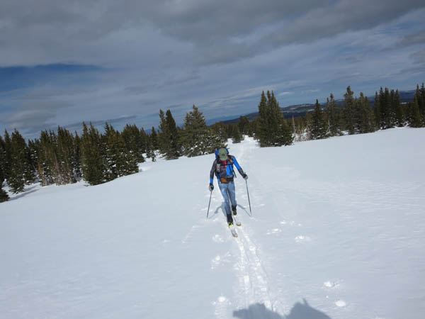
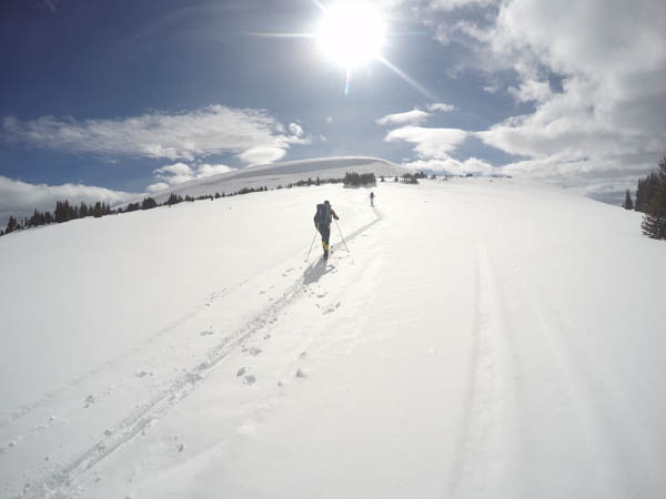
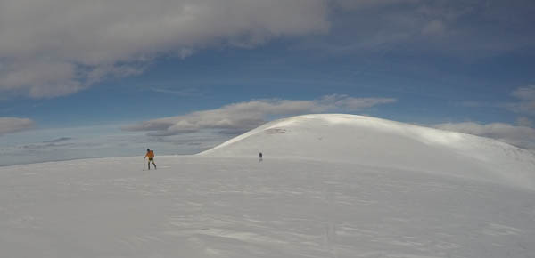
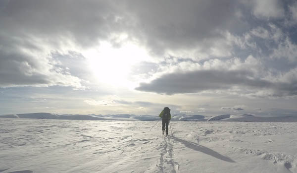
Here are a few photos from March and April.  Maybe I will start snapping a few running.
Powder Keg Week
Powder Keg week
Chipman Peak into Dry Fork with Tom and Blake
Thin snow on the ridgeline to Pfiefferhorn on our way to ski corn into Dry Fork with Blake and T-Dawg
Red Baldy to Tibble Fork with Andy
Skiing Icefall off Red Baldy with Andy – this might be the best corn run in the Wasatch.
Red Baldy to Tibble Fork with Andy
Cooking on our climb out of the Icefall – shirts off skinning at 11K in March!

Powder Keg

Skiing with Sarah and Blake after a 40″ April storm.  Best powder day since Christmas.