The Hardrock 100 is one of the legendary 100-mile ultras, famous for its staggering climbing (33,000+ feet), thin air (13 summits over 13,000 feet, including 14,048-foot Handies Peak), and a loop through the San Juan Mountains that doubles as a rolling mining museum. My first experience with the Hardrock course was back in 2008 when I pre-ran portions of it with Mark Christopherson and then paced him during his first Hardrock. It was also my first trip to the San Juans—and I was hooked. These felt like the most beautiful mountains in the lower 48.
I applied to Hardrock eight times and finally got in for the 2013 race, where I had the race of my life, finishing 12th in 30:47.
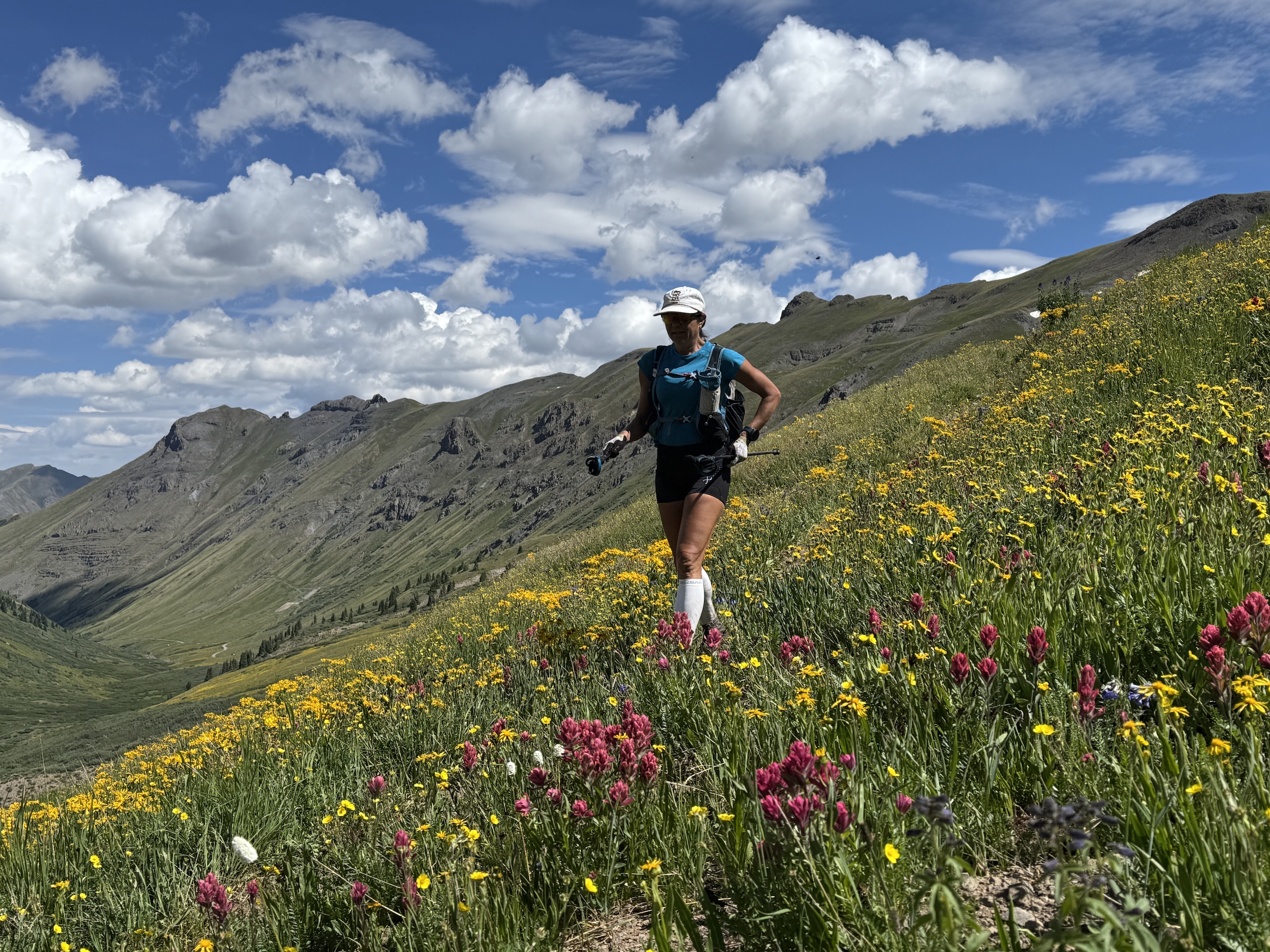
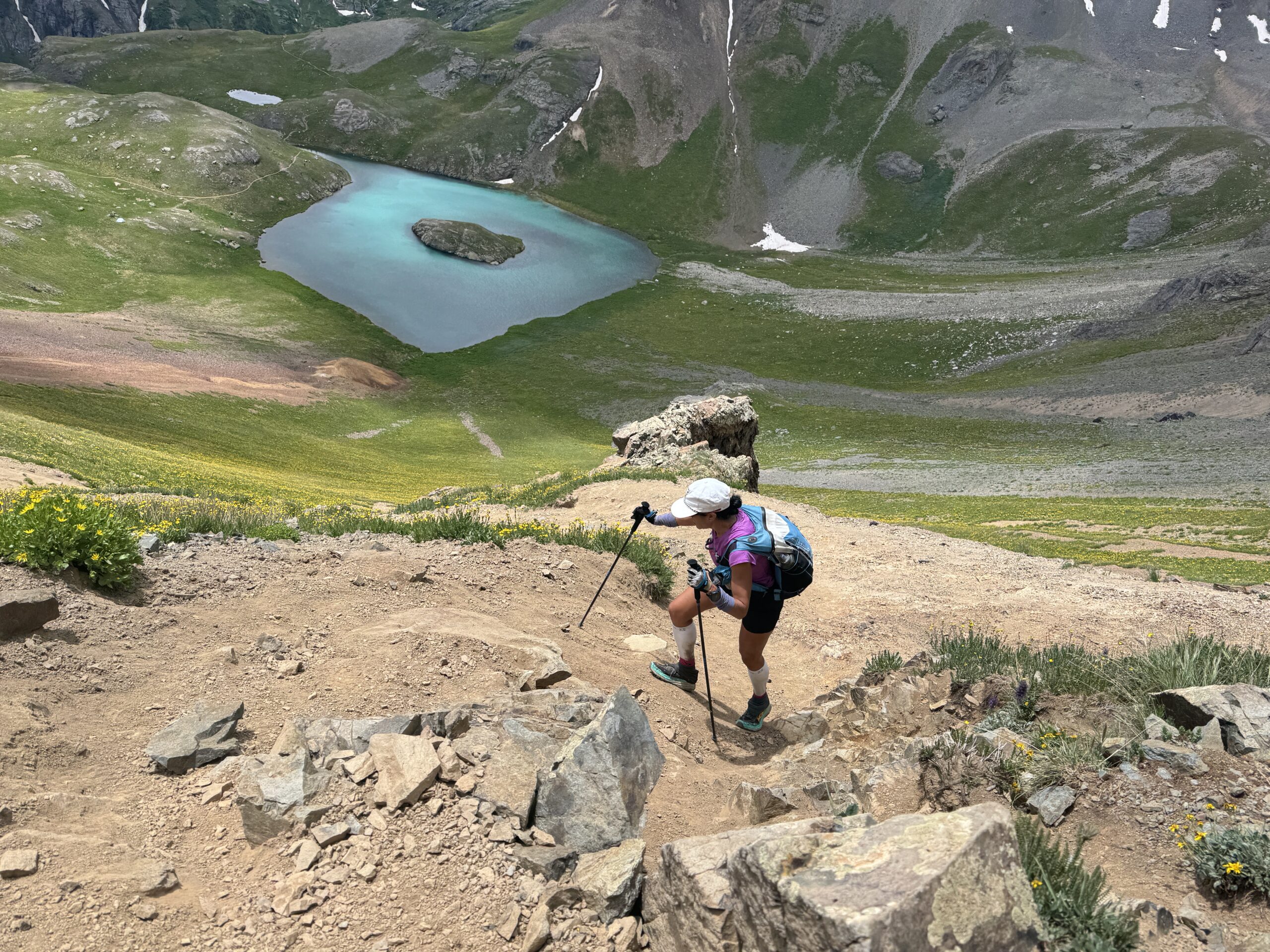
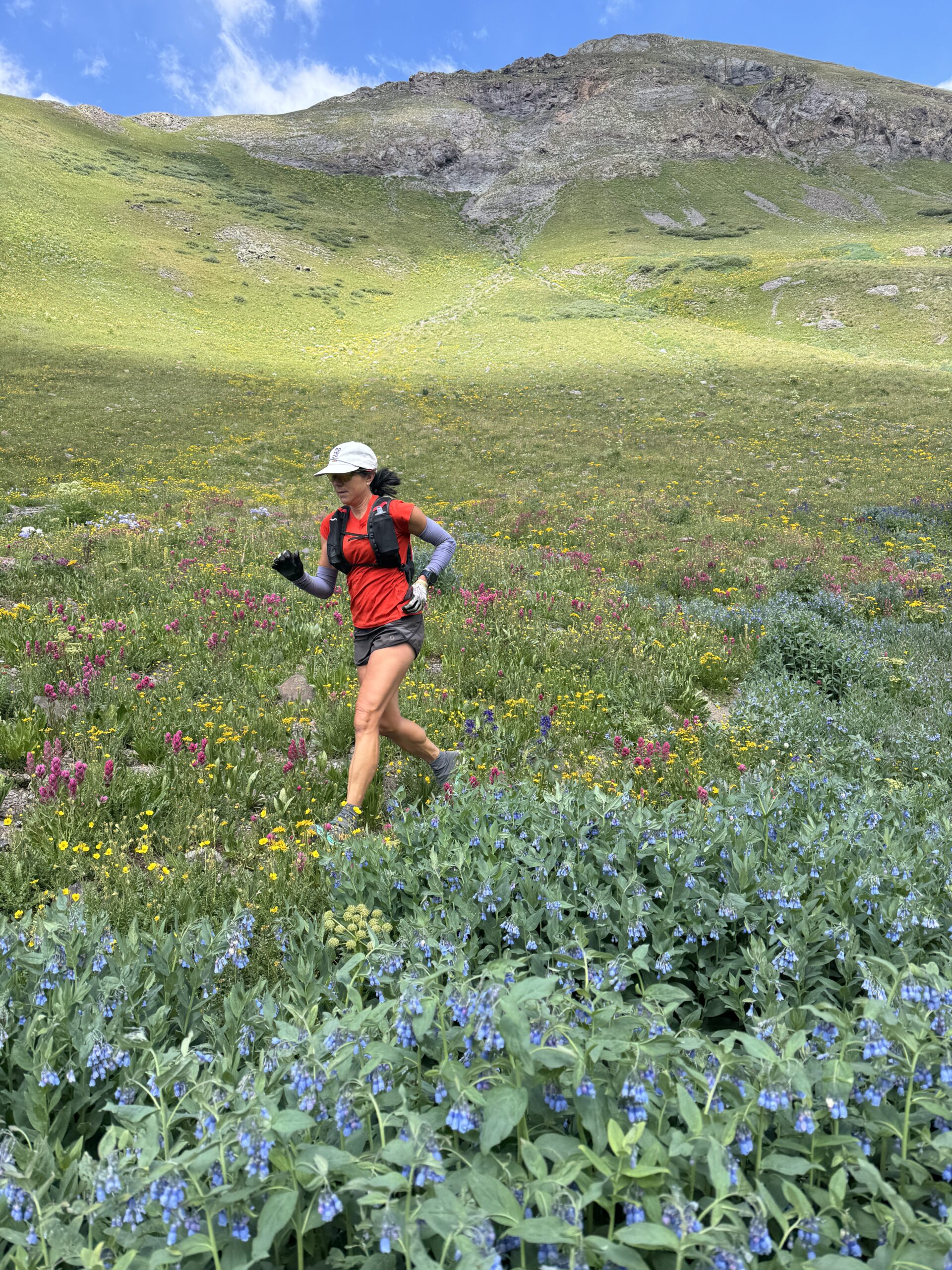
Emily and I had long talked about doing Softrock—splitting the course into four days instead of one grueling push. When a wedding brought us to Silverton in late July, it felt like the perfect time. The plan: run it clockwise (I’d only raced counterclockwise), start in Sherman Gulch, and stay in towns each night instead of juggling camping logistics. Three of the four days would be over 28 miles with more than 9,800 feet of climbing—this wasn’t going to be an “off-the-couch” adventure.
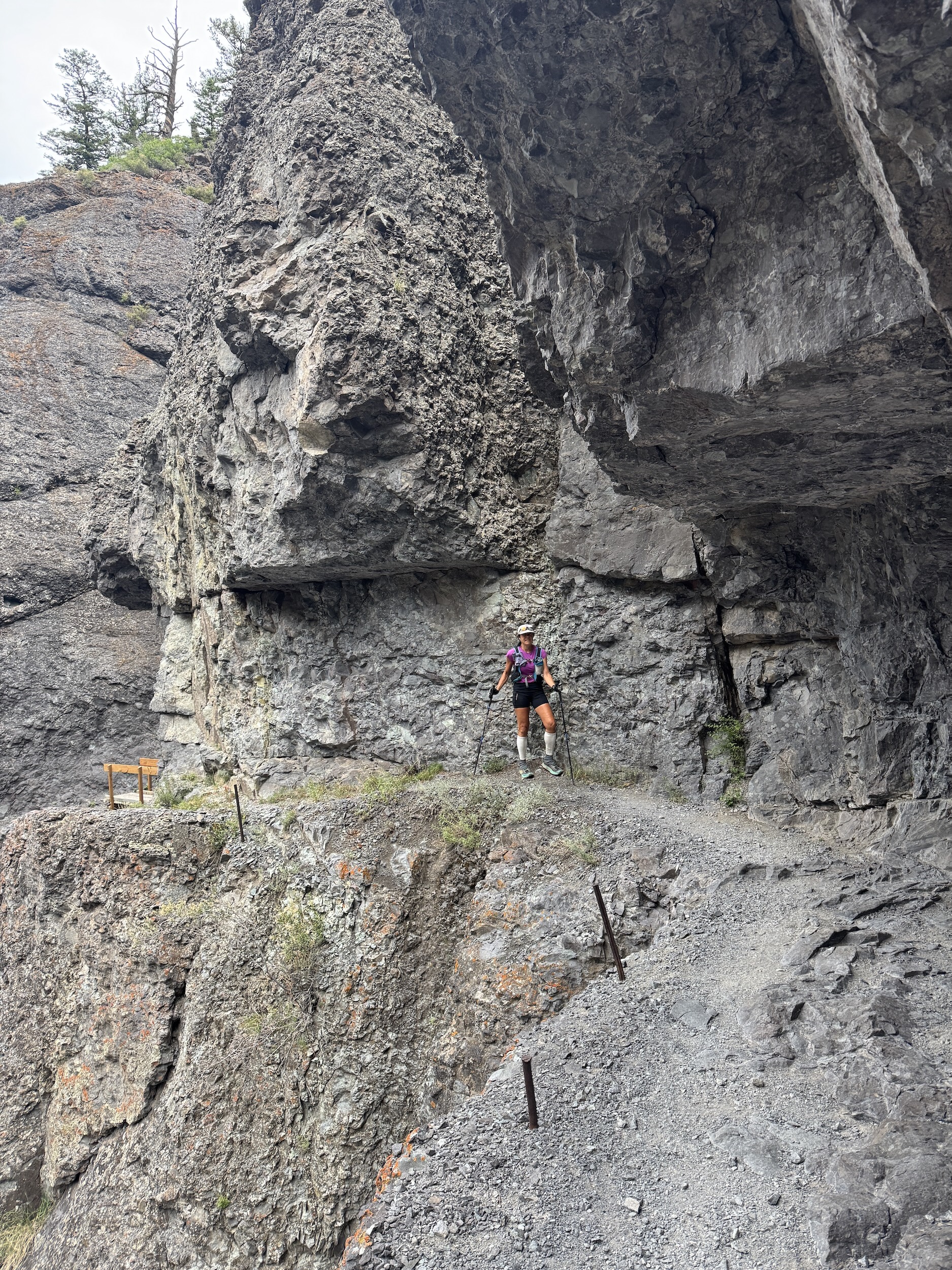
One of the things that makes Hardrock so special is how it connects the dots of the San Juan mining era—linking Silverton, Telluride, Ouray, Sherman and dozens of ghost towns, prospect tunnels, and collapsed headframes. These miners carved roads, laid rails, and blasted drifts in places that feel impossible to reach even with modern gear. They moved mountains, sometimes literally, with hand tools, mule teams, and sheer stubbornness.
We had our friend Kate take a “drop bag” with her to Silverton so we were able to pick up fresh clothes. After each long day, having a shower and a bed was a huge luxury instead of sleeping on the ground. Our days were long so as soon as we arrived in each town we were focused on clearing up, eating, and getting ready for an early start the next day. The San Juan’s are known for voracious afternoon thunderstorms. With most of our time being above 11,000’ (and above treeline), we needed an early start each morning in hopes of either avoiding the thunderstorms are being at a lower elevation.
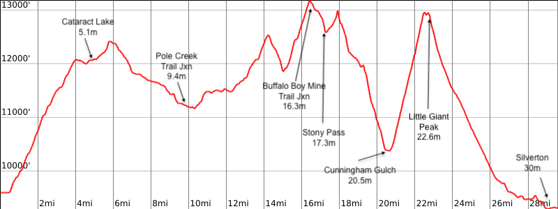
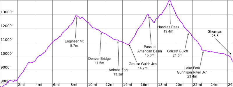
Day 1: Sherman to Silverton (29.5 miles; 9,000’ ascent; 9,300’ descent)
We had an amazing weather day with sunshine and cool temps. We started our mining tour with a few highlights.
- Sherman: Once a bustling silver camp with its own post office and hotel in the 1880s, now a quiet ghost town with weathered cabins and rusting ore bins.
- Cataract Lake: A high alpine lake near early silver prospects; miners often camped here while surveying.
- Pole Creek: Remote grazing and prospecting area; scattered remains of small diggings still hide in willows.
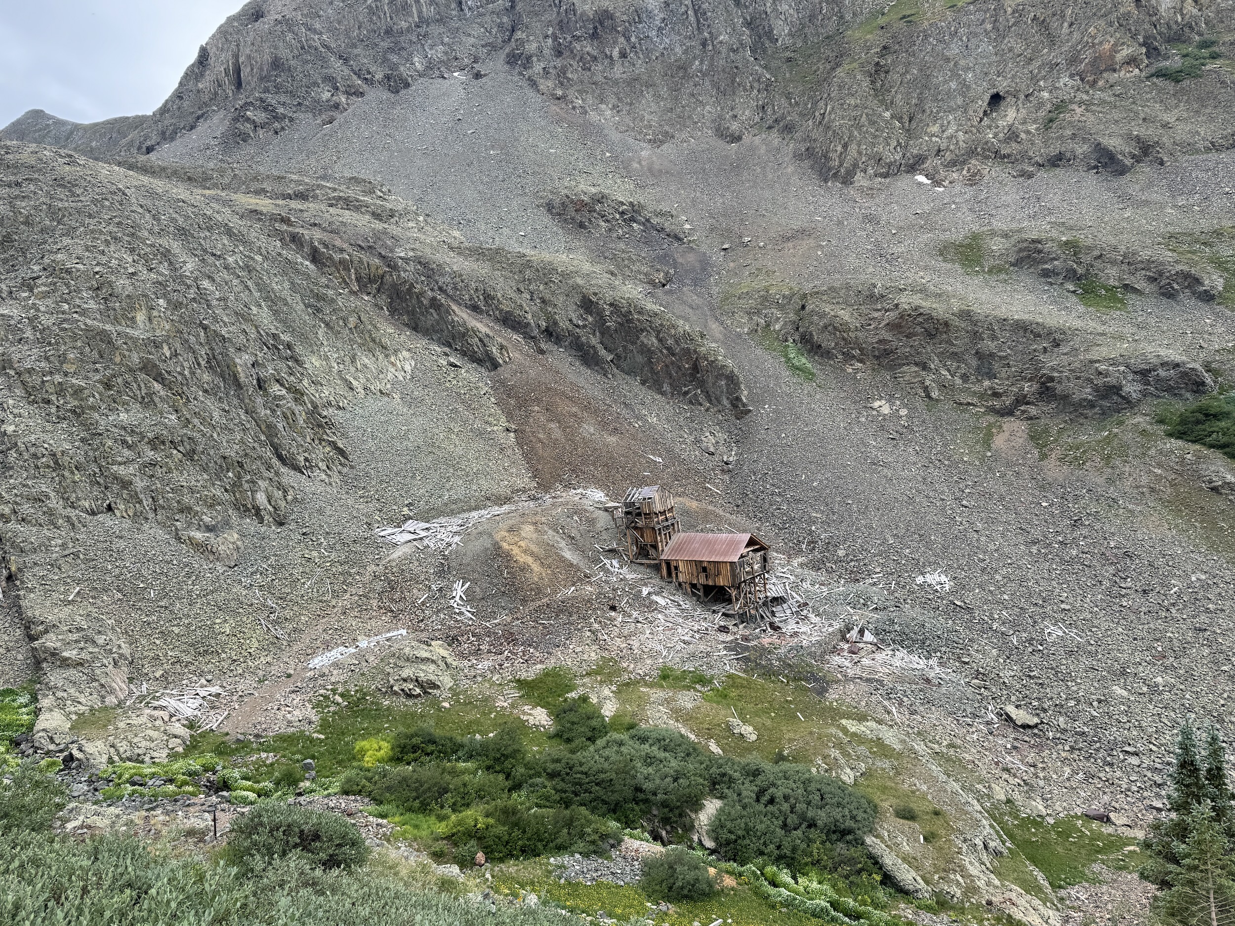
- Maggi Gulch: Home to the Buffalo Boy Mine and other gold/silver claims worked until the 1920s.
- Green Mountain: Overlooks multiple historic mining basins.
- Cunningham Gulch: A once-productive area that fed ore to mills in Silverton. The Highland Mary Mine sat just above.
- Little Giant Pass: A rugged crossing into the Animas River drainage with views of Silverton’s smelter site.
- Silverton: Founded in the 1870s during the silver boom, by 1883 it had 400 buildings, including 29 saloons.
Day 2: Silverton to Telluride (28.8 miles; 9,800’ ascent; 10,300’ descent)
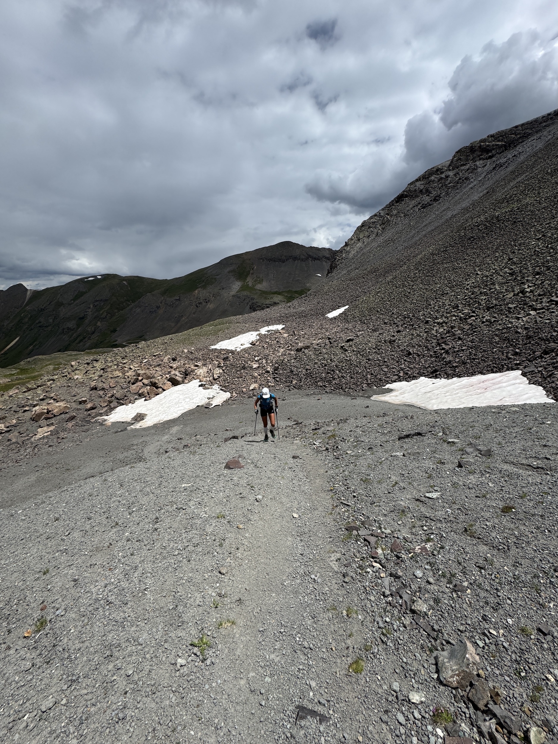
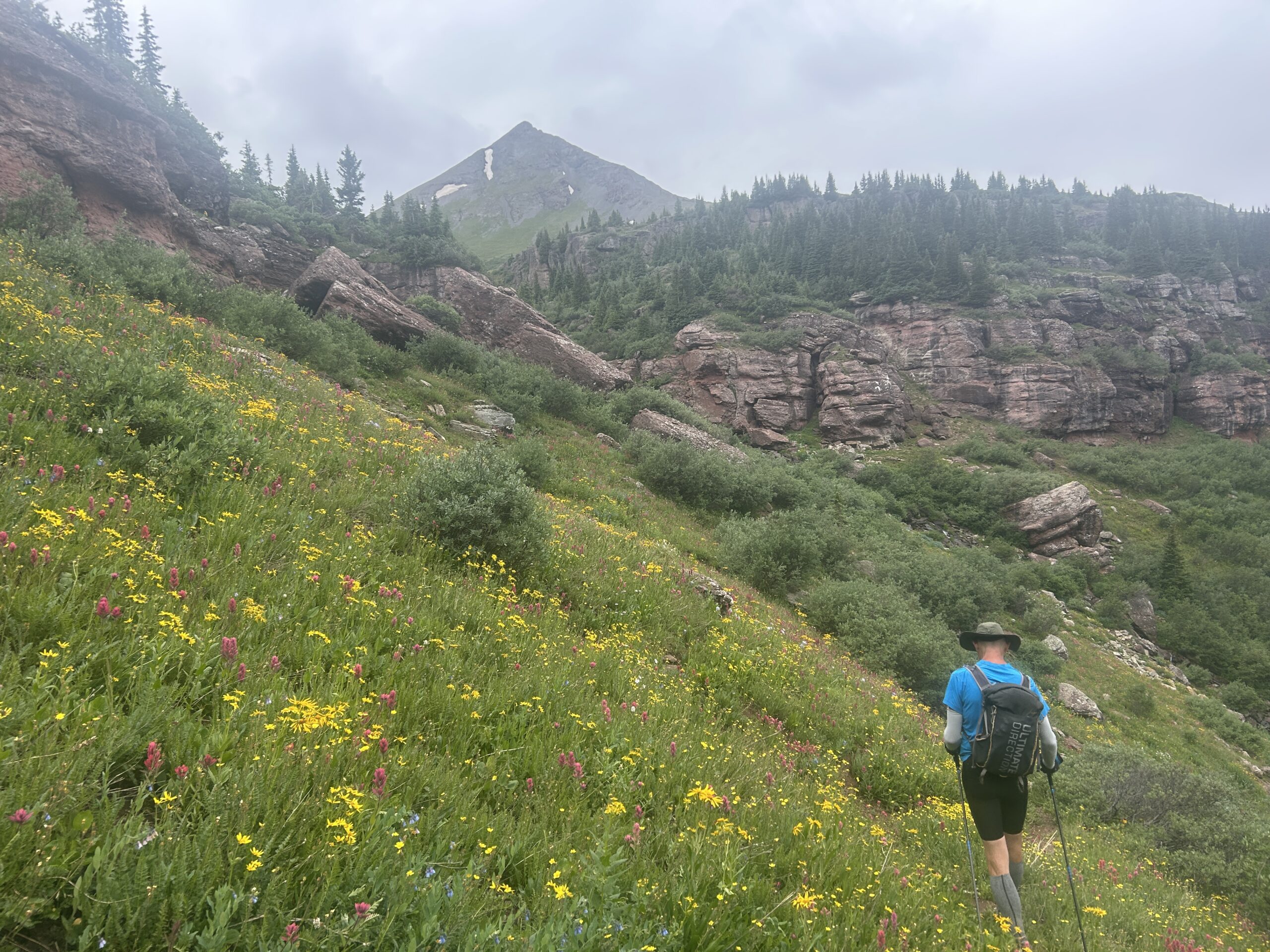
This was going to be a big day with long, steep climbs. Unfortunately, we were overtaken by thunderstorms early in the day while still well above 12,000’. We had torrential down pours and lightening directly over our head for several hours. We finally arrived in Telluride wet and exhausted. Even though being tired, we took advantage of the hotel hot tub to make sure it was truly a Softrock experience. Some of the mining museum highlights included:
- Mineral Creek: Steep valley where ore wagons once rattled down to the Silverton smelters.
- Putnam Basin & Lime Creek Saddle: Summer grazing for miners’ pack animals; a few exploratory pits still visible.
- KT Aid Station site: Named for KT Mining Co., which worked small claims in the area.
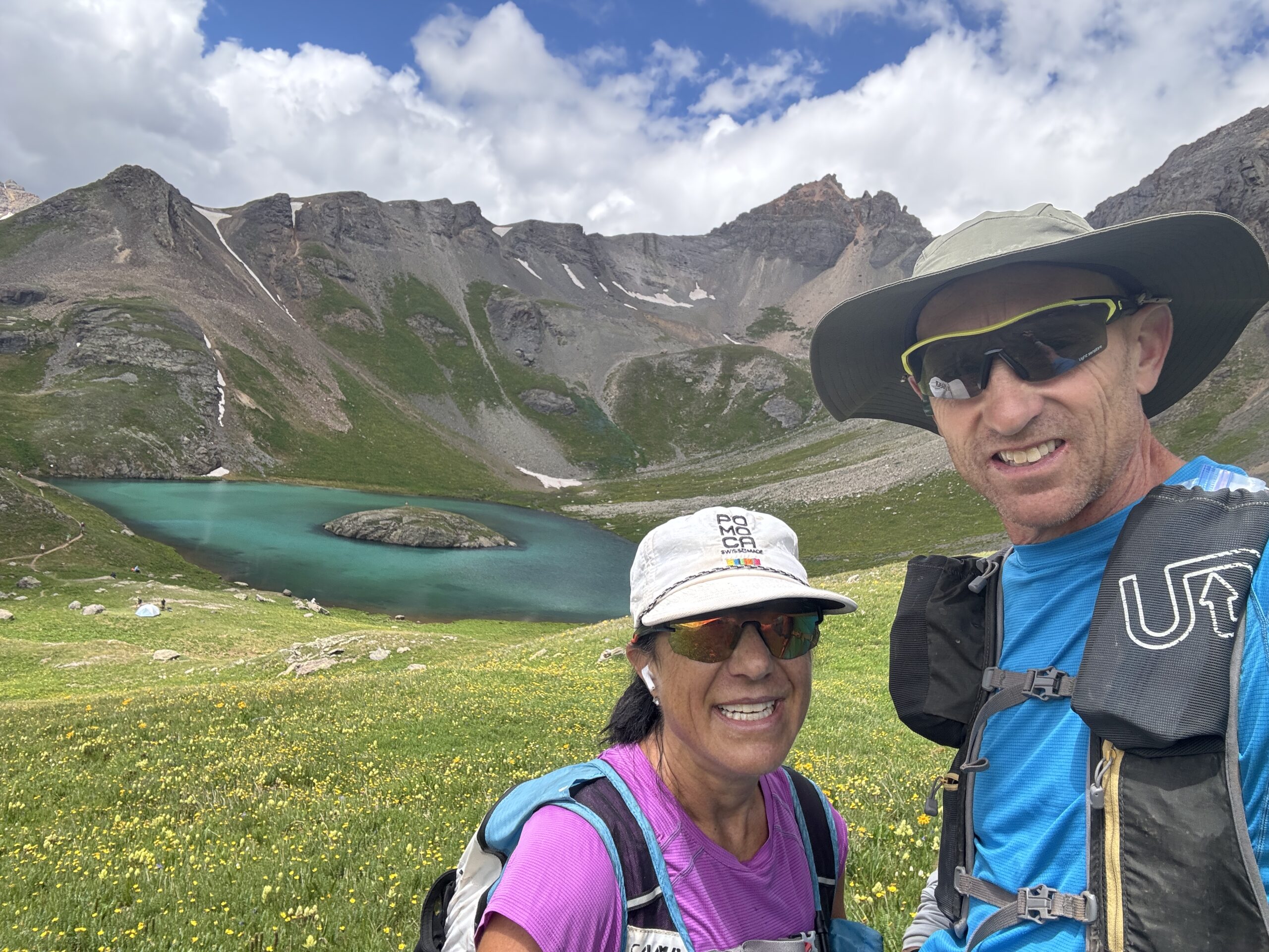
- Island Lake: Jewel-blue tarn near the Idarado Mine tunnel system.
- Grant Swamp Pass: Historic mule route between Telluride and Silverton mining districts.
- Chapman Gulch: Once had a small sawmill supporting area mines.
- Oscar’s Pass: High saddle on an old supply route into Telluride.
- Telluride: Founded in the 1870s, rich in gold and silver; the Smuggler-Union Mine was one of the most productive in Colorado history.
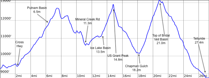
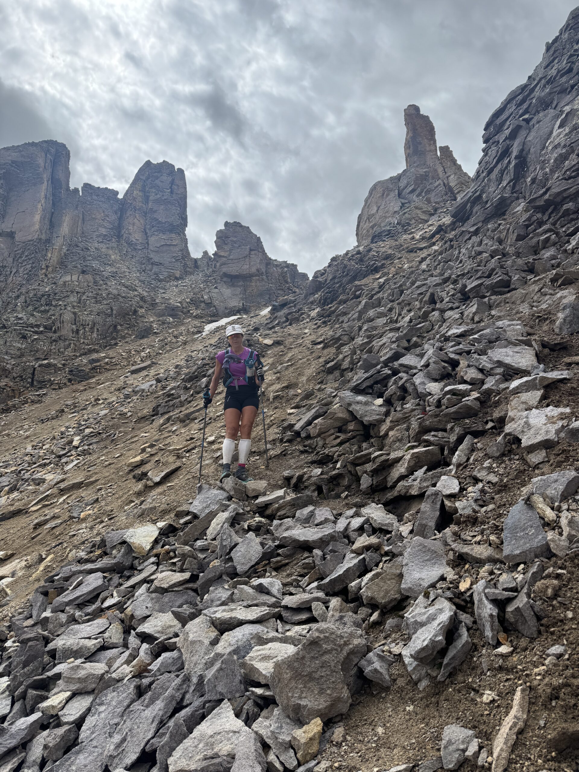
Day 3: Telluride to Ouray (15.4 miles; 4,500’ ascent; 5,500’ descent)
Day 3 was our “rest” day. A shorter day, but also a repeat of the rain from the prior day. Luckily no thunder and lightening this day. We took advantage of the hot springs at our hotel which was a welcome relief with 3 days on our legs. Our friend Cheryl met us for dinner so it was great to catchup. Day 3’s mining museum highlights included:
- Virginius Pass / Kroger’s Canteen: Narrow notch above the Tomboy Mine, once a thriving camp with over 900 residents and its own ice rink.
- Governor Basin: Site of multiple lode claims; ore was trammed to mills far below.
- Camp Bird Mine: Discovered in 1896 by Thomas Walsh; produced over 1.5 million ounces of gold and became one of Colorado’s richest mines.
- Ouray: Known as the “Switzerland of America,” the town boomed with silver, lead, and zinc mining in the late 1800s.
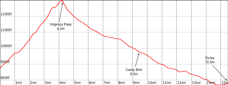
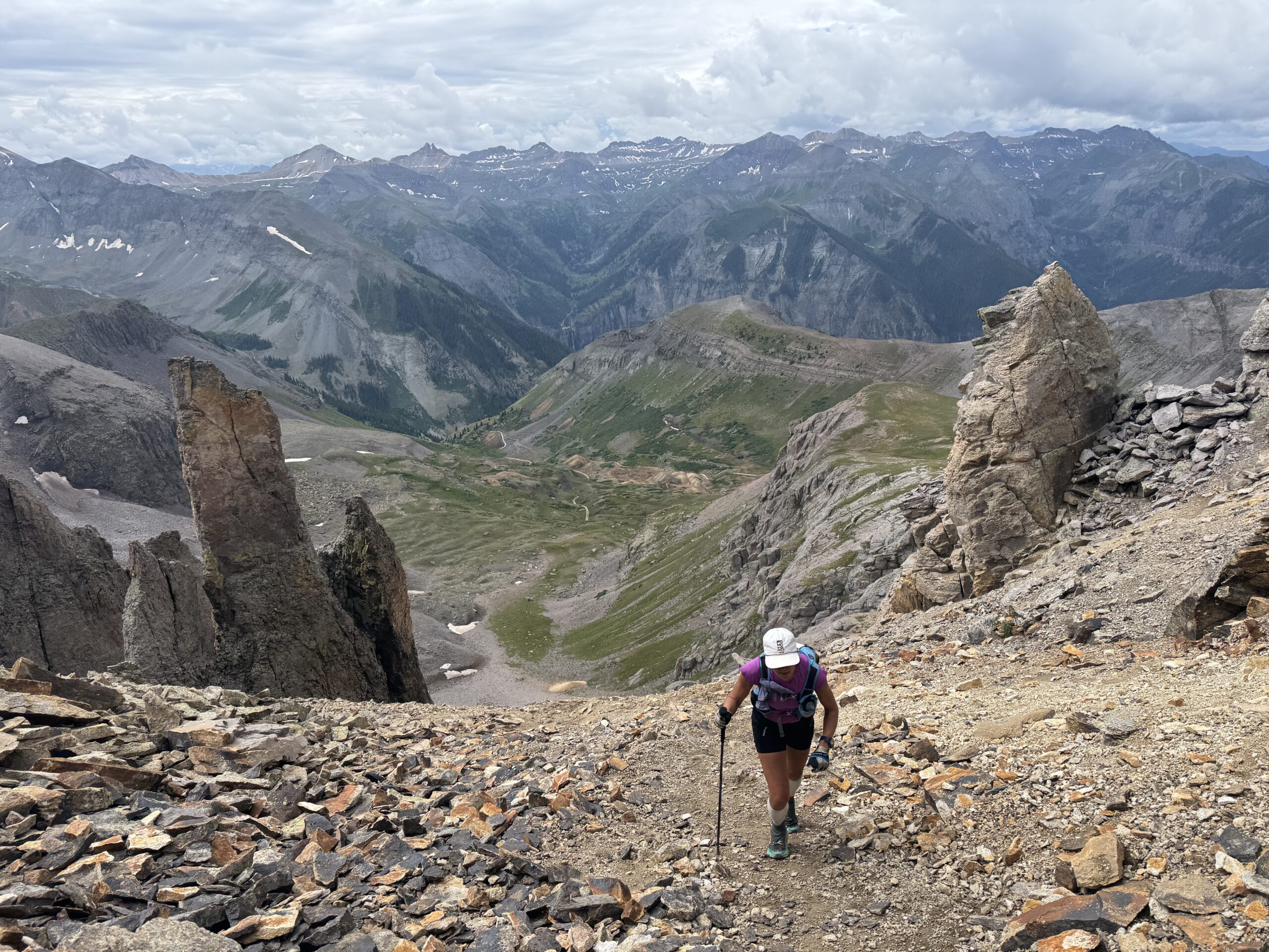
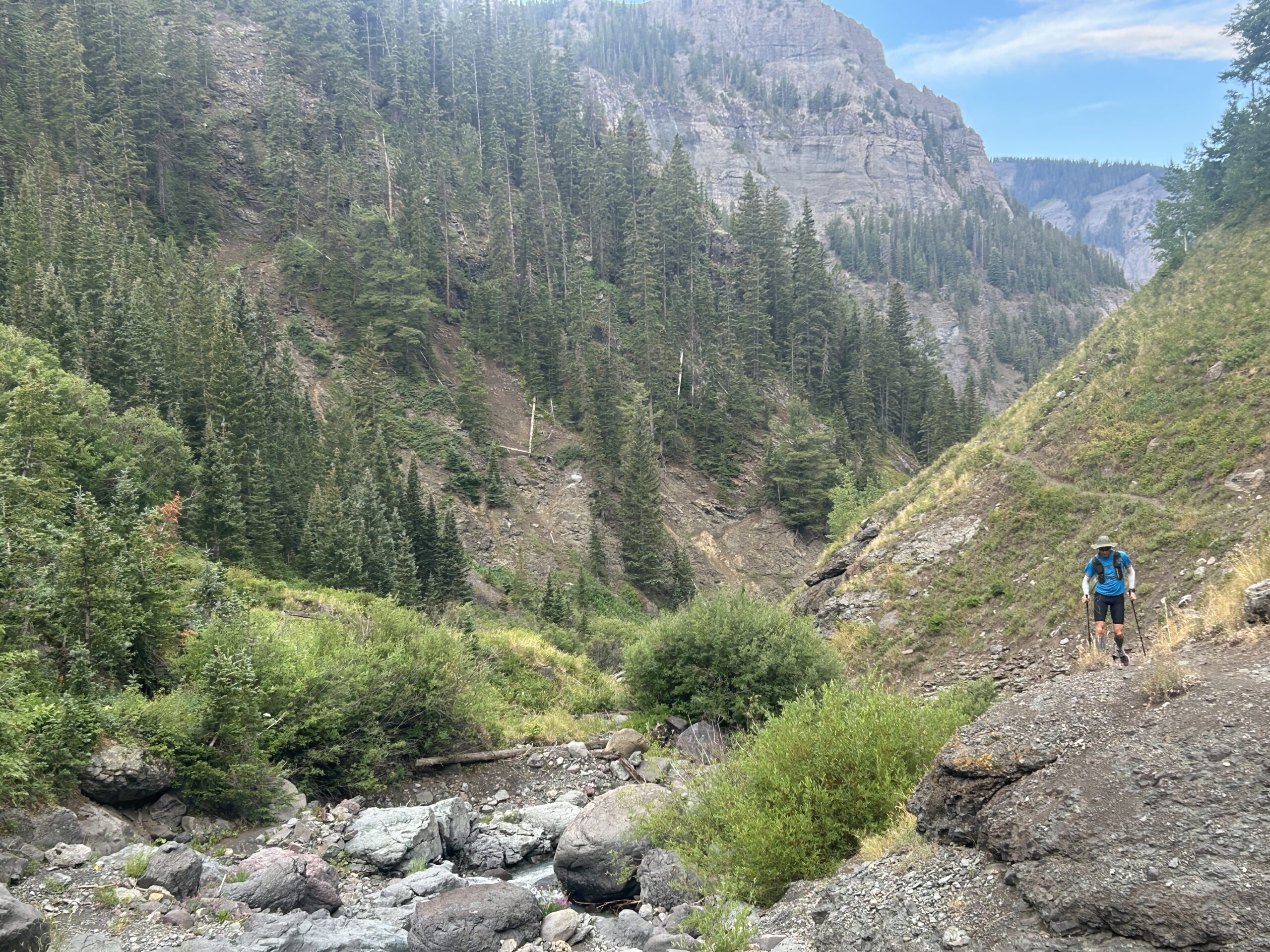
Day 4: Ouray to Sherman (27.1 miles; 9,600’ ascent; 7,800’ desent)
Like is normal for our trips, our legs feel great on day 1, then we have 2 days of getting in the groove. This trip proved the same and we felt great on our final day. Not only did our legs feel good, but we had adjusted to the elevation so we felt good moving fast up high.
- Bear Creek Trail: Cut into cliffs by miners heading toward the Yellow Jacket Mine.
- Engineer Pass: Once part of the Alpine Loop supply route between mining camps.
- Animas Forks: Ghost town at 11,200 feet; once had a hotel, saloon, post office, and several large mills.
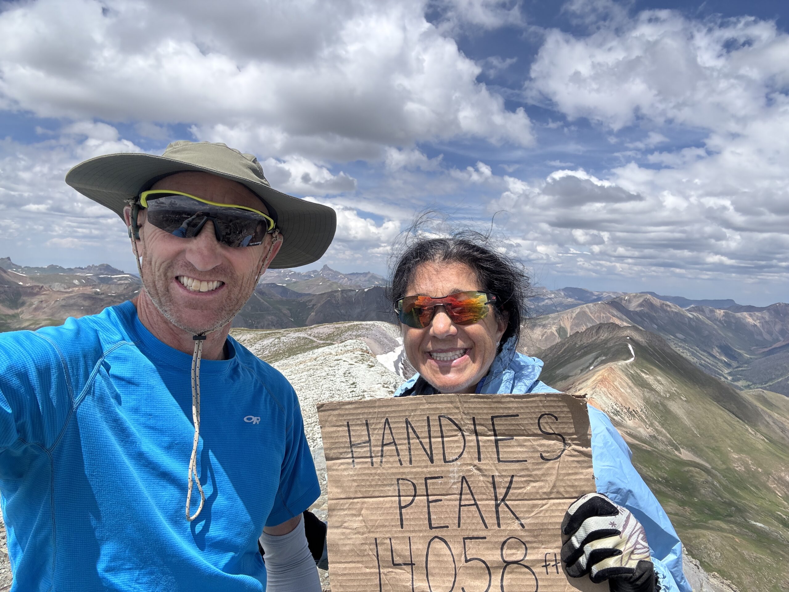
- Handies Peak:– The race’s high point; nearby slopes were dotted with silver claims like the American Tunnel area.
- Burrows Park: Another ghost camp, active in the 1880s with a cluster of cabins and a stamp mill.
- Return to Sherman: Closing the loop where the adventure began.
We had an amazing 4 days on the Hardrock course. It was time for a day of recovery. We headed from Sherman to Silverton for the remainder of the trip.
Not quite ready to hang up our trail shoes, we squeezed in a stunning run up to Tower Mountain (13,558’). The views from the summit reminded us why the San Juans are truly some of the most breathtaking mountains in the lower 48.
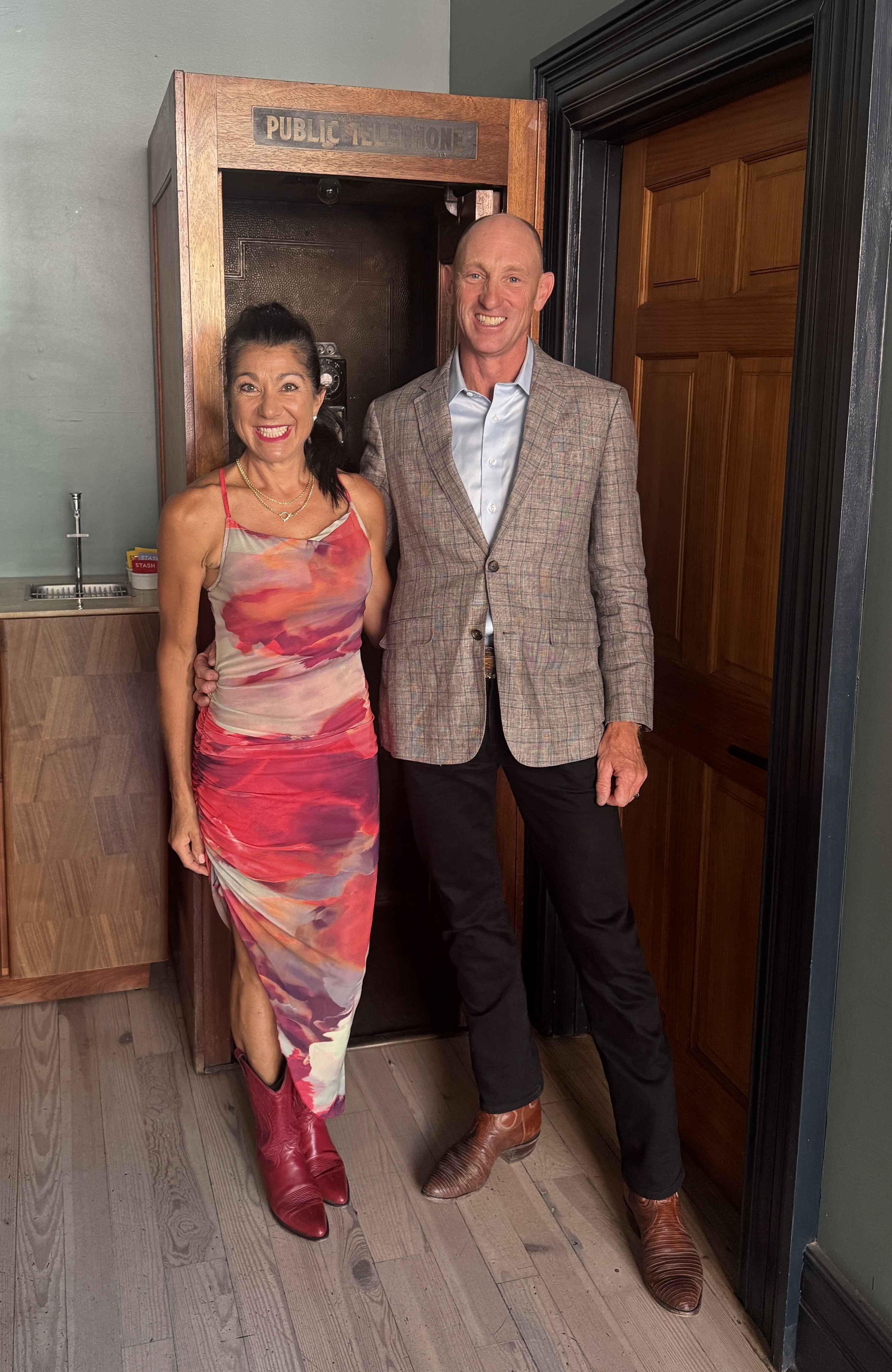
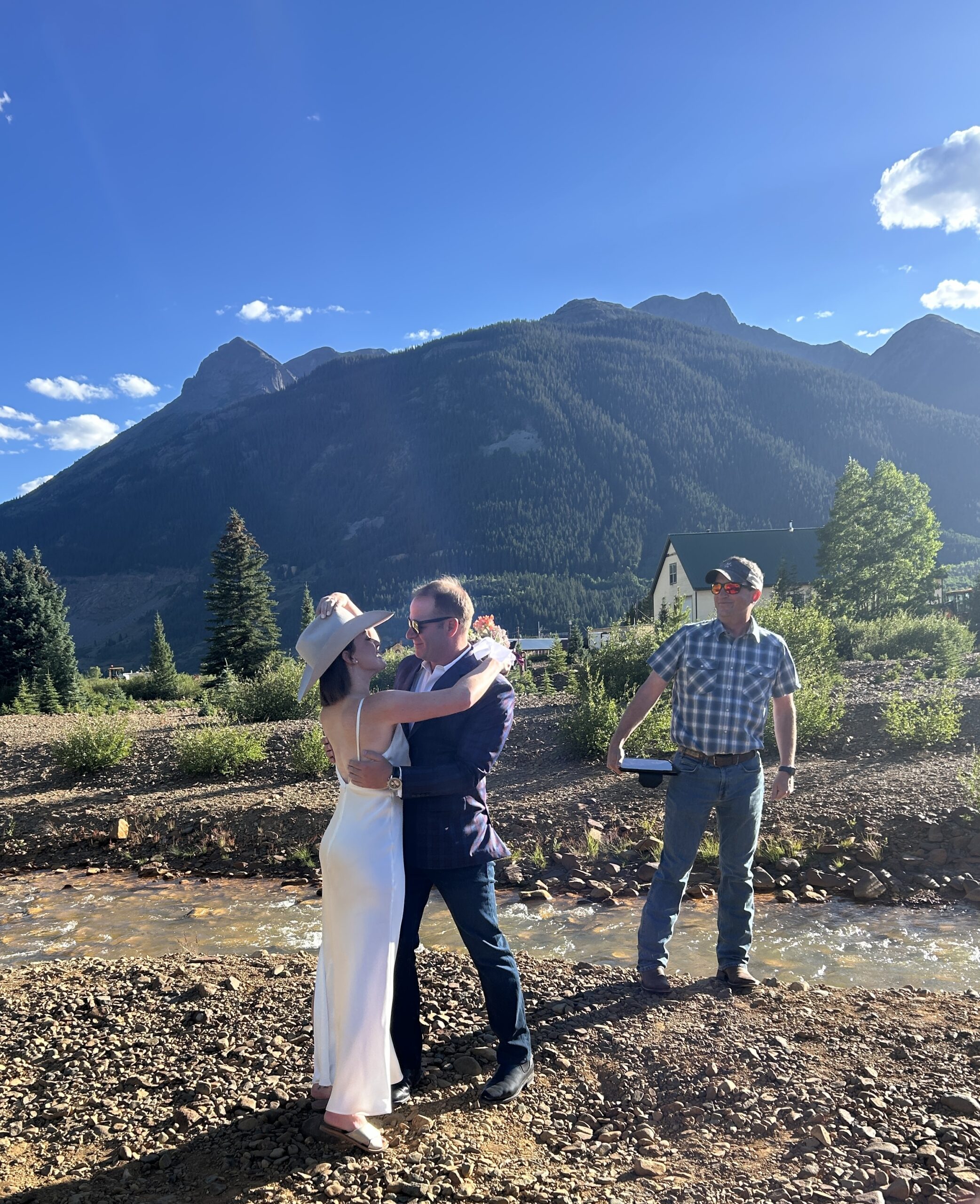
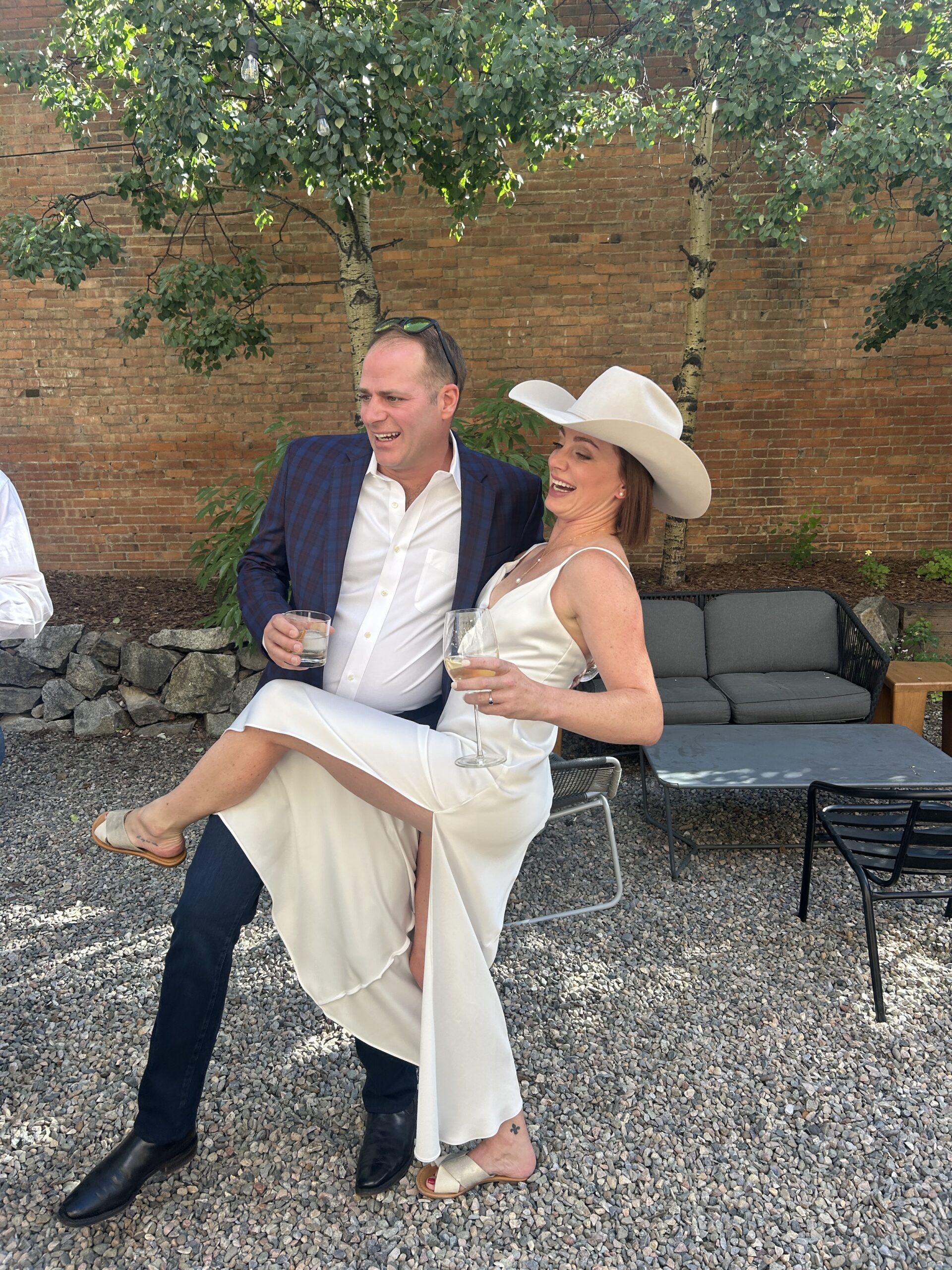
That evening, we shifted gears from trail runners to wedding guests, joining the pre-party and meeting many of the other attendees. The following day’s wedding was picture-perfect—the weather cooperated beautifully, and it was a wonderful way to celebrate amidst these majestic mountains.
Looking back, Softrock was everything we hoped for: a perfect blend of adventure, history, and the pure joy of running through some of Colorado’s most spectacular and storied landscapes.
Leave a Reply