Tag Archives: wasatch

Mt Nebo Traverse & Loop

On Independence Day Emily S, Mindy, and I ran the 3 summits of Mt. Nebo and made a loop running back to the car on the Bench Trail. We put this run together very quickly: Jared showed us the trail on Google maps, we found a couple rudimentary maps and descriptions and decided to go for it and knew we could find our way as we are very capable women who love an adventure.

Tuesday night we ladies set out for Maple (to meet up with Brent) to camp and enjoy a nice night out under the stars and get closer to the trailhead for an early start. We enjoyed dinner and a beer at the campsite. We woke up to wonderfully cool weather which felt very good with the hot weather we have been having in the valley.

We hit the trail just a few minutes after 8a (elevation 6,670’). The trail up to the South Summit was a great trail but steep enough that there were very few runnable sections. There were also several sections that were super steep. After we made it up to the South Summit (elevation 11,851’) we proceeded on what we could see of a “trail” to the Middle Summit (elevation 11,814’) and on to the North Summit (elevation 11,933’) of Mt Nebo. There was a lot of scrambling and route finding in this section and we ventured a little too far down in a scree field between the Middle and North Summits which added some time to our adventure. The information that we read about this part stated that it would take ~2 hours and it was ~1 mile and it took us a little over an hour even with our bonus vert during this section. There wasn’t anything that was sketchy, just lots of places where we had to be cautious of every move as a slip could have big consequences. This section was super fun and challenging.

     Mindy and Emily S scrambling between summits

     Mindy and Emily S scrambling between summits


   Emily S and I on the Middle Summit with the South Summit in the background

     Mindy and I on the Middle Summit with the North Summit in the background

The trail down from the North Summit was very well defined and although steep and scrambling in a few sections the majority was very runnable so we were able to click away a few miles faster than the first 9ish miles up and across the summits. From the North Summit Trailhead (mile 12.32 and elevation 9,260’) we ran the dirt road for approximately 1 mile before we hit the Bench Trail. The Bench Trail is a 12 mile trail which would take us back to the car at the South Summit Trailhead. We thought this would be an easy 12 miles as we had read that there was only 800 feet of vertical gain (which actually ended up that from the Trailhead to the highest point on the this trail was 800 feet of vertical gain and the actual vert gain was around 3,000’) and we thought it would be a very well defined trail.

We cruised along for a number of miles stopping at a few springs and small snowfields to fill and cool off our water supplies. The hardest part of our run was miles 17-20 in which we affectionately named the “Magic Trail” because one minute we would see it and another minute it would be gone and we would have to search for the trail, see it in the distance, and make our way “cross country” to get to it. Once we hit the main trail we were able to run the whole way down back to the car (with the help of Emily S magic jelly beans for energy).

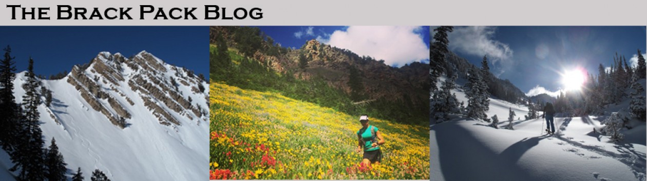
The whole day was filled with our expressions of gratitude for the perfect weather, wonderful scenery, and beautiful wildflowers, and excellent company.

This was an amazing run and a great day with fabulous girlfriends!\

     Gamin Connect route of the run

Box Elder Peak – The Long Way

As part of my skiing redemption, this spring I have been working on summiting and skiing peaks that have previously eluded me.  Box Elder Peak is only 11,101’ (additional information), but has a beautiful northwest face that, when viewed from the Little Cottonwood Canyon ridgeline (Red Pine, Maybird, Hogum, etc), begs to be skied.


Five or so years ago, Chip, Audrey, Emily and I attempted this peak.  We ended up getting stormed out.  On this attempt, we started in Alpine and hiked the summer trail for a couple of miles to reach snow, then continued on skis.  For this attempt, we thought it would be more enjoyable to maximize our time on skis so we decided to start at the White Pine Trailhead in Little Cottonwood Canyon, ascend to the top of the Red Pine ridge, ski down into Dry Creek Canyon, ascend Box Elder Peak, then return mostly the way we came.  This route had a lot of appeal as it would be around 8,000’ of climbing and have 3 descents of 3,000’, 2,000’, and 3,000’.  There are not many places in the Wasatch to get that much vertical in 3 runs.

We didn’t have great snow coverage down low on the Red Pine Trail.


We made steady progress up to Red Pine enjoying a chilly, but bluebird day in the Wasatch.


We were treated to some fantastic snow on our long, 3,000’ descent into Dry Creek Canyon.


I have always enjoyed skiing into Dry Creek Canyon as the terrain is huge and you are looking up at the back side of some fantastic peaks.  Each time I ski the Pfieferhorn, I try to make a long descent into Dry Creek Canyon.  I was excited to get to ski 3,000’ down this time.  Unfortunately, our snow ran out and eventually we were forced to boot back down.


Once at the bottom of Dry Creek, we had a few issues finding our route up to the ridge, but we eventually made it.  The skinning was challenging with a mix of ice and new snow that easily slide off of the ice it was sitting on.  Ski crampons were a huge asset here, unfortunately, Paul didn’t have any so he struggle up the icy climb until we reached the ridge.


The final 3/4 mile (or so) was easiest done booting on the firm snow.


Once at the top, we were treated with amazing views of Timpanogos (the south Summit on the left is what Evan and I had skied 2 weeks earlier) and down to Tibble Fork Reservoir.


We were excited for our descent, until we dropped into a slope of solid ice.  Making the best of it, we enjoyed a long, scenic descent.


Since the snow was not great, we decided to traverse off the slope early to reduce our climb out.  We had also had a great idea that we could reach White Baldy from the ridgeline at the top of Dry Creek Canyon and then we could descent White Pine.  We made great time up the ridge and thought we were getting very close to White Baldy, but we knew there were several false summits.


Our route eventually got technical.  At this point of the day, we were over 8 hours and 7,500’ in and we were getting tired.


We had to make the decision to continue on through the crux, or down climb and try to find a passage through the sub-ridge rather than have to ski 1,000’+ back down into Dry Creek Canyon and have to climb out again.


We chose the down climb.


And were treated to some great turns in softening snow.

We were able to find a passage to avoid the long descent (and ascent) in to Dry Creek.


At the top of this passage, we still had some scrambling to get to snow where we could descend, but at least we could again see the Pfieferhorn, our descent tracks from the morning, and where we needed to be going.


As always, the views down into Dry Creek are amazing.  You can see Utah Lake and Provo 6,000’ below us in the valley and our skin track up through Dry Creek.


And finally we were back in Red Pine with it being mostly downhill to the trailhead.


Where cold beer awaited

I wore my Garmin Forerunner for the ski day.  Our final stats were just over 11 hours, 8,800’ climbing, and 18.5 miles.

For higher resolution, captioned photos, see the Box Elder Album.